- Kanton La Gacilly
-
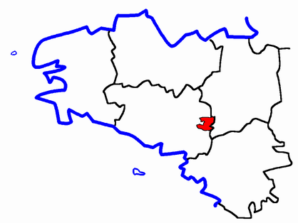
Kanton La Gacilly Region Bretagne Département Morbihan Arrondissement Vannes Hauptort La Gacilly Einwohner 10.619 (1. Jan. 2008) Bevölkerungsdichte 56 Einw./km² Fläche 189 km² Gemeinden 9 INSEE-Code 5608 Der Kanton La Gacilly (bretonisch: Kanton Gazilieg) ist eine französische Verwaltungseinheit im Arrondissement Vannes, im Département Morbihan und in der Region Bretagne; sein Hauptort ist La Gacilly.
Lage

Gemeinden
Der Kanton La Gacilly umfasst neun Gemeinden. Diese sind:
Gemeinde Bretonisch Einwohner Fläche in km² Code postal Code Insee Carentoir Karantoer 2544 59.02 56910 56033 Cournon Kornon 632 10.87 56200 56044 Glénac Glenneg 810 13.70 56200 56064 La Chapelle-Gaceline Ar Chapel-Wagelin 502 7.79 56200 56038 La Gacilly Gazilieg 2277 16.48 56200 56061 Les Fougerêts Felgerieg-al-Lann 788 19.91 56200 56060 Quelneuc Kelenneg 485 13.85 56910 56183 Saint-Martin-sur-Oust Sant-Varzhin-an-Oud 1281 28.24 56200 56229 Tréal Treal 672 19.28 56140 56253 Kanton Gazilieg 9991 189.14 - 5608 Bevölkerungsentwicklung
1962 1968 1975 1982 1990 1999 8873 8617 8816 9655 9829 9991 
Allaire | Auray | Baud | Belle-Île | Belz | Cléguérec | Elven | Le Faouët | La Gacilly | Gourin | Grand-Champ | Groix | Guémené-sur-Scorff | Guer | Hennebont | Josselin | Lanester | Locminé | Lorient-Centre | Lorient-Nord | Lorient-Sud | Malestroit | Mauron | Muzillac | Ploemeur | Ploërmel | Plouay | Pluvigner | Pontivy | Pont-Scorff | Port-Louis | Questembert | Quiberon | La Roche-Bernard | Rochefort-en-Terre | Rohan | Saint-Jean-Brévelay | Sarzeau | La Trinité-Porhoët | Vannes-Centre | Vannes-Est | Vannes-Ouest
Wikimedia Foundation.
Schlagen Sie auch in anderen Wörterbüchern nach:
Kanton Plœmeur — Region Bretagne Département Morbihan Arrondissement Lorient Chef lieu Plœmeur Einwohner – insgesamt – Bevölkerungsdichte … Deutsch Wikipedia
Kanton Groix — Region Bretagne Département Morbihan Arrondissement Lorient Hauptort Groix Einwohner 2.318 (1. Jan. 2008) Be … Deutsch Wikipedia
Kanton Lanester — Region Bretagne Département Morbihan Arrondissement Lorient Hauptort Lanester Einwohner 22.490 (1. Jan. 2008) … Deutsch Wikipedia
Kanton Lorient-Centre — Region Bretagne Département Morbihan Arrondissement Lorient Hauptort Lorient Einwohner 14.606 (1. Jan. 2008) … Deutsch Wikipedia
Kanton Lorient-Nord — Region Bretagne Département Morbihan Arrondissement Lorient Hauptort Lorient Einwohner 22.371 (1. Jan. 2008) … Deutsch Wikipedia
Kanton Lorient-Sud — Region Bretagne Département Morbihan Arrondissement Lorient Hauptort Lorient Einwohner 21.171 (1. Jan. 2008) … Deutsch Wikipedia
Kanton Vannes-Centre — Region Bretagne Département Morbihan Arrondissement Vannes Hauptort Vannes Einwohner 25.828 (1. Jan. 2008) … Deutsch Wikipedia
Kanton Vannes-Est — Region Bretagne Département Morbihan Arrondissement Vannes Hauptort Vannes Einwohner 43.258 (1. Jan. 2008) … Deutsch Wikipedia
Kanton Vannes-Ouest — Region Bretagne Département Morbihan Arrondissement Vannes Hauptort Vannes Einwohner 31.498 (1. Jan. 2008) … Deutsch Wikipedia
Kanton Allaire — Region Bretagne Département Morbihan Arrondissement Vannes Hauptort Allaire Einwohner 15.643 (1. Jan. 2008) … Deutsch Wikipedia
Kanton La Gacilly
18+
© Academic, 2000-2026
- Kontaktieren Sie uns: Unterstützung, Werbung
Wörterbücher Export, schritte mit PHP, Joomla, Drupal, WordPress, MODx.