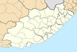
Kareedouw

Kareedouw
Kareedouw
Kareedouw (Ostkap)
Kareedouw
Kareedouw
Basisdaten
Staat Südafrika
Provinz Ostkap
Distrikt Cacadu
Gemeinde Kou-Kamma
Höhe 300 m
Einwohner 3.676 (2010)
Gründung 1905
ISO 3166-2 ZA-EC
-33.95194444444424.289444444444

Kareedouw ist eine Kleinstadt mit 3.676 Einwohnern (Stand: 2010; Hochrechnung).[1] in der Gemeinde Kou-Kamma, Distrikt Cacadu, Provinz Ostkap in Südafrika. Die Stadt liegt auf 300 Metern Höhe zwischen dem Tsitsikamma National Park und der Baviaanskloof Mega-Reserve an der Route 62, 48 Kilometer von Humansdorp und 42 Kilometer von Joubertina entfernt. Die Stadt ist Sitz der Gemeindeverwaltung.

Gegründet wurde die Stadt 1905 als Gemeinde der niederländisch reformierten Kirche. Benannt ist sie nach einem Baum mit dem Namen Karee. Gemeint ist hier der Tau (afrikaans: douw) auf diesem Baum. Im Langkloof-Tal ziehen häufig Wolken und Nebel vom Meer heran, die sich dann als Tau auf den Bäumen niederschlagen.

Wirtschaftlich bedeutend für die Stadt sind die Forstwirtschaft, Obstplantagen und in geringem Umfang der Tourismus.

Sehenswürdigkeiten

Einzelnachweise

  1. World Gazetteer: Republik Südafrika - die wichtigsten Städte. World Gazetteer. Abgerufen am 6. April 2010.

Wikimedia Foundation.

Игры ⚽ Поможем решить контрольную работу

Schlagen Sie auch in anderen Wörterbüchern nach:

  • Kareedouw — Original name in latin Kareedouw Name in other language Kareedouw, Karreedouw State code ZA Continent/City Africa/Johannesburg longitude 33.9528 latitude 24.29053 altitude 328 Population 0 Date 2012 07 12 …   Cities with a population over 1000 database

  • Assegaaibosch Country Lodge — (Kareedouw,Южно Африканская Республика) Категория отеля: 4 звездочный отель Адрес …   Каталог отелей

  • Andrew Geddes Bain — (baptised 11 June 1797 Thurso, Scotland 20 October 1864 Cape Town), South African geologist, road engineer, palaeontologist and explorer. Life historyThe only child of Alexander Bain and Jean Geddes, both of whom died when Bain was still a young… …   Wikipedia

  • Kou-Kamma — Local Municipality Basisdaten …   Deutsch Wikipedia

  • Route 62 — Die Route 62 (auch Cape Route 62 [1]) ist eine Fernstraße in den Provinzen Westkap und Ostkap in Südafrika. Sie führt von Kapstadt über Paarl, Tulbagh, Worcester, Montagu, Calitzdorp, Oudtshoorn, Uniondale und Kareedouw nach Port Elizabeth. Sie… …   Deutsch Wikipedia

  • Protected areas of South Africa — include any geographical area protected for a specific use. Most protected areas are intended for the conservation of flora and fauna, including peace parks, national parks, and national botanical gardens. South Africa s national parks are… …   Wikipedia

  • Tsitsikamma Mountains — The Tsitsikamma mountains are a mountain range located in the Garden Route region of the southern South African coast in the Western Cape and Eastern Cape provinces. Stretching just over 80km from the Keurbooms River in the west just north of… …   Wikipedia

  • Popeye Strydom — Infobox Rugbyman Popeye Strydom Pas d image ? Cliquez ici. Fiche d identité Nom complet …   Wikipédia en Français

  • List of cities and towns in the Eastern Cape — This is a list of cities and towns in the Eastern Cape province of South Africa.The Amatola Region* Adelaide * Alice * Balfour * Berlin * Bhisho, (previously Bisho) * Braunschweig * Cathcart * Dohne * Dordrecht * East London(eMonti) * Elliot *… …   Wikipedia

  • Ndlambe Local Municipality —   Local municipality   Location …   Wikipedia

Share the article and excerpts

Direct link
Do a right-click on the link above
and select “Copy Link”