- Kazungula
-
-17.79027777777825.269444444444Koordinaten: 17° 47′ S, 25° 16′ O
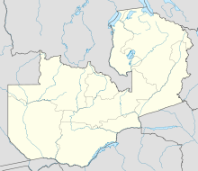
Kazungula ist eine Grenzstadt im Südwesten von Sambia am Sambesifluss gelegen, unweit der Grenzen zu Namibia, Botsuana und Simbabwe. Es besteht ein Fährverkehr über den Fluss nach Botsuana, außer im Flugverkehr die einzige direkte Verbindung der beiden Staaten. Kazangula ist Sitz der Verwaltung des gleichnamigen Distrikts mit 68.265 Einwohnern (Volkszählung 2000).
Kazungula liegt im Süden einer weitläufigen Sambesiaue, in der viel Viehzucht betrieben wird. Der Ort liegt an der Schmalstelle, die diese Aue staut. Der Ort ist ein wichtiges Handelszentrum.
Auf der Seite von Botsuana liegt ein Flughafen mit asphaltierter, zwei Kilometer langer Landebahn und Terminal.
Distrikte der SüdprovinzChoma | Gwembe | Itezhi Tezhi | Kalomo | Kazungula | Livingstone | Mazabuka | Monze | Namwala | Siavonga | Sinazongwe
Wikimedia Foundation.
Schlagen Sie auch in anderen Wörterbüchern nach:
Kazungula — is a small border town in the Southern Province of Zambia, lying on the north bank of the Zambezi River about 70 km west of Livingstone, at a point where four countries meet. It is home to the Kazungula Ferry across the 400 m wide river to the… … Wikipedia
Kazungula, Zimbabwe — Kazungula is a small border post settlement in Matabeleland North, Zimbabwe close to Botswana, Namibia and Zambia. Just to the west is the Zambian border town of Kazungula which operates a pontoon service for vehicles across the Zambezi River… … Wikipedia
Kazungula Ferry — The Kazungula Ferry is a pontoon ferry across the 400 metre wide Zambezi River between Botswana and Zambia. It is one of the largest ferries in south central Africa, having a capacity of 70 tonnes. The service is provided by two motorised… … Wikipedia
Kazungula District — Admin ASC 2 Code Orig. name Kazungula District Country and Admin Code ZM.07.8260555 ZM … World countries Adminstrative division ASC I-II
District de Kazungula — Districts de Zambie Vue sur une carte de District de Kazungula Administration Pays … Wikipédia en Français
Zambezi — Infobox River river name = Zambezi caption = The Zambezi and its river basin origin = Near Mwinilunga, Zambia mouth = Indian Ocean basin countries = Zambia, DR Congo, Angola, Namibia, Botswana, Zimbabwe, Mozambique, Malawi, Tanzania length =… … Wikipedia
Cuando River — Aerial photo of the confluence of the Kuando (Chobe) River (centre left) and the Zambezi River at Kazungula (map, 9) looking west … Wikipedia
Districts of Zambia — Zambia This article is part of the series: Politics and government of Zambia President Michael Sata … Wikipedia
Quadripoint — In geography, a quadripoint is a point on the Earth that touches four distinct regions. Such points are often called four corners , from the corners of the four regions meeting there. [One could argue that, if one region lies on one side of a… … Wikipedia
Botsuanisch — Republic of Botswana Republik Botsuana … Deutsch Wikipedia