- Kimmirut
-
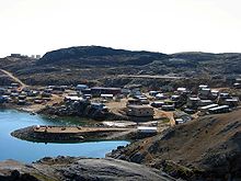 Blick auf Kimmirut
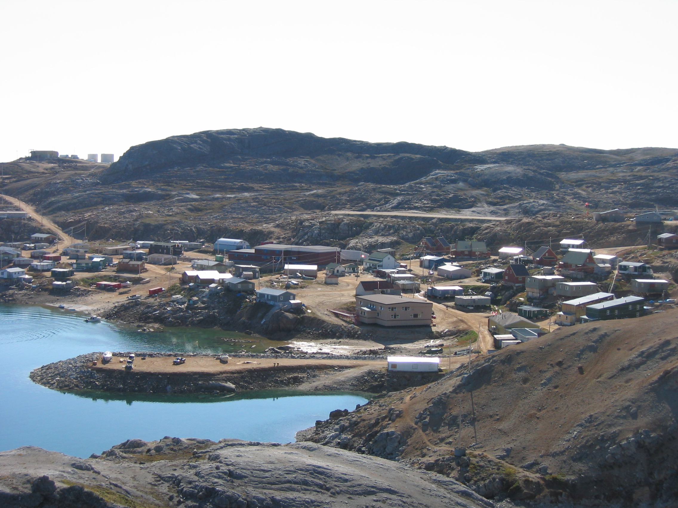
Die Siedlung Kimmirut (Inuktitut-Wort für „Ferse“, nach einer nahe gelegenen Felsformation), Territorium Nunavut, liegt an der Südküste der Baffin-Insel, genauer: auf der Halbinsel Meta Incognita, an der Hudsonstraße, 130 Kilometer südwestlich von Iqaluit und 360 Kilometer östlich von Cape Dorset. Sie hat rund 450 Einwohner (92% Inuit), und zu den Bewohnern der benachbarten Siedlung Cape Dorset bestehen vielerlei verwandtschaftliche Beziehungen.
Der Kontakt zur Außenwelt begann im 17. Jahrhundert, als die Hudson’s Bay Company den ersten Handel mit den Inuit aufnahm. Intensivere Kontakte entstanden, als ab 1860 Walfänger aus Schottland und den USA hier Walfangschiffe stationierten und wenig später eine Glimmermine eröffnet wurde. Im Jahr 1900 etablierte die anglikanische Kirche an einer der heutigen Siedlung gegenüberliegenden Bucht ihre zweite Missionsstation auf der Baffin-Insel. 1911 richtete die Hudson’s Bay Company einen Handelsposten ein, und 1927 entstand ein Posten der kanadischen Polizei. Bis 1945 wurde das damals noch Lake Harbour genannte Kimmirut zum Verwaltungszentrum für die Südbaffin-Region; mit Errichtung der US-amerikanischen Militärbasis in Frobisher Bay, der späteren Hauptstadt Iqaluit, verlor Kimmirut jedoch diese Funktion und damit auch seine Bedeutung.
In Kimmirut leben viele kunstbegabte Menschen. Infolgedessen ist für die Bevölkerung das Herstellen von künstlerischen Steinskulpturen eine wichtige Quelle zur Wertschöpfung bzw. Einkommensverbesserung geworden.
Kimmirut ist bekannt für seinen Tidenhub von etwa 11 Metern, der im Winter durch gefrierendes Meerwasser Eiswälle von bis zu 10 Metern auftürmt.
Der Ort ist Ausgangspunkt für Touren in den Katannilik-Territorialpark, der sich über die Halbinsel Meta Incognita bis zur Frobisher Bay erstreckt und zu großen Teilen vom Soper River beherrscht wird.
Literatur
- Miriam Dewar (Hrsg.): The Nunavut Handbook: Travelling in Canada's Arctic. Ayaya Marketing & Communications, Iqaluit/Ottawa 2004, ISBN 0973675403.
Weblinks
 Commons: Kimmirut – Sammlung von Bildern, Videos und Audiodateien62.848055555556-69.874444444444450Koordinaten: 62° 50′ 53″ N, 69° 52′ 28″ WKategorien:
- Inuit
- Ort in Nunavut
- Baffininsel
Wikimedia Foundation.