Kolacin

Kolacin
Kołacin
Wappen fehlt
Hilfe zu Wappen
Kołacin (Polen)
DEC
Kołacin
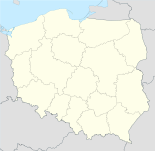
Kołacin
Basisdaten
Staat: Polen
Woiwodschaft: Großpolen
Landkreis: Śrem
Gmina: Książ Wielkopolski
Geographische Lage: 52° 0′ N, 17° 16′ O5217.2666666666677Koordinaten: 52° 0′ 0″ N, 17° 16′ 0″ O
Einwohner: 340
Postleitzahl: 63-130
Telefonvorwahl: (+48) 61
Wirtschaft und Verkehr
Nächster int. Flughafen: Posen-Ławica

Kołacin (deutsch Kolacin, 1939-45 Altdorf) ist ein kleines zur Gemeinde Książ Wielkopolski gehörendes Dorf in Polen in der Woiwodschaft Großpolen im Powiat Śremski. Die Bevölkerung Kołacins beträgt 340 Personen. In der Nähe von Kołacin liegen Chwałkowo Kościelne, Mchy und Książ Wielkopolski. Die Bewohner gehen der Landwirtschaft nach.

Ortseinfahrt von Kołacin

Siehe auch


Wikimedia Foundation.

Игры ⚽ Поможем написать реферат

Schlagen Sie auch in anderen Wörterbüchern nach:

  • Kołacin — Hilfe zu Wappen …   Deutsch Wikipedia

  • Kołacin, Łódź Voivodeship — Infobox Settlement name = Kołacin settlement type = Village total type = image shield = subdivision type = Country subdivision name = POL subdivision type1 = Voivodeship subdivision name1 = Łódź subdivision type2 = County subdivision name2 =… …   Wikipedia

  • Nova Dubnica — Nová Dubnica Wappen Karte …   Deutsch Wikipedia

  • Nová Dubnica — Wappen Karte …   Deutsch Wikipedia

  • Nová Dubnica — Coordinates: 48°55′59″N 18°08′38″E / 48.93306°N 18.14389°E / 48.93306; 18.14389 …   Wikipedia

  • Ksiaz Wielkopolski — Książ Wielkopolski …   Deutsch Wikipedia

  • Xions — Książ Wielkopolski …   Deutsch Wikipedia

  • Gmina Dmosin — Dmosin Commune   Gmina   …   Wikipedia

  • Gmina Miastko — Miastko Commune   Gmina   …   Wikipedia

  • Chwalkowo Koscielne — Chwałkowo Kościelne Hilfe zu Wappen …   Deutsch Wikipedia

Share the article and excerpts

Direct link
Do a right-click on the link above
and select “Copy Link”