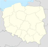
Kołacin

Kołacin
Kołacin
Wappen fehlt
Hilfe zu Wappen
Kołacin (Polen)
Kołacin
Kołacin
Basisdaten
Staat: Polen
Woiwodschaft: Großpolen
Landkreis: Śrem
Gmina: Książ Wielkopolski
Geographische Lage: 52° 0′ N, 17° 16′ O5217.266666666667Koordinaten: 52° 0′ 0″ N, 17° 16′ 0″ O
Einwohner:

340

Postleitzahl: 63-130
Telefonvorwahl: (+48) 61
Wirtschaft und Verkehr
Nächster int. Flughafen: Posen-Ławica

Kołacin (deutsch Kolacin, 1939-45 Altdorf) ist ein kleines zur Gemeinde Książ Wielkopolski gehörendes Dorf in Polen in der Woiwodschaft Großpolen im Powiat Śremski[1]. Die Bevölkerung Kołacins beträgt 340 Personen. In der Nähe von Kołacin liegen Chwałkowo Kościelne, Mchy und Książ Wielkopolski. Die Bewohner gehen der Landwirtschaft nach.

Ortseinfahrt von Kołacin

Siehe auch

 Commons: Kołacin – Album mit Bildern und/oder Videos und Audiodateien

Einzelnachweis

  1. http://www.stat.gov.pl/broker/access/prefile/listPreFiles.jspa

Wikimedia Foundation.

Игры ⚽ Нужна курсовая?

Schlagen Sie auch in anderen Wörterbüchern nach:

  • Kolacin — Kołacin Hilfe zu Wappen …   Deutsch Wikipedia

  • Kołacin, Łódź Voivodeship — Infobox Settlement name = Kołacin settlement type = Village total type = image shield = subdivision type = Country subdivision name = POL subdivision type1 = Voivodeship subdivision name1 = Łódź subdivision type2 = County subdivision name2 =… …   Wikipedia

  • Nova Dubnica — Nová Dubnica Wappen Karte …   Deutsch Wikipedia

  • Nová Dubnica — Wappen Karte …   Deutsch Wikipedia

  • Nová Dubnica — Coordinates: 48°55′59″N 18°08′38″E / 48.93306°N 18.14389°E / 48.93306; 18.14389 …   Wikipedia

  • Ksiaz Wielkopolski — Książ Wielkopolski …   Deutsch Wikipedia

  • Xions — Książ Wielkopolski …   Deutsch Wikipedia

  • Gmina Dmosin — Dmosin Commune   Gmina   …   Wikipedia

  • Gmina Miastko — Miastko Commune   Gmina   …   Wikipedia

  • Chwalkowo Koscielne — Chwałkowo Kościelne Hilfe zu Wappen …   Deutsch Wikipedia

Share the article and excerpts

Direct link
Do a right-click on the link above
and select “Copy Link”