- Latah (Washington)
-

Dieser Artikel wurde aufgrund von inhaltlichen Mängeln auf der Qualitätssicherungsseite des Projektes USA eingetragen. Hilf mit, die Qualität dieses Artikels auf ein akzeptables Niveau zu bringen, und beteilige dich an der Diskussion! 
Latah 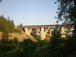
Die Sunset Boulevard BridgeLage in Washington 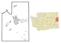
Basisdaten Gründung: 9. April 1892 Staat: Vereinigte Staaten Bundesstaat: Washington County: Koordinaten: 47° 17′ N, 117° 9′ W47.281666666667-117.15666666667765Koordinaten: 47° 17′ N, 117° 9′ W Zeitzone: Pacific Standard Time (UTC−8) Einwohner: 151 (Stand: 2000) Bevölkerungsdichte: 167,8 Einwohner je km² Fläche: 0,9 km² (ca. 0 mi²)
davon 0,9 km² (ca. 0 mi²) LandHöhe: 765 m Postleitzahl: 99018 Vorwahl: +1 509 FIPS: 53-38495 GNIS-ID: 1512380 Latah ist eine Ortschaft im Spokane County im US-Bundesstaat Washington. Laut Volkszählung im Jahr 2000 hatte sie eine Einwohnerzahl von 151 auf einer Fläche von 0,9 km².
Geschichte
Latah wurde am 9. April 1892 gegründet.
Demographie
Die 151 Einwohner leben in 56 Haushalten und verteilen sich auf 43 Familien.
Altersstruktur:
Altersgruppe Anzahl in % <-18 31,1 18-24 6,6 25-44 31,1 45-64 24,5 65-< 6,6 Kategorie:- Ort in Washington


Wikimedia Foundation.