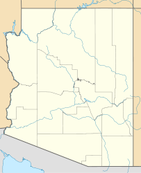
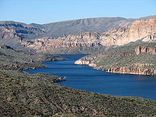
Apache Lake (Arizona) — Infobox lake lake name = Apache Lake image lake = ApacheLakeNArea02.jpg caption lake = image bathymetry = caption bathymetry = location = central Arizona coords = coord|33|34|43|N|111|15|48|W|region:US AZ type:waterbody… … Wikipedia
Apache — (dt.: /aˈpaʧə, aˈpaxə/; engl.: /əˈpætʃi/) bezeichnet: Indianer Apachen, mehrere nordamerikanische Indianerstämme Apache Sprachen Apache Kid (Haskay bay nay natyl) (*1860 – †n.n.), einen Indianerscout unter General George Crook Orte Apache County … Deutsch Wikipedia
Apache Trail — The Apache Trail in Arizona was originally a stagecoach trail that ran through the Superstition Mountains. It was named the Apache Trail after the Apache Indians who originally used this trail to move through the Superstition Mountains.The… … Wikipedia
Apache Plaza — was a former shopping center, located in St. Anthony, Minnesota, a small suburb of Minneapolis. This mall has historic significance because it was one of the first enclosed malls in the US, and was the second such center in the state of Minnesota … Wikipedia
Apache trout — Conservation status Critically Endangered (IUCN 2 … Wikipedia
Lake Valley, New Mexico — Lake Valley was a silver mining town in Sierra County, New Mexico, United States. The town had its heyday from 1881 to 1893. The last resident left in 1994. Today the town is a completely deserted ghost town. The townsite is partly privately… … Wikipedia
Lake Montezuma, Arizona — CDP The Rimrock Ranch airplane, around 1930. Rimrock Ranch was a dude ranch near Montezuma Well … Wikipedia
Apache-Sitgreaves National Forest — Infobox protected area | name = Apache Sitgreaves National Forest iucn category = VI caption = locator x = 64 locator y = 113 location = Arizona and New Mexico, USA nearest city = Springerville, AZ lat degrees = 33 lat minutes = 38 lat seconds =… … Wikipedia
Apache-Sitgreaves National Forest — Der Apache Sitgreaves National Forest ist ein Nationalforst in den Vereinigten Staaten. Es handelt sich um zwei insgesamt 8.000 km² große Waldgebiete, die sich entlang der Mogollon Kette und der White Mountains im östlichen Arizona bis hinein… … Deutsch Wikipedia
Apache — Infobox Ethnic group group = Apache poptime = 31,000+Fact|date=October 2007 popplace = Arizona, New Mexico and Oklahoma rels = Shamanism, Christianity langs = Chiricahua, Jicarilla, Lipan, Plains Apache, Mescalero, Western Apache related =… … Wikipedia


