- Marylebone
-
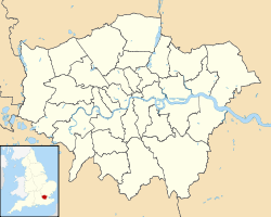
Lage von Marylebone in Greater London
Marylebone ([ˈmɑrlɨbən], St. Marylebone, Mary-le-bone) ist ein Stadtviertel in London in der City of Westminster nördlich der Oxford Street bzw. des Stadtteiles Mayfair und südlich des Regent’s Park. Nach Westen ist Marylebone durch die Edgware Road bzw. den Stadtteil Paddington, nach Osten durch den Portland Place und das Fitzrovia-Viertel begrenzt.
Der Name leitet sich von einer „St Mary’s“ Kirche (jetzt: St Marylebone Parish Church) her, die am Ufer des kleinen Baches „Tybourne“ steht. Die Gegend wurde deshalb St Mary at the bourne genannt, was sich später zu Marylebone verschliff. Dass sich der Name von Marie la bonne herleite, ist dagegen nur eine populäre Mißinterpretation.
Das Metropolitan Borough of St Marylebone war von 1899 bis 1965 ein Metropolitan Borough des County of London, dann wurde es mit dem Metropolitan Borough of Paddington und dem Metropolitan Borough of Westminster zum London Borough of Westminster vereinigt.
Inhaltsverzeichnis
Verkehr
U-Bahnhöfe
- Baker Street
- Bond Street
- Edgware Road
- Great Portland Street
- Marble Arch
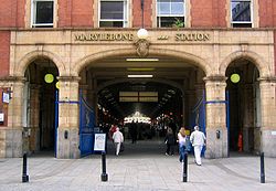
- Marylebone
- Oxford Circus
- Regent’s Park
Eisenbahn
Sehenswürdigkeiten
- Madame Tussauds Wachsfigurenkabinett und Planetarium
- Marble Arch
- University of Westminster
- Royal Academy of Music
- Harley Street
- Regent’s Park
- Kunstmuseum Wallace Collection
- Hyde Park grenzt im Südwesten an Marylebone
- Lord’s Cricket Ground liegt nordwestlich von Marylebone
Berühmte Einwohner
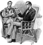
- Sherlock Holmes Romanfigur als Detektiv 19./20. Jahrhundert
- H. G. Wells (1866-1946), Science-Fiction-Schriftsteller
- Yoko Ono (* 1933), Künstlerin
- Brian Epstein (1934-1967), Manager der The Beatles
- John Lennon (1940-1980), The Beatles
- Paul McCartney (*1942), The Beatles
- Ringo Starr (*1940), The Beatles
- Jacqueline du Pre (1945-1987), Cellistin
- David Chipperfield (*1953), Architekt
- Madonna (*1958), Sängerin
- Noel Gallagher (*1967), Musiker
- Guy Ritchie (*1968), Regisseur
Weblinks
- Straßenkarte von Marylebone
- Beschreibung und Geschichte von St Marylebone aus dem Gazetteer von 1868
- Beschreibung und Geschichte von St Marylebone in der Encyclopaedia Britannica von 1911
- Wigmore Hall
- The Marylebone Association
51.5177-0.1606999999999935Koordinaten: 51° 31′ N, 0° 10′ W
Wikimedia Foundation.


