Mercury Bay

Mercury Bay
-36.783333333333175.8
Mercury Bay (Neuseeland)
Mercury Bay
Mercury Bay

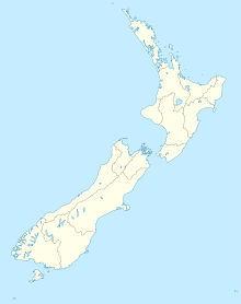
Die Mercury Bay ist eine große V-förmige Bucht an der östlichen Pazifikküste der Coromandel-Halbinsel in Neuseeland. Die Mündung der Bucht ist etwa 10 km breit und etwa 10 km tief.

In der Mitte der Bucht verengt sich die Bucht zu einer schmalen Durchfahrt, dahinter bildet sich der 'Whitianga Harbour, ein Naturhafen mit mehreren Armen, der sich weitere 6 km in das Land erstreckt. An der Nordseite der Engstelle liegt die Gemeinde Whitianga. Eine Fähre überquert die Enge nach Cooks Beach. Weitere Orte um die Bucht sind Kaimarama und Coroglen.

Der State Highway 25 verläuft um die Bucht und durch Whitanga. Nördlich und südlich der Mündung liegen mehrere kleine Inselchen. Die Mercury Islands liegen über 10 km entfernt im Norden.

In die Bucht münden mehrere kleine Flüsse, die ihr Einzugsgebiet in der Coromandel Range haben, darunter der Mahakirau und Kaimarama River, Ounuora, Waiwara, Kapowai und Whanuakite River.

Die Bucht wird von Sportfischern geschätzt, so kann hier der Marlin gefangen werden. In der Bucht gibt es auch einen Yachtclub, den Mercury Bay Yacht Club, der 1988 der Herausforderer in Neuseelands erster Challenge für den America’s Cup war.

Am Südwestufer des äußeren Teiles der Bucht liegt der Ort Cooks Beach. Ein Steinsockel erinnert an die Landung von James Cook und seine Beobachtung des Durchgang des Merkur.

Quellen

Weblinks


Wikimedia Foundation.

Игры ⚽ Нужна курсовая?

Schlagen Sie auch in anderen Wörterbüchern nach:

  • Mercury Bay — Memorial of Cook s observation of a transit of Mercury, at Shakespeare Cliff lookout near Cooks Beach. Mercury Bay is a large V shaped bay on the eastern coast of the Coromandel Peninsula on the North Island of New Zealand. This bay was named by… …   Wikipedia

  • Mercury Bay Holiday Park — (Фитианга,Новая Зеландия) Категория отеля: 4 звездочный отель Адрес: 121 Albe …   Каталог отелей

  • Club Náutico Mercury Bay — Mercury Bay Boating Club Sede Social 90 Buffalo Beach Road, Whitianga País …   Wikipedia Español

  • Mercury Islands — Eine Echtfarbenaufnahme des NASA Satelliten Terra vom 23. Oktober 2002, die Mercury Islands liegen ganz oben rechts, nordöstlich der …   Deutsch Wikipedia

  • Mercury Islands — Maori: (?) A true colour image acquired by NASA s Terra satellite, on October 23, 2002. The Mercury Islands are just visible at top right, to the northeast of the Coromandel Peninsula. Geography …   Wikipedia

  • Mercury — Contents 1 Geography 2 Populated places 3 Transportation 4 …   Wikipedia

  • Bay Area News Group — is the largest newspaper publisher in the San Francisco Bay Area and has corporate headquarters based in San Ramon, California with publications offices in San Jose and Walnut Creek, although the Walnut Creek location is scheduled to be closed… …   Wikipedia

  • Mercury Island — Luftaufnahme von Mercury Island Gewässer …   Deutsch Wikipedia

  • Mercury(II) sulfate — Other names Mercuric sulfate, Mercurypersulfate, Mercury Bisulfate …   Wikipedia

  • Mercury Island — from the air. Note the building on the center left of this photograph for scale …   Wikipedia

Share the article and excerpts

Direct link
Do a right-click on the link above
and select “Copy Link”