- Mishawaka, Indiana
-
Mishawaka Spitzname: The Princess City 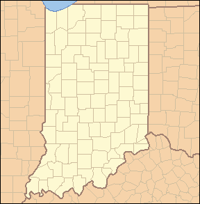

Mishawaka Lage in IndianaBasisdaten Staat: Vereinigte Staaten Bundesstaat: Indiana County: St. Joseph County Koordinaten: 41° 40′ N, 86° 10′ W41.6675-86.171388888889219Koordinaten: 41° 40′ N, 86° 10′ W Zeitzone: Eastern Standard Time (UTC−5) Einwohner: 46.557 (Stand: 2000) Bevölkerungsdichte: 1.143,9 Einwohner je km² Fläche: 41,6 km²
davon 40,7 km² LandHöhe: 219 m Postleitzahlen: 46544-46546 Vorwahl: +1 574 FIPS: 18-49932 GNIS-ID: 0452691 Webpräsenz: http://www.mishawakacity.com/ Bürgermeister: Jeffrey L. Rea Mishawaka ist eine Stadt im St. Joseph County im US-Bundesstaat Indiana. Die Bevölkerung bei der letzten Zählung von 2000 betrug 46.557.
Inhaltsverzeichnis
Geographie
Mishawaka liegt auf 41° 40′ 3″ (41,667498) nördlicher Breite und 86° 10′ 17″ (-86.171253) westlicher Länge.
Die Gesamtfläche der Stadt beträgt 41,6 km². 2,12 % der Fläche ist Wasser.
Einwohnerentwicklung
Jahr Einwohner¹ 1980 40.201 1990 42.608 2000 46.557 2005 48.497 ¹ 1980–2000: Volkszählungsergebnisse; 2005: Fortschreibung des US Census Bureau
Bevölkerung
Nach der Volkszählung von 2000 gibt es in Mishawaka 20.248 Haushalte und 11.642 Familien, die Bevölkerungsdichte beträgt 1.144 Einwohner je km².
91,58 % der Bevölkerung sind Weiße, 3,56 % Afro-Amerikaner, 2,79 % Latinos, 0,43 % Indianer, 1,39 % Asiaten und 2,04 % anderen Ursprungs.
Von den 20.248 Haushalten haben 28,2 % Kinder unter 18 Jahren, 40,2 % sind verheiratete Paare, 13,0 % Einelternfamilien und 42,5 % Nicht-Familien.
24,0 % der Bevölkerung ist unter 18 Jahre alt, 11,8 % 18–24 Jahre, 30,7 % 25–44 Jahre, 19,4 % 45–64 Jahre, 14,0 % sind 65 Jahre und älter. Das Durchschnittsalter beträgt 34 Jahre. Auf 100 Frauen entfallen 89,7 Männer.
Söhne und Töchter der Stadt
- Lisa Germano, Sängerin, Liedermacherin und Geigerin
- Pete Candoli, Jazz-Trompeter
- Conte Candoli, Jazz-Trompeter
Wikimedia Foundation.