Argalasti

Argalasti
Argalasti
Αργαλαστή
Argalasti (Griechenland)
Bluedot.svg
Basisdaten
Staat: Griechenland
Region: Thessalien
Regionalbezirk: Magnisia
Gemeinde: Notio Pilio
Geographische Koordinaten: 39° 14′ N, 23° 13′ O39.22569444444423.219694444444Koordinaten: 39° 14′ N, 23° 13′ O
Höhe ü. d. M.: 248 m
Dorfzentrum
Einwohner: 1820 (2001[1])

Argalasti (griechisch Αργαλαστή (f. sg)) ist eine Kleinstadt in Thessalien und Sitz der Gemeinde Notio Pilio. Sie liegt im Süden des Pilion-Gebirgszugs (1.624 m, Pourianos Stavros) auf einer fruchtbaren Hochebene 196 m über den Meeresspiegel und ca. 41 km von der Stadt Volos entfernt. Der Ort ist ein Handels- und Tourismus-Zentrum der Region. Argalasti ist Ausgangspunkt für die nahe gelegenen Strände am Pagasäischen Golf (Horto, Kalamos, Lefokastro) und am Ägäischen Meer (Potistika, Melani, Paltsi).

Argalasti wurde 1912 als Landgemeinde (kinotita) anerkannt und 1997 mit der Eingemeindung von Metochi und Xinovrysi zur Stadtgemeinde (dimos) hochgestuft. Mit der Verwaltungsreform 2010 wurde sie mit vier weiteren Gemeinden der Pilion-Halbinsel zur neuen Gemeinde Notio Pilio (‚Süd-Pilion‘) fusioniert.

Argalasti hat eine Schule, ein Gymnasium, ein Postamt und einen Hauptplatz (Platia).

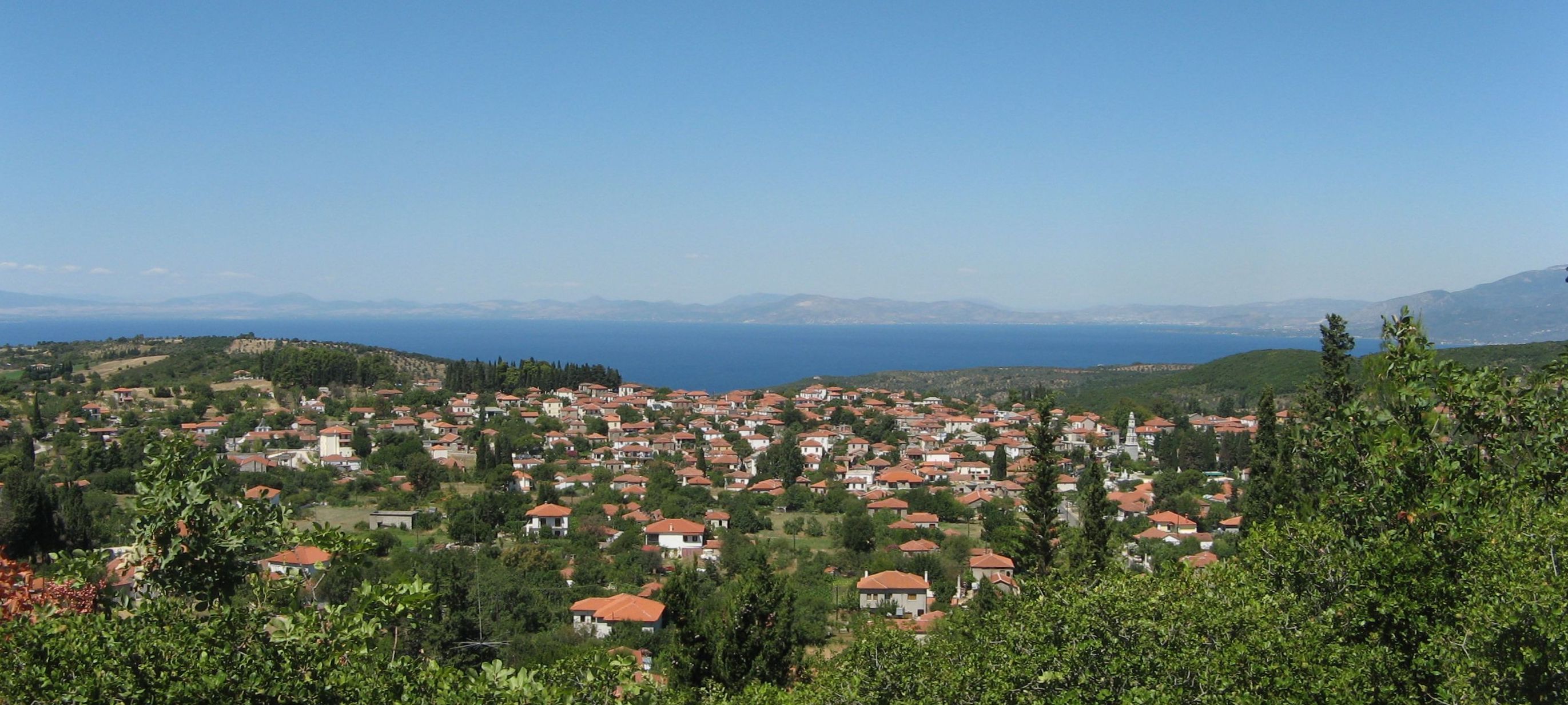
Panorama von Argalasti

Sehenswertes

Die Platia bildet die gesellschaftliche Mitte des Ortes. Um den Platz gruppieren sich Cafés, Tavernen, Kioske, ein Postamt und ein Spielplatz. Der Platz wird besonders zur Abendzeit als Treffpunkt der Einheimischen genutzt.

Eine Meisterleistung der Architektur zu Beginn des 20. Jahrhunderts ist der Turm der Kirche St. Aposteln mit seiner sehenswerten Turmuhr.

Einzelnachweise

  1. Nationaler Statistischer Dienst Griechenlands (ΕΣΥΕ) nach Volkszählung 2001 (PDF, 1.009 KB)

Siehe auch


Wikimedia Foundation.

Игры ⚽ Поможем решить контрольную работу

Schlagen Sie auch in anderen Wörterbüchern nach:

  • Argalasti — Infobox Greek Dimos name = Argalasti name local = Αργαλαστή caption skyline = Argalasti square 2007 periph = Thessaly prefec = Magnesia province = population = 2158 population as of = 2001 population ref = [http://www.statistics.gr/gr… …   Wikipedia

  • Argalasti — Original name in latin Argalast Name in other language Argalasti, Argalast State code GR Continent/City Europe/Athens longitude 39.23333 latitude 23.21667 altitude 206 Population 1285 Date 2012 05 09 …   Cities with a population over 1000 database

  • Argalasti — Sp Argalãstė Ap Αργαλαστή/Argalasti L R Graikija …   Pasaulio vietovardžiai. Internetinė duomenų bazė

  • Kokoslis Museum of Argalasti — is a museum in Magnesia, Greece …   Wikipedia

  • Xinovrysi — Xinovrysi, other forms: Xinovryssi, Xinovrissi and Xinovrissi (Greek: Ξινόβρυση), other forms: Xynovrysi or Xynovryssi, is a Greek village located near Argalasti in the Pelion area in the Magnesia prefecture. Xinovrysi is connected with a road… …   Wikipedia

  • GR-43 — Präfektur Magnisia Νομός Μαγνησίας Basisdaten Staat: Griechenland …   Deutsch Wikipedia

  • El Villa House — (Argalastí,Греция) Категория отеля: Адрес: Argalasti Pilio, Argalastí, 37006, Греция …   Каталог отелей

  • Chorto — Χόρτο Location …   Wikipedia

  • Lefokastro — (Greek: Λεφόκαστρον), older form: Lefokastron is a picturesque fishing village on the Pagasetic Gulf, 8 km from Argalasti and 34 km from Volos. Lefokastro is part of the municipal district and the municipality of Argalasti in the Magnesia… …   Wikipedia

  • Milies — For other uses, see Milies (disambiguation). Milies Μηλιές Location …   Wikipedia

Share the article and excerpts

Direct link
Do a right-click on the link above
and select “Copy Link”