- Modrý Kameň
-
Modrý Kameň
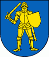
Wappen Karte  Basisdaten
Kraj: Banskobystrický kraj Okres: Veľký Krtíš Region: Poiplie Fläche: 19,644 km² Einwohner: 1.585 (31. Dez. 2010) Bevölkerungsdichte: 80,69 Einwohner je km² Höhe: 240 m n.m. Postleitzahl: 992 01 Telefonvorwahl: 0 47 Geographische Lage: 48° 14′ N, 19° 20′ O48.24138888888919.334444444444240Koordinaten: 48° 14′ 29″ N, 19° 20′ 4″ O Kfz-Kennzeichen: VK Gemeindekennziffer: 516210 StrukturGemeindeart: Stadt Verwaltung (Stand: Januar 2011)Bürgermeister: Aladár Bariak Adresse: Mestský úrad Modrý Kameň
Mariánske námestie 1
99280 Modrý KameňWebpräsenz: www.modrykamen.sk Gemeindeinformation
auf portal.gov.skStatistikinformation
auf statistics.skModrý Kameň (deutsch Blauenstein, ungarisch Kékkő) ist eine Stadt im Okres Veľký Krtíš im Süden der Slowakei.
Sie wurde 1290 zum ersten Mal schriftlich als Keykkw erwähnt.
Bis 1918 gehörte sie zum Königreich Ungarn und kam dann zur neu entstandenen Tschechoslowakei. Durch den Ersten Wiener Schiedsspruch kam die Stadt von 1938 bis 1945 kurzzeitig wieder zu Ungarn.
Siehe auch
Weblinks
Balog nad Ipľom | Bátorová | Brusník | Bušince | Čebovce | Čeláre | Čelovce | Červeňany | Dačov Lom (Lam) | Dolinka | Dolná Strehová | Dolné Plachtince (Unterplachtintz) | Dolné Strháre | Ďurkovce | Glabušovce | Horná Strehová | Horné Plachtince (Oberplachtintz) | Horné Strháre | Hrušov | Chrastince | Chrťany | Ipeľské Predmostie | Kamenné Kosihy | Kiarov | Kleňany (Kleinen) | Koláre | Kosihovce | Kosihy nad Ipľom | Kováčovce | Lesenice (Lesenitz) | Ľuboriečka | Malá Čalomija | Malé Straciny | Malé Zlievce (Kleinzellowitz) | Malý Krtíš | Modrý Kameň (Blauenstein) | Muľa | Nenince (Luka-Ninitz) | Nová Ves | Obeckov | Olováry | Opatovská Nová Ves | Opava | Pôtor | Pravica | Príbelce | Sečianky | Seľany | Senné | Sklabiná | Slovenské Ďarmoty | Slovenské Kľačany | Stredné Plachtince (Mitterplachtintz) | Sucháň | Suché Brezovo | Širákov | Šuľa | Trebušovce | Veľká Čalomija | Veľká Ves nad Ipľom | Veľké Straciny | Veľké Zlievce (Großzellowitz) | Veľký Krtíš | Veľký Lom | Vieska | Vinica (Ninik) | Vrbovka | Záhorce | Závada | Zombor | Želovce
Wikimedia Foundation.


