Oquirrh Mountains

Oquirrh Mountains
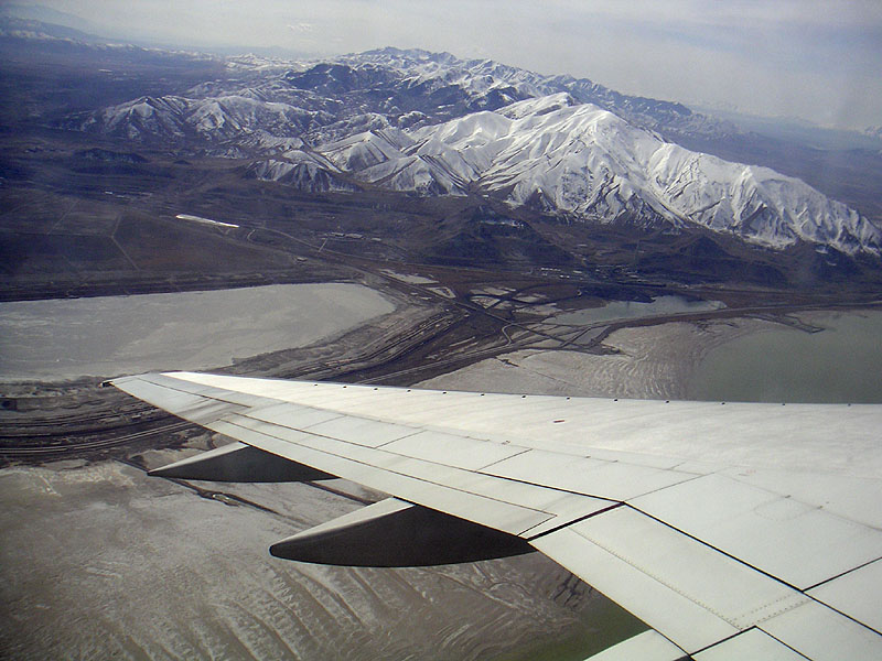
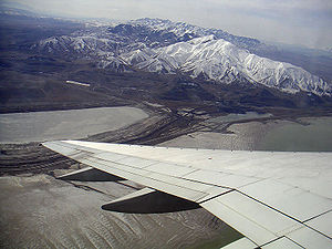
Das Oquirrh Gebirge aus der Luft

Das Oquirrh-Gebirge ist ein Bergzug im US-Bundesstaat Utah, der das Salzseetal über 50 km vom westlich gelegenen Tooeletal abtrennt. Das Gebirge endet am Nordufer des Großen Salzsees. Die höchste Erhebung ist der 3.237 Meter hohe Flat Top Mountain. Der Name Oquirrh (O-Ker ausgesprochen) bedeutet in der Sprache der Goshute-Indianer bewaldeter Berg.

Im Gebirge wurden Gold, Silber, Blei und besonders Kupfer abgebaut. Von Salt Lake City aus gesehen fällt besonders das abgelagerte Material des Kupfertagebaus auf.

In den Wintermonaten werden die Berge durch eine kleine Population von Weißkopfseeadlern besiedelt.

Geologie

Das Oquirrh-Gebirge hat sich mit den Appalachen, damals noch als zusammenhängender Gebirgszug, vor ca. 300 Mio. Jahren gebildet. Nachdem die Bildung des Superkontinenten Pangaea abgeschlossen war und er wieder zerbrach, wanderte der sich ausbildende Nordamerikanische Kontinent vor 95 Mio Jahren über den Bermuda-Hotspot, dieser hob den Bereich um das heutige Mississippi Tiefland innerhalb von 10 Mio. Jahren um 2000m bis 3000m hoch. Erosion trug die Aufwölbung im Laufe der nächsten 70 Mio. Jahren ab und nachdem der Kontinent über den Plume hinweg gewandert ist, senkte sich der Bereich um denselben Beitrag, wie er vorher angehoben wurde. Das nun überflutete Mississippi-Tiefland trennt das Oquirrh- vom Appalachen-Gebirge.

Literatur

  • Roy B. Van Arsdale u. Randel T. Cox: Die merkwürdige Geschichte des Mississippi. In: Spektrum der Wissenschaft. 6/07., Nr. 6, 2007, ISSN 0170-2971, S. 68–75.

Weblinks


Wikimedia Foundation.

Игры ⚽ Нужно решить контрольную?

Schlagen Sie auch in anderen Wörterbüchern nach:

  • Oquirrh Mountains — Range The Oquirrh Mountains as seen looking southwest from Salt Lake City s City Creek Canyon …   Wikipedia

  • Oquirrh Mountains — ▪ mountains, Utah, United States also called  Oquirrh Range        mountain range that extends about 30 miles (50 km) southward from the southern end of the Great Salt Lake, Utah, U.S., overlooking the Tooele and Salt Lake valleys. The mountains… …   Universalium

  • Oquirrh Mountains — geographical name mountain range N central Utah S of Great Salt Lake; highest point about 11,000 feet (3353 meters) …   New Collegiate Dictionary

  • Oquirrh Mountain Utah Temple — in May 2009. Number 130 …   Wikipedia

  • Oquirrh, Utah —   CDP   Coordinates …   Wikipedia

  • Old Oquirrh Bucket — The Old Oquirrh Bucket The Old Oquirrh Bucket (named after the Oquirrh Mountains to the west of Salt Lake City) is the symbol of in state basketball supremacy in Utah. Every year since 1974 the trophy has been awarded to the in state college team …   Wikipedia

  • Salt Lake County, Utah — Infobox U.S. County county = Salt Lake County state = Utah seal seallink map size = 150 founded year = 1852 seat wl = Salt Lake City largest city wl = Salt Lake City area total sq mi = 808 area total km2 = 2092 area land sq mi = 737 area land km2 …   Wikipedia

  • West Jordan, Utah — Infobox Settlement official name = West Jordan, Utah settlement type = City nickname = motto = imagesize = image caption = image mapsize = 250px map caption = Location of West Jordan, Utah mapsize1 = map caption1 = subdivision type = Country… …   Wikipedia

  • South Jordan, Utah — Infobox Settlement official name = South Jordan, Utah settlement type = City nickname = motto = imagesize = image caption = image mapsize = 250px map caption = Location of South Jordan, Utah mapsize1 = map caption1 = subdivision type = Country… …   Wikipedia

  • Salt Lake Valley — is a 500 square mile valley in Salt Lake County in the north central portion of the U.S. state of Utah. It contains Salt Lake City and many of its suburbs, notably West Valley City, Sandy, and West Jordan; its total population is 948,172 as of… …   Wikipedia

Share the article and excerpts

Direct link
Do a right-click on the link above
and select “Copy Link”