- Pandora (Ohio)
-
Pandora 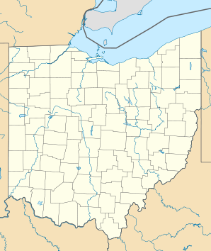

Pandora Lage in OhioBasisdaten Staat: Vereinigte Staaten Bundesstaat: Ohio County: Koordinaten: 40° 57′ N, 83° 58′ W40.946944444444-83.96236Koordinaten: 40° 57′ N, 83° 58′ W Zeitzone: Eastern Standard Time (UTC−5) Einwohner: 1188 (Stand: 2000) Bevölkerungsdichte: 565,7 Einwohner je km² Fläche: 2,1 km² (ca. 1 mi²)
davon 2,1 km² (ca. 1 mi²) LandHöhe: 236 m Postleitzahl: 45877 Vorwahl: +1 419 FIPS: 39-59738 GNIS-ID: 1085224 Bürgermeister: John Schlumbohm Pandora ist ein Village im Putnam County, Ohio, Vereinigte Staaten. Bei der Volkszählung 2000 hatte der Ort 1.188 Einwohner.
Inhaltsverzeichnis
Geographie
Pandora liegt in der fruchtbaren Ebene des ehemaligen Great Black Swamp im Nordwesten Ohios, 84,3 Meilen (135 Kilometer) südwestlich des Eriesees. Durch den Ort fließt der Riley Creek.
Nachbarorte Pandoras sind die County-Hauptstadt Ottawa und Gilboa im Norden sowie Columbus Grove und Bluffton im Süden. In Bluffton hat der Ort Anschluss an den Interstate 75, wenige Kilometer weiter südlich verläuft der U.S. Highway 30.
Geschichte
Putnam County wurde ab den 1830er Jahren vorwiegend von Schweizer Mennoniten besiedelt. Die Keimzelle Pandoras war eine Getreidemühle, die John Stout 1835 am Ufer des Riley Creek errichtete. Der Ort wurde zunächst Columbia, später Pendleton und ab 1883 Pandora genannt. 1959 hatte das Dorf 717 Einwohner, 2000 war die Bevölkerung auf 1188 angewachsen.
In Pandora und Umgebung leben gegenwärtig etwa 750 Mennoniten, die überwiegend der General Conference Mennonite Church angehören. Die Hälfte der Gemeindemitglieder lebt im Ort selbst.
Wirtschaft und Infrastruktur
Die wichtigste Einnahmequelle der Bewohner von Putnam County ist die Landwirtschaft. Produziert werden Fleisch, Getreide, Tomaten, Kartoffeln, Sojabohnen und Zuckerrüben. In Pandora sind auch mehrere Gewerbebetriebe angesiedelt, die vor allem den lokalen Bedarf decken. Vor Ort gibt es mit der Pandora-Gilboa Local School eine High School sowie vier Kirchen.
Sehenswürdigkeiten
Südlich des Ortes liegt das Areal des Swiss Settlement of Bluffton-Pandora. Die Gebäude der ersten Siedler sind zum Teil restauriert und als Museum eingerichtet. Das Bluffton-College hat historische Fotografien veröffentlicht, die das Alltagsleben der Farmer im 19. Jahrhundert dokumentieren.
Literatur und Weblinks
- Delbert Gratz et. al.: The Swiss Settlement of Bluffton-Pandora, Ohio. Mennonite Life, Dezember 1988. (pdf; 18,30 MB)
- www.gameo.org – Eintrag in der Global Anabaptist Mennonite Encyclopedia Online

Wikimedia Foundation.