- Putnam County (Ohio)
-
Verwaltung US-Bundesstaat: Ohio Verwaltungssitz: Ottawa Adresse des
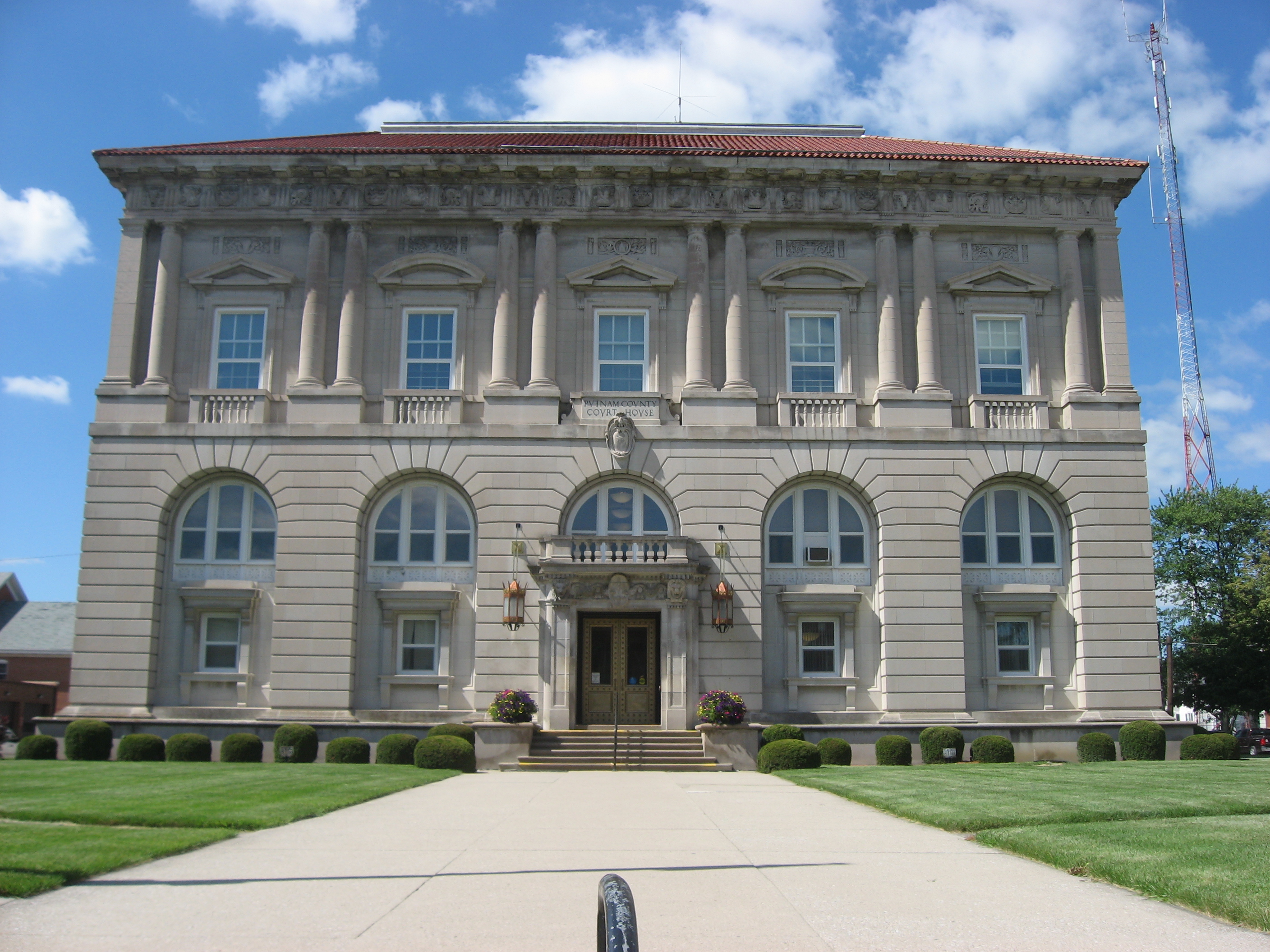
Verwaltungssitzes:County Courthouse
245 East Main Street
Ottawa, OH 45875-1971Gründung: 12. Februar 1820 Gebildet aus: Shelby County Vorwahl: 001 419 Demographie Einwohner: 34.928 (2005) Bevölkerungsdichte: 27,9 Einwohner/km² Geographie Fläche gesamt: 1.254 km² Wasserfläche: 1 km² Karte 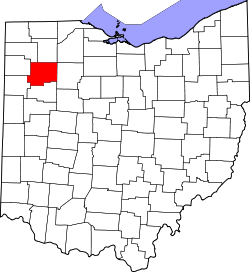
Website: www.putnamnet.com Putnam County[2] ist ein County im Bundesstaat Ohio der Vereinigten Staaten von Amerika. Der Verwaltungssitz (County Seat) ist Ottawa.
Inhaltsverzeichnis
Geografie
Das County liegt im Nordwesten von Ohio, ist im Westen etwa 50 km von der Grenze zu Indiana entfernt und hat eine Fläche von 1254 Quadratkilometern, wovon 1 Quadratkilometer Wasserfläche sind. Es grenzt im Uhrzeigersinn an folgende Countys: Henry County, Hancock County, Allen County, Van Wert County, Paulding County, Defiance County und Wood County.
Geschichte
Putnam County wurde am 12. Februar 1820 aus Teilen des Shelby County gebildet. Benannt wurde es nach Israel Putnam, einem General im Amerikanischen Unabhängigkeitskrieg, der u.a. bei der Schlacht von Bunker Hill (1775) kämpfte.
Demografische Daten
Historische Einwohnerzahlen Census Einwohner ± in % 1830 230 — 1840 5189 2.000 % 1850 7221 40 % 1860 12.808 80 % 1870 17.081 30 % 1880 23.713 40 % 1890 30.188 30 % 1900 32.525 8 % 1910 29.972 -8 % 1920 27.751 -7 % 1930 25.074 -10 % 1940 25.016 -0,2 % 1950 25.248 0,9 % 1960 28.331 10 % 1970 31.134 10 % 1980 32.991 6 % 1990 33.819 3 % 2000 34.726 3 % Vor 1900[3] 
Nach der Volkszählung im Jahr 2000 lebten im Putnam County 34.726 Menschen in 12.200 Haushalten und 9.308 Familien. Die Bevölkerungsdichte betrug 28 Einwohner pro Quadratkilometer. Ethnisch betrachtet setzte sich die Bevölkerung zusammen aus 96,26 Prozent Weißen, 0,17 Prozent Afroamerikanern, 0,15 Prozent amerikanischen Ureinwohnern, 0,18 Prozent Asiaten, 0,01 Prozent Bewohnern aus dem pazifischen Inselraum und 2,51 Prozent aus anderen ethnischen Gruppen; 0,73 Prozent stammten von zwei oder mehr Ethnien ab. 4,38 Prozent der Bevölkerung waren spanischer oder lateinamerikanischer Abstammung.
Von den 12.200 Haushalten hatten 39,2 Prozent Kinder und Jugendliche unter 18 Jahre, die bei ihnen lebten. 64,9 Prozent waren verheiratete, zusammenlebende Paare, 7,4 Prozent waren allein erziehende Mütter, 23,7 Prozent waren keine Familien, 21,3 Prozent waren Singlehaushalte und in 10,5 Prozent lebten Menschen im Alter von 65 Jahren oder darüber. Die Durchschnittshaushaltsgröße betrug 2,81 und die durchschnittliche Familiengröße lag bei 3,29 Personen.
Auf das gesamte County bezogen setzte sich die Bevölkerung zusammen aus 29,7 Prozent Einwohnern unter 18 Jahren, 8,3 Prozent zwischen 18 und 24 Jahren, 28,1 Prozent zwischen 25 und 44 Jahren, 20,6 Prozent zwischen 45 und 64 Jahren und 13,3 Prozent waren 65 Jahre alt oder darüber. Das Durchschnittsalter betrug 35 Jahre. Auf 100 weibliche Personen kamen 98,5 männliche Personen. Auf 100 Frauen im Alter von 18 Jahren oder darüber kamen statistisch 97,0 Männer.
Das jährliche Durchschnittseinkommen eines Haushalts betrug 46.426 USD, das Durchschnittseinkommen der Familien betrug 52.859 USD. Männer hatten ein Durchschnittseinkommen von 36.548 USD, Frauen 23.963 USD. Das Prokopfeinkommen betrug 18.680 USD. 4,0 Prozent der Familien und 5,6 Prozent der Bevölkerung lebten unterhalb der Armutsgrenze. Davon waren 6,4 Prozent Kinder oder Jugendliche unter 18 Jahre und 9,8 Prozent waren Menschen über 65 Jahre. [6]
Orte
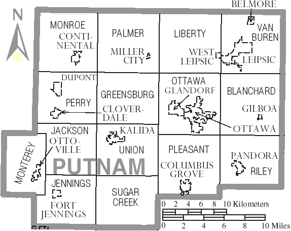
 Verwaltungsgliederung von Putnam County
Villages
- Belmore
- Cloverdale
- Columbus Grove
- Continental
- Dupont
- Fort Jennings
- Gilboa
- Glandorf
- Ottoville
- Pandora
- West Leipsic
Townships
- Blanchard
- Greensburg
- Jackson
- Jennings
- Liberty
- Monroe
- Monterey
- Ottawa
- Palmer
- Perry
- Pleasant
- Riley
- Sugar Creek
- Union
- Van Buren
Unincorporated communitys
- Avis
- Croswell
- Cuba
- Dorninton
- Douglas
- Elm Center
- Hartsburg
- Hector
- Jones City
- Kieferville
- Muntanna
- New Cleveland
- North Creek
- Prentiss
- Rice
- Rimer
- Rushmore
- Townwood
- Vaughnsville
- Wisterman
Einzelnachweise
- ↑ Auszug aus dem National Register of Historic Places. Abgerufen am 13. März 2011
- ↑ Putnam County im Geographic Names Information System des United States Geological Survey. Abgerufen am 22. Februar 2011
- ↑ U.S. Census Bureau _ Census of Population and Housing. Abgerufen am 17. Februar 2011
- ↑ Auszug aus Census.gov. Abgerufen am 21. Februar 2011
- ↑ Auszug aus factfinder.census.gov Abgerufen am 21. Februar 2011
- ↑ Putnam County, Ohio, Datenblatt mit den Ergebnissen der Volkszählung im Jahre 2000 bei factfinder.census.gov.

Liste der Countys in Ohio
Adams | Allen | Ashland | Ashtabula | Athens | Auglaize | Belmont | Brown | Butler | Carroll | Champaign | Clark | Clermont | Clinton | Columbiana | Coshocton | Crawford | Cuyahoga | Darke | Defiance | Delaware | Erie | Fairfield | Fayette | Franklin | Fulton | Gallia | Geauga | Greene | Guernsey | Hamilton | Hancock | Hardin | Harrison | Henry | Highland | Hocking | Holmes | Huron | Jackson | Jefferson | Knox | Lake | Lawrence | Licking | Logan | Lorain | Lucas | Madison | Mahoning | Marion | Medina | Meigs | Mercer | Miami | Monroe | Montgomery | Morgan | Morrow | Muskingum | Noble | Ottawa | Paulding | Perry | Pickaway | Pike | Portage | Preble | Putnam | Richland | Ross | Sandusky | Scioto | Seneca | Shelby | Stark | Summit | Trumbull | Tuscarawas | Union | Van Wert | Vinton | Warren | Washington | Wayne | Williams | Wood | Wyandot


Wikimedia Foundation.