- Shaktoolik
-
Shaktoolik 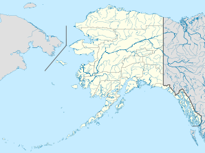

Shaktoolik Lage in AlaskaBasisdaten Staat: Vereinigte Staaten Bundesstaat: Alaska Borough: Koordinaten: 64° 21′ N, 161° 11′ W64.355611111111-161.191305555567Koordinaten: 64° 21′ N, 161° 11′ W Zeitzone: Alaska Standard Time (UTC−9) Einwohner: 230 (Stand: 2000) Bevölkerungsdichte: 85,2 Einwohner je km² Fläche: 2,7 km² (ca. 1 mi²)
davon 2,7 km² (ca. 1 mi²) LandHöhe: 7 m Postleitzahl: 99771 Vorwahl: +1 907 FIPS: 02-68890 GNIS-ID: 1669434 Shaktoolik ist eine kleine Stadt im Nome Census Area des US-Bundesstaats Alaska. Bei der Volkszählung im Jahr 2000 hatte Shaktoolik 230 Einwohner mit einem Indianer-Anteil von etwas über 94 %.
Shaktoolik liegt an der Ostküste des Norton Sounds an der Mündung des Shaktoolik Rivers in die gleichnamige Bucht.
Geschichte
Am nahe gelegenen Cape Denbigh, einer National Historic Landmark, sind 6000–8000 Jahre alte Zeugnisse menschlicher Anwesenheit gefunden worden. Shaktoolik selbst wurde erstmals 1842–44 von Lawrenti Sagoskin, einem Offizier der Kaiserlich Russischen Marine, unter dem Namen „Tshaktogmyut“ kartiert. Der Name Shaktoolik ist von dem Unaliq-Wort „suktuliq“ abgeleitet und bedeutet so viel wie „weit verstreute Dinge“.
1933 wurde die Siedlung von der ursprünglichen Stelle 10 km flussaufwärts an die Mündung in den Norton Sound verlegt. Da sie dort schweren Stürmen von der offenen See ausgesetzt war, wurde sie 1967 nach einem Beschluss des Stadtrats 4 km nach Norden an ihre heutige Stelle verlegt.
Der Ort ist jedes Jahr Checkpoint am Iditarod-Hundeschlittenrennen.
Weblinks
- Native Village of Shaktoolik (engl.)
Kategorien:- Ort in Alaska
- Nome Census Area

Wikimedia Foundation.