- Shire of Hepburn
-
Hepburn Shire 
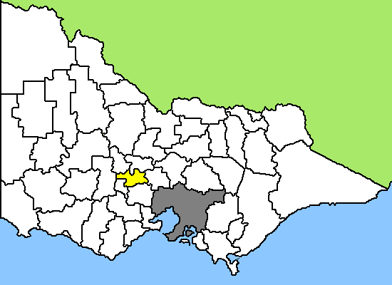
Lage des Hepburn Shire in Victoria Basisdaten Bundesstaat: Victoria Hauptort: Daylesford Fläche: 1.470 km² Einwohner: 14.959 (Juni 2006) Wards: 5 Hepburn Shire ist ein lokales Verwaltungsgebiet (LGA) im australischen Bundesstaat Victoria. Das Gebiet ist 1.470 km² groß und hat etwa 15.000 Einwohner.
Hepburn liegt im Zentrum Victorias etwa 110 km nordwestlich der Hauptstadt Melbourne und schließt folgende Ortschaften ein: Allendale, Broomfield, Bullarto, Cambeltown, Clunes, Creswick, Daylesford, Dean, Eganstown, Hepburn Springs, Kingston, Leonards Hill, Lyonville, Musk, Newlyn, Rocklyn, Smeaton und Trentham. Der Sitz des City Councils befindet sich in Daylesford in der Osthälfte der LGA mit etwa 3.400 Einwohnern.
In den 30er Jahren des 19. Jahrhunderts ließen sich erste, vereinzelte Schafzüchter in der Region nieder. Am 7. Juli 1851 begann die Goldgräberzeit in Victoria, als bei Clunes der erste offizielle Goldfund des Staates bekannt gemacht wurde. Während des Goldrauschs prosperierte die Gegend, aber nach dessen Ende ging es genauso schnell wieder abwärts. So stieg die Zahl der Einwohner in Creswick in den zehn Jahren bis 1861 erst auf 25.000 bis 50.000 und sank dann wieder unter 5.000.
Creswick war 1882 auch der Schauplatz des größten Minenunglücks in der australischen Geschichte. Bei der Überflutung der Mine Australia No 2 ertranken 22 Goldgräber.
Neben der Landwirtschaft prägt auch die Forstwirtschaft die Region. In den Eukalyptuswälder um Trentham wurden zeitweise mehrere tausend Tonnen Holz pro Jahr geschlagen. In Creswick wurde 1910 die School of Forestry gegründet, die heute ein Lehrstuhl für Forst- und Ökowissenschaften der Universität Melbourne ist.
Daylesford und Hepburn Springs sind zudem als "Spa Town" bekannt. Dort befindet sich die höchste Dichte an Heilquellen in ganz Australien. Über 60 davon befinden sich in der Region. Entsprechend sind dort viele Heilbäder und Einrichtungen rund um Gesundheit und Wellness sowie Unterkünfte für über 3.500 Besucher zu finden.
Die Gegend um Clunes ist auch als Drehort sehr beliebt. Mehrere australische Film- und Fernsehproduktionen stammen von hier, unter Anderem wurden hier auch Szenen für den international erfolgreichen Film Mad Max gedreht.
Verwaltung
Der Hepburn Shire Council hat fünf Mitglieder, die von den Bewohnern der fünf Wards gewählt werden. Diese Bezirke sind Birch, Cameron, Coliban, Creswick und Holcombe. Aus dem Kreis der Councillor rekrutiert sich auch der Mayor (Bürgermeister) des Councils.
Weblinks
Ländliche Gebiete: Alpine | Ararat | Ballarat | Bass Coast | Baw Baw | Benalla | Buloke | Campaspe | Central Goldfields | Colac Otway | Corangamite | East Gippsland | Gannawarra | Glenelg | Golden Plains | Greater Bendigo | Greater Geelong | Greater Shepparton | Hepburn | Hindmarsh | Horsham | Indigo | Latrobe | Loddon | Macedon Ranges | Mansfield | Mildura | Mitchell | Moira | Moorabool | Mount Alexander | Moyne | Murrindindi | Northern Grampians | Pyrenees | Queenscliffe | South Gippsland | Southern Grampians | Strathbogie | Surf Coast | Swan Hill | Towong | Wangaratta | Warrnambool | Wellington | West Wimmera | Wodonga | Yarriambiack
Greater Melbourne: Banyule | Bayside | Boroondara | Brimbank | Cardinia | Casey | Darebin | Frankston | Glen Eira | Greater Dandenong | Hobsons Bay | Hume | Kingston | Knox | Manningham | Maroondah | Maribyrnong | Melbourne | Melton | Monash | Moonee Valley | Moreland | Mornington Peninsula | Nillumbik | Port Phillip | Stonnington | Whitehorse | Whittlesea | Wyndham | Yarra | Yarra Ranges
Wikimedia Foundation.