Bagerhat

Bagerhat
Bagerhat
Bagerhat (Bangladesch)
Bagerhat
Bagerhat
Basisdaten
Staat Bangladesch
Division Khulna
Distrikt Bagerhat
Gründung 15. JahrhundertVorlage:Infobox Ort/Wartung/Datum
ISO 3166-2 BD-05
22.65706146416789.80368

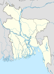
Die Historische Moscheenstadt Bagerhat, früher Khalifatabad, liegt im Distrikt Bagerhat der Division Khulna in Bangladesch am Bhairab. Sie wurde im 15. Jahrh. n. Chr. vom türkischen General Khan Jahan Ali unter Sultan Nasiruddin Mahmud Shah (1442-1459) gegründet. Wegen ihrer zahlreichen islamischen Baudenkmäler gehört sie seit 1985 zum Weltkulturerbe der UNESCO.

Wahrzeichen ist die Sechzig-Säulen-Moschee, auch Shait Gumbad Moschee, im Stil der Tughluq-Dynastie. Errichtet wurde sie noch unter Khan Jahan Ali, dem örtlichen Herrscher von Khalifatabad bis zu seinem Lebensende. Heute wird Khan Jahan Ali als Heiliger verehrt und sein Mausoleum ist muslimische Pilgerstätte. Die Säulen tragen ein in 77 Kuppeln gegliedertes Dach.Vier weitere Kuppeln schließen die Ecktürme ab.

Weblinks

 Commons: Bagerhat – Sammlung von Bildern, Videos und Audiodateien

Wikimedia Foundation.

Игры ⚽ Нужно решить контрольную?

Schlagen Sie auch in anderen Wörterbüchern nach:

  • Bagerhat — ▪ Bangladesh also spelled  Bagherhat    town, southwestern Bangladesh. It lies just south of the Bhairab River. Bagerhat was the capital of Hazrat Khan Jahan Ali the 15th century pioneer of the Sundarbans region of the southern Padma River… …   Universalium

  • Bagerhat District — Infobox of BD districts native name = Bagerhat skyline = Bagerhat (Mosque City).jpg skyline size = skyline caption = The historic 60 dome mosque (ষাট গম্বুজ মসজিদ) has become the symbol of Bagerhat District locator position = right latd = 22.66… …   Wikipedia

  • Bagerhat Sadar Upazila — Infobox of upazilas native name = Bagerhat Sadar locator position = right latd = 22.6625 longd = 89.7917 division name = Khulna Division district = Bagerhat District population as of = 1991 population total = 235848 population density = 865 area… …   Wikipedia

  • Bagerhat (district) — 22° 24′ N 89° 45′ E / 22.4, 89.75 …   Wikipédia en Français

  • Bagerhat District — Admin ASC 2 Code Orig. name Bāgerhāt District Country and Admin Code BD.82.05 BD …   World countries Adminstrative division ASC I-II

  • Bagerhat District — noun One of the ten districts in the Khulna Division of Bangladesh …   Wiktionary

  • Mosque City of Bagerhat — Historic Shat Gombuj Mosque (Sixty Tomb Mosque) * UNESCO World Heritage Site …   Wikipedia

  • Mosque city of Bagerhat — Infobox World Heritage Site WHS = Historic Mosque City of Bagerhat State Party = BAN Type = Cultural Criteria = iv ID = 321 Region = Asia Pacific Year = 1985 Session = 9th Link = http://whc.unesco.org/en/list/321Mosque City of Bagerhat is one of… …   Wikipedia

  • Ville-mosquee historique de Bagerhat — Ville mosquée historique de Bagerhat Ville mosquée historique de Bagerhat 1 Patrimoine mondial Vue de l un des murs de la mosquée Shatgumbad Latitude Longitude …   Wikipédia en Français

  • Ville-mosquée de Bagerhat — Ville mosquée historique de Bagerhat Ville mosquée historique de Bagerhat 1 Patrimoine mondial Vue de l un des murs de la mosquée Shatgumbad Latitude Longitude …   Wikipédia en Français

Share the article and excerpts

Direct link
Do a right-click on the link above
and select “Copy Link”