Stranorlar

Stranorlar
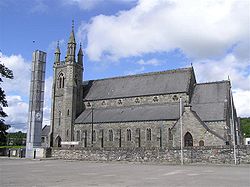
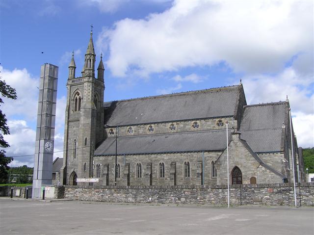
Catholic church of St Mary's in Stranorlar mit Uhrturm (2008)
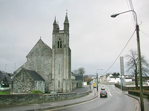
Dieselbe Kirche mit Uhrturm in anderer Perspektive (2007)

Stranorlar (irisch: Srath an Urláir) ist eine Stadt in der Grafschaft Donegal im Nordwesten der Republik Irland.

Stranorlar liegt im östlichen Teil des Countys direkt gegenüber von Ballybofey, mit dem zusammen es die landesweit so genannten Twin Towns bildet. Dabei liegt Stranorlar im Finn Valley am nördlichen, Ballybofey am südlichen Ufer des River Finn.[1] Ballybofey-Stranorlar hatten beim Census 2006 zusammen 4176 Einwohner.[2]

Stranorlar liegt an der N15 von Sligo nach Derry City, etwa in der Mitte zwischen Donegal Town in südwestlicher und Lifford, dem Hauptort des Countys, sowie dem größeren nordirischen Strabane in östlicher Richtung. Mit dem wenige Meilen entfernten Letterkenny, der größten Stadt des Countys, ist Stranorlar durch die N56 verbunden. Da die N56 eine Zirkularroute durch das gesamte County ist, wird Stranorlar von vielen Donegal-Touristen passiert.

Für knapp 100 Jahre war Stranorlar das Zentrum des Eisenbahnsystems im County Donegal; der örtliche Bahnhof wurde 1863 eröffnet, 1960 jedoch geschlossen und abgerissen. An seiner Stelle wurde ein Omnibusdepot für Bus Éireann errichtet, das bis heute den Hauptbetriebshof von Bus Éireann im County Donegal darstellt. Zur Feier der Jahrtausendwende wurde die alte Bahnhofsuhr restauriert und in einem neu errichteten Uhrturm am Ort des alten Bahnhofszugangs aufgestellt.

Der Gründer der Home Rule League, Isaac Butt (1813–1879), ist auf dem Gräberfeld der alten Church of Ireland-Kirche in Stranorlar beerdigt.

Weblinks

 Commons: Stranorlar – Sammlung von Bildern, Videos und Audiodateien

Einzelnachweise

  1. Karte von Irland (stark vergrößerbar)
  2. Census 2006, S. 54
54.805-7.7677777777778

Wikimedia Foundation.

Игры ⚽ Нужен реферат?

Schlagen Sie auch in anderen Wörterbüchern nach:

  • Stranorlar — Administration Nom irlandais Srath an Urláir Pays Irlande Province Ulster Comté Comté de Donegal Site web …   Wikipédia en Français

  • Stranorlar — Infobox Irish Place name = Stranorlar gaeilge = Srath an Urláir crest motto = map pin coords = left: 83px; top: 71px north coord = 54.8 | west coord = 7.790 | irish grid = H194946 area = | elevation = 30 m province = Ulster county = County… …   Wikipedia

  • Stranorlar Vocational School — is a small, well established school located in Stranorlar, Co. Donegal. It has over 300 pupils and currently offers over 20 subjects for students to study. The school is currently in the process of building a new school in Drumboe, near… …   Wikipedia

  • Ballybofey-Stranorlar — Ballybofey/Stranolar is a census town in County Donegal, Ireland, comprising the villages of Ballybofey and Stranorlar which face each other across the River Finn. Its population at the 2002 census was 3603.External linksOfficial site… …   Wikipedia

  • County Donegal Railways Joint Committee — The County Donegal Railways Joint Committee operated an extensive 3 foot gauge railway system serving county Donegal ,Ireland,from 1906 until 1960. The committee was incorporated by an Act of Parliament in 1906, which authorised the joint… …   Wikipedia

  • N15 road (Ireland) — N15 road Location Primary destinations: (bypassed routes in italics) County Donegal Lifford* Castlefin* Killygordo …   Wikipedia

  • Seán McCool — (Irish: Seán MacCumhaill) (died 1st May 1949) was a prominent Irish Republican and a former chief of staff of the Irish Republican Army. Imprisoned on numerous occasions, North and South, he embarked on a number of hunger strikes and also stood… …   Wikipedia

  • N13 road (Ireland) — N13 road Location Primary destinations: (bypassed routes in italics) County Donegal (N15 from Sligo) Stran …   Wikipedia

  • Ballybofey — Infobox Irish Place name = Ballybofey gaeilge = Bealach Féich crest motto = map pin coords = left: 81px; top: 73px north coord = 54.8 | west coord = 7.790 | irish grid = H194946 area = | elevation = 30 m province = Ulster county = County Donegal… …   Wikipedia

  • Ballybofey — Administration Nom irlandais Bealach Féich Pays Irlande Province Ulster Comté Comté de Donegal Démographie …   Wikipédia en Français

Share the article and excerpts

Direct link
Do a right-click on the link above
and select “Copy Link”