Syvota

Syvota
Stadtgemeinde Syvota
(1997–2010)

Δήμος Συβότων (Συβότα)
Syvota (Griechenland)
Bluedot.svg
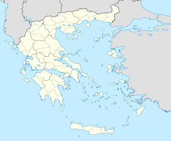
Basisdaten
Staat: Griechenland
Verwaltungsregion: Epirus
Präfektur: Thesprotia
Geographische Koordinaten: 39° 24′ N, 20° 14′ O39.40833333333320.239722222222Koordinaten: 39° 24′ N, 20° 14′ O
Höhe ü. d. M.: 0 m
Hafen
Fläche: 72,439 km²
Einwohner: 2.908 (Volkszählung 2001)
Bevölkerungsdichte: 40,14 Ew./km²
Sitz: Syvota
LAU-1-Code-Nr.: 320700
Gemeindegliederung: 5 Gemeindebezirke
Website: www.nthesprotias.com//munic_category.php?id=7
Lage in der ehem. Präfektur Thesprotia
File:Dimos Syvoton.png

f9f10

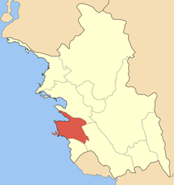
Sonnenuntergang im Hafen von Syvota

Syvota (griechisch Σύβοτα (n. pl.), früher Mourtos oder Volia, albanisch Vola) ist ein Ort in der Gemeinde Igoumenitsa an der westlichen Küste Griechenlands. Er liegt auf dem Festland in der Region Epirus und ist Namensgeber des gleichnamigen Gemeindebezirks.

Weitere Dörfer im Gemeindebezirk sind Faskomilia, Polyneri, Skorpiona, Argyrotopos und Vryssi.

Die nächste größere Stadt ist 24 km nördlich Igoumenitsa 12 km nördlich liegt der Ort Plataria.

Geschichte

Erstmals erwähnt wurde Syvota 433 v. Chr., als vor den Inseln eine Seeschlacht zwischen den Korinthern und den Korfioten stattgefunden hat.

Unter dem Namen Volia oder Mourtos (Βώλια ή Μούρτος) erhielt der Ort 1919 die Anerkennung als Landgemeinde (kinotita). 1927 wurde er in Mourtos, 1940 schließlich in Syvota umbenannt. 1997 erfolgte mit der Eingemeindung einiger umliegender Orte die Hochstufung zur Stadtgemeinde (dimos). 2010 wurde Syvota nach Igoumenitsa eingemeindet, wo es seither einen Gemeindebezirk bildet.

Weblinks


Wikimedia Foundation.

Игры ⚽ Нужен реферат?

Schlagen Sie auch in anderen Wörterbüchern nach:

  • Syvota — Σύβοτα View of Syvota. Location …   Wikipedia

  • Sivota — Gemeinde Syvota Δήμος Συβότων (Συβότα) DEC …   Deutsch Wikipedia

  • Porto Sivota — (Сивота,Греция) Категория отеля: Адрес: Syvota, Сивота, 46100, Греция …   Каталог отелей

  • GR-32 — Präfektur Thesprotia Νομός Θεσπρωτίας Basisdaten Staat: Griechenland …   Deutsch Wikipedia

  • Varfani — Parapotamos (griechisch Παραπόταμοs (m. sg.), albanisch Varfanji), früher Varfani, ist eine Stadt Griechenlands in der Präfektur Thesprotia. Der Name bedeutet übersetzt „neben dem Fluss“, was auf die Lage am Fluss Kalamas hinweist. Die Stadt… …   Deutsch Wikipedia

  • List of municipalities and communities in Greece — This is an alphabetical list of municipalities and communities in Greece. For an ordered list of cities with population over 30,000 see List of cities in Greece. A B C D E F G H I K L M N O P R S T V X Y Z See also A Name Greek name Prefecture A …   Wikipedia

  • List of settlements in the Lefkada prefecture — This is a list of settlements in the Lefkada prefecture, Greece.On the island of Lefkada*Agios Ilias *Agios Nikitas *Agios Petros **Ponti Agiou Petrou *Alexandros *Apolpena *Athani *Charadiatika *Chortata *Dragano *Egklouvi **Syvota *Evgiros… …   Wikipedia

  • Epirus (periphery) — Infobox Peri GR name = Epirus name local = Περιφέρεια Ηπείρου prefec = Arta Ioannina Preveza Thesprotia capital = Ioannina population = 358698 population as of = 2005 area = 9203 website = [http://www.roe.gr www.roe.gr] Epirus (Greek: Ήπειρος,… …   Wikipedia

  • Paramythia — For the bird genus see Paramythia Infobox Greek Dimos name = Paramythia name local = Παραμυθιά periph = Epirus prefec = Thesprotia population = 7601 population as of = 2001 area = 316 lat deg = 39 lat min = 28 lon deg = 20 lon min = 30 postal… …   Wikipedia

  • Apollonioi — Infobox Greek Dimos name = Apollonioi name local = Απολλώνιοι caption skyline = city city lat deg = 38 lat min = 38 lon deg = 20 lon min = 36 elevation min = 0 elevation max = periph = Ionian Islands prefec = Lefkada districts = 11 mayor = party …   Wikipedia

Share the article and excerpts

Direct link
Do a right-click on the link above
and select “Copy Link”