- Szamotuły
-
Szamotuły 
Basisdaten Staat: Polen Woiwodschaft: Großpolen Landkreis: Szamotuły Fläche: 10,1 km² Geographische Lage: 52° 36′ N, 16° 35′ O52.616.583333333333Koordinaten: 52° 36′ 0″ N, 16° 35′ 0″ O Einwohner: 18.878
(31. Dez. 2010)[1]Postleitzahl: 64-501 Telefonvorwahl: (+48) 61 Kfz-Kennzeichen: PSZ Wirtschaft und Verkehr Schienenweg: Posen–Stettin Nächster int. Flughafen: Posen-Ławica Gemeinde Gemeindeart: Stadt- und Landgemeinde Fläche: 175 km² Einwohner: 29.165
(31. Dez. 2010) [2]Bevölkerungsdichte: 167 Einw./km² Gemeindenummer (GUS): 3024073 Verwaltung (Stand: 2007) Bürgermeister: Jacek Grabowski Adresse: ul. Dworcowa 26
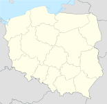
64-500 SzamotułyWebpräsenz: www.szamotuly.pl Szamotuły [ʃamɔ'tuwɨ] (deutsch Samter) ist eine Stadt in der Woiwodschaft Großpolen in Polen. Sie hat 18.700 Einwohner und ist Kreissitz des Powiat Szamotulski. Die Stadt befindet sich 32 km nordwestlich von Posen.
Inhaltsverzeichnis
Geschichte
Die erste bekannte Siedlung an der Stelle von Szamotuły existierte bereits im 11. Jahrhundert. Sie wurde im Jahr 1306 zerstört und später unter dem Namen Nowe Szamotuły wiederaufgebaut. Im Jahr 1420 erhielt sie die Stadtrechte.
Im Jahre 1793 kam die Stadt zu Preußen. Von 1815 bis 1918 war sie Sitz des deutschen Kreises Samter und wurde nach dem Versailler Vertrag Teil Polens.
Sehenswürdigkeiten
Zu den Sehenswürdigkeiten der Stadt gehört die Kirche Matki Bożej Pocieszenia i św. Stanisława Biskupa, die in den Jahren 1423 bis 1430 im Stil der Gotik gebaut wurde. Die Gebäude des früheren Klosters św. Krzyża im Stil des Barock wurden in den Jahren 1675 bis 1682 gebaut.
Söhne und Töchter der Stadt
- Wacław z Szamotuł (* um 1526), polnischer Komponist und Dichter
- John Johnston (* 1603), Naturforscher und Historiker schottischer Herkunft
- Theophil Magdzinski (*1818), Reichstags- und Landtagsabgeordneter
- Philipp Scharwenka (* 1847), Komponist und Musikpädagoge
- Xaver Scharwenka (* 1850), Komponist und Pianist
- Hans Groß (* 1860), deutscher Luftschiffkonstrukteur
- Janusz Grabianski (* 1929), polnischer Illustrator
- Małgorzata Braunek (* 1947), polnische Schauspielerin
- Jakub Rutnicki (* 1978), polnischer Politiker
Gmina Szamotuły
Die Stadt- und Landgemeinde Szamotuły besteht aus folgenden Ortschaften:
Name deutscher Name
(1815-1918)deutscher Name
(1939-45)Baborówko Baborowko Hartschütz Baborowo Baborowo Barkendorf Brodziszewo Brodziszewo
1906-18 SachsenhofSachsenhof Czyściec Vorwerk Czysciec ? Emilianowo Vorwerk Emilianowo ? Gałowo Gut Galowo Dornbusch Gałowo-Majątek Galowo Abbau
1906-18 GalowoDornbusch Abbau Gąsawy Gonsawy
1906-18 IlsenauIlsenau Grabowiec Grabowiec ? Jastrowo Jastrowo Schwedenberg Jastrowo-Majątek Vorwerk Jastrowo ? Kamionka Kamionka ? Kąsinowo Konsinowo Kosenfeld Kępa Kempa Kempa Koźle Kuzle Kuschel Krzeszkowice Krzeszkowice Bauernhau Lipnica Gut Lipnica Gut Lipnitz Lipnickie Huby Lipnica Lipnitz Ludwikowo Vorwerk Louisenhof ? Lulinek Lulinko Lulendorf Mutowo Vorwerk Mutowo ? Myszkowo Myszkowo (zu Freital) Nowy Folwark Neuvorwerk Neuvorwerk Ostrolesie Ostrolesie ? Otorowo Ottorowo 1939-43 Ottoswalde
1943-45 OtterwaldePamiątkowo Pamiontkowo 1939-43 Feldheim
1943-45 PamenPiaskowo Vorwerk Piaskowo
1906-18 SandhofenSandhofen Piotrkówko Peterkowko
1906-18 LindenhöheLindenhöhe Poświętne Poswientno ? Przecław Przeclaw
1906-18 PrinzenauPrinzenau Przecławek Vorwerk Przeclawek Prinzenfelde Przyborówko Gut Przyborowko Gut Freital Przyborowo Przyborowo
1887-1918 FreithalFreital Śmiłowo Smilowo Stoppelhang Szamotuły Samter Samter Szczuczyn Szczuczyn ? Twardowo Twardowo ? Wincentowo Vincentowo ? Witoldzin Witoldzin ? Żalewo Vorwerk Zalewo ? Partnerstädte
Szamotuły hat seit dem Jahr 2000 vier Partnerstädte in Europa:
- Brignoles in Südfrankreich,
- Bruneck (Brunico) in Südtirol (Italien),
- Groß-Gerau in Deutschland und
- Tielt in Belgien.
Verweise
Weblinks
Fußnoten
- ↑ Population. Size and Structure by Territorial Division. As of December 31, 2010. Główny Urząd Statystyczny (GUS), abgerufen am 23. Juni 2011.
- ↑ Population. Size and Structure by Territorial Division. As of December 31, 2010. Główny Urząd Statystyczny (GUS), abgerufen am 23. Juni 2011.
Wikimedia Foundation.

