- Takehara
-
Takehara-shi
竹原市
Geographische Lage in Japan 

Region: Chūgoku Präfektur: Hiroshima Koordinaten: 34° 21′ N, 132° 54′ O34.341794444444132.90708888889Koordinaten: 34° 20′ 30″ N, 132° 54′ 26″ O Basisdaten Fläche: 118,30 km² Einwohner: 28.185
(1. Oktober 2011)Bevölkerungsdichte: 238 Einwohner je km² Gemeindeschlüssel: 34203-3 Symbole Baum: Bambus Blume: Ume Rathaus Adresse: Takehara City Hall
5-1-35, Chūō
Takehara-shi
Hiroshima 725-8666Webadresse: http://www.city.takehara.hiroshima.jp Lage Takeharas in der Präfektur Hiroshima 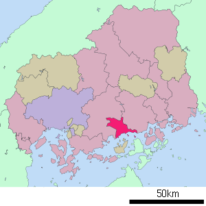
Takehara (jap. 竹原市, -shi, wörtlich: „Bambusebene“) ist eine Stadt in der Präfektur Hiroshima in Japan.
Inhaltsverzeichnis
Geographie
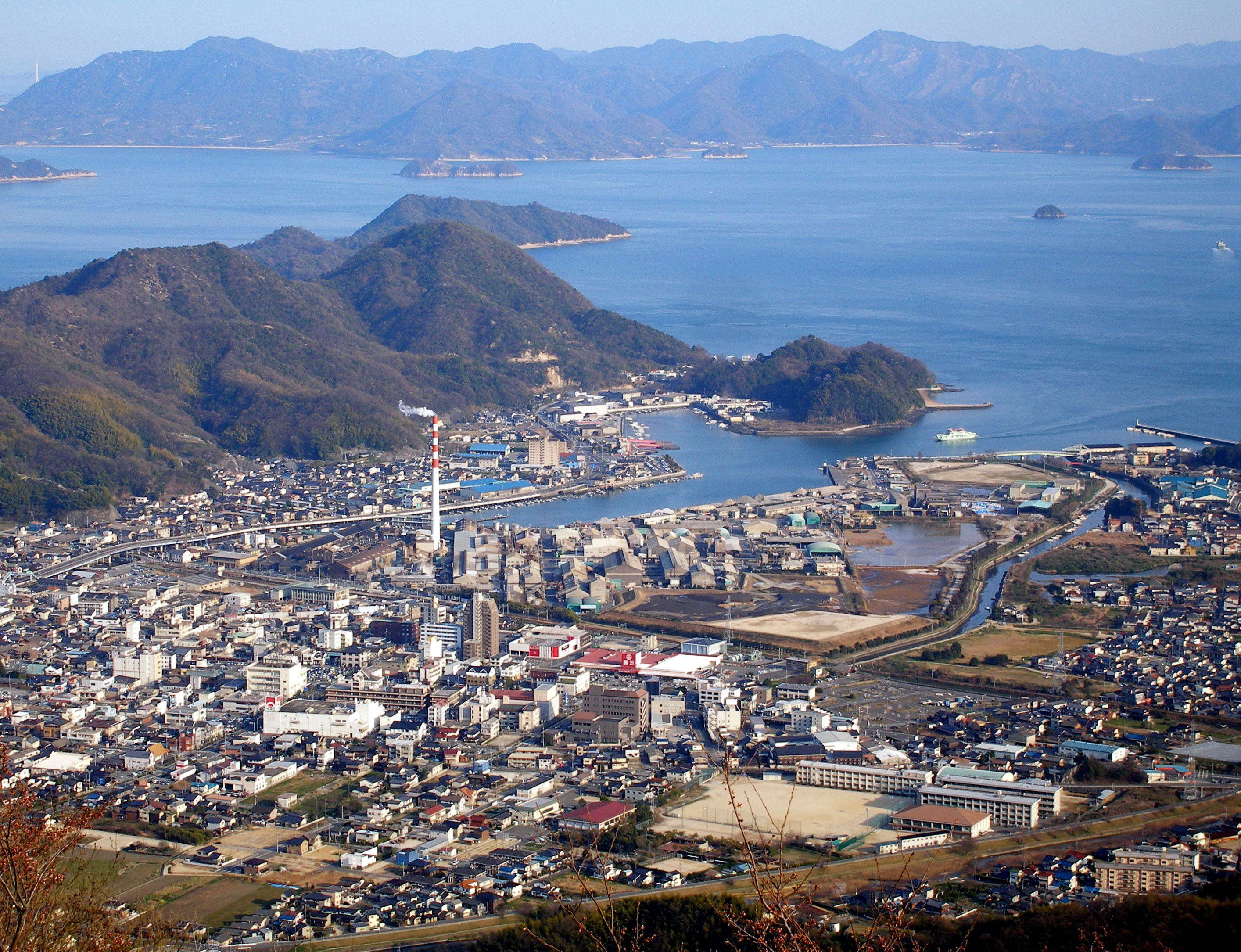
Takehara liegt östlich von Hiroshima und westlich von Fukuyama an der Seto-Inlandsee. Zum Stadtgebiet gehören auch mehrere Inseln in der Inlandssee, darunter Ōkunoshima, die in der Shōwa-Zeit für die Produktion von Giftgas genutzt wurde.
Geschichte
Die Stadt Takehara wurde am 3. November 1958 gegründet.
Verkehr
Takehara liegt an der Nationalstraße 2 nach Osaka und Kitakyushu. Der Bahnhof liegt an der JR Sanyo-Hauptlinie nach Kobe und Kitakyushu.
Söhne und Töchter der Stadt
Angrenzende Städte und Gemeinden
Die Stadt grenzt an Mihara und Higashihiroshima.
Weblinks
 Commons: Takehara – Sammlung von Bildern, Videos und Audiodateien
 Gemeinden und Landkreise in der Präfektur Hiroshima
Kreisfreie Städte (shi): Akitakata | Etajima | Fuchū | Fukuyama | Hatsukaichi | Higashihiroshima | Hiroshima (Verwaltungssitz) | Kure | Mihara | Miyoshi | Onomichi | Ōtake | Shōbara | Takehara
Aki-gun: Fuchū | Kaita | Kumano | Saka | Jinseki-gun: Jinsekikōgen | Sera-gun: Sera | Toyota-gun: Ōsakikamijima | Yamagata-gun: Akiōta | Kitahiroshima
Wikimedia Foundation.
Schlagen Sie auch in anderen Wörterbüchern nach:
Takehara — Original name in latin Takehara Name in other language Takehara, Takekara State code JP Continent/City Asia/Tokyo longitude 34.33833 latitude 132.91667 altitude 19 Population 30506 Date 2012 01 19 … Cities with a population over 1000 database
Takehara, Hiroshima — nihongo|Takehara|竹原市|Takehara shi is a city located in Hiroshima, Japan.As of 2003, the city has an estimated population of 31,223 and a density of 263.93 persons per km². The total area is 118.30 km².The city was founded on November 3,… … Wikipedia
Takehara Station — is a train station in Takehara, Hiroshima Prefecture, Japan.Lines*West Japan Railway Company **Kure LineLayoutAdjacent stations !colspan=5|JR West ###@@@KEYEND@@@### … Wikipedia
Shinji Takehara — (竹原慎二 born January 25, 1972 in Fuchū, Hiroshima, Japan), was a professional boxer in the Middleweight (160lb) division. Takehara was Japan s only boxer to capture a World Middleweight Title, which is also the highest weight class in which a… … Wikipedia
Shinji Takehara — Fiche d’identité Nom complet Shinji Takehara Nationalité … Wikipédia en Français
Kamo District, Hiroshima — (Japan > Hiroshima Prefecture > Kamo District)Kamo (賀茂郡; gun) was a district located in Hiroshima Prefecture until 2005. On March 22, 2005 the town of Daiwa merged with the city of Mihara and two towns to form the city of Mihara at which point… … Wikipedia
Figuren aus Bōnen no Xam’d — Dies ist eine Liste der Figuren aus dem Web Anime Bōnen no Xam’d, der in den ersten Wochen am häufigsten heruntergeladenen Serie des PlayStation Network.[1] Inhaltsverzeichnis 1 Hauptcharaktere 1.1 Akiyuki Takehara 1.2 … Deutsch Wikipedia
Toyota District, Hiroshima — Japan > Hiroshima Prefecture > Toyota DistrictToyota (豊田郡; gun) is a one of the districts located in Hiroshima Prefecture, Japan. Currently the district has only the town of Ōsakikamijima. The towns and villages within Toyota District (As of the… … Wikipedia
Xam'd: Lost Memories — 亡念のザムド (Bōnen no Zamudo) Género Fantasía, Mecha ONA Dirección Masayuki Miyaji Estudio … Wikipedia Español
Hayato Ikeda — Ikeda Hayato (1956) Ikeda Hayato (jap. 池田 勇人; * 3. Dezember 1899 in Takehara; † 13. August 1965) war ein japanischer LDP Politiker. Er war von 19. Juni 1960 bis 9. November 1964 der 38. Premierminister … Deutsch Wikipedia
Takehara


18+
© Academic, 2000-2026
- Kontaktieren Sie uns: Unterstützung, Werbung
Wörterbücher Export, schritte mit PHP, Joomla, Drupal, WordPress, MODx.