Teseney — Teseney … Wikipedia Español
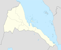
Teseney — Infobox Settlement official name = PAGENAME native name = imagesize = image caption = image map caption = pushpin pushpin label position =bottom pushpin mapsize = 300 pushpin map caption =Location in Eritrea subdivision type = Country subdivision … Wikipedia
Teseney — Original name in latin Teseney Name in other language TES, Tehsehnehj, Tesene, Tesenei, Tessenei, Тэсэнэй State code ER Continent/City Africa/Asmara longitude 15.11 latitude 36.6575 altitude 594 Population 3753 Date 2013 06 07 … Cities with a population over 1000 database
Teseney District — Infobox Settlement name = Teseney settlement type =District official name = other name = native name = nickname = motto = imagesize = image caption = flag size = image seal size = image shield = shield size = image blank emblem = blank emblem… … Wikipedia
Aligider — Infobox Settlement official name = PAGENAME native name = imagesize = image caption = image map caption = pushpin pushpin label position =bottom pushpin mapsize = 300 pushpin map caption =Location in Eritrea subdivision type = Country subdivision … Wikipedia
Bitama — Infobox Settlement official name = PAGENAME native name = imagesize = image caption = image map caption = pushpin pushpin label position =bottom pushpin mapsize = 300 pushpin map caption =Location in Eritrea subdivision type = Country subdivision … Wikipedia
Ellit — is a small town in westren Eritrea on the road between Agordat and Teseney. Transport In the 1920s, design work was carried out to extend the railway from Asmara through Ellit to Teseney and Sudan, but work stalled. Links *… … Wikipedia
Gash-Barka — Infobox Eritrea zoba Zoba = Gash Barka Zone (Zoba Gash Barka) AdministrationType = Zoba Capital = Barentu Administrator = Kahsai Gebrehiwet Population = 564,574 Area = 33,200Gash Barka ( ti. ጋሽ ባርካ) is one of the six regions of Eritrea. It is… … Wikipedia
Eritrean Telecommunications Corporation — Infobox Company company name = EriTel company logo = company type = foundation = 1996 [cite web|url=http://www.itu.int/WORLD2003/forum/youthforum/national report2003.pdf|title=Telecommunication Development Country Reportfor… … Wikipedia
Elit — Infobox Settlement official name = PAGENAME native name = imagesize = image caption = image map caption = pushpin pushpin label position =bottom pushpin mapsize = 300 pushpin map caption =Location in Eritrea subdivision type = Country subdivision … Wikipedia
 Lage von Tesseney in Eritrea