Basalt (Colorado)

Basalt (Colorado)
Basalt
Basalt (Colorado)
Basalt
Basalt
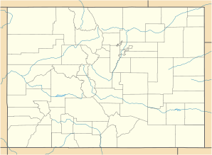
Lage in Colorado
Basisdaten
Staat: Vereinigte Staaten
Bundesstaat: Colorado
Countys:

Eagle County
Pitkin County

Koordinaten: 39° 22′ N, 107° 2′ W39.368333333333-107.038333333332015Koordinaten: 39° 22′ N, 107° 2′ W
Zeitzone: Mountain Standard Time (UTC−7)
Einwohner: 2681 (Stand: 2000)
Bevölkerungsdichte: 536,2 Einwohner je km²
Fläche: 5,0 km² (ca. 2 mi²)
davon 5,0 km² (ca. 2 mi²) Land
Höhe: 2015 m
Postleitzahl: 81621
Vorwahl: +1 970
FIPS: 08-04935
GNIS-ID: 0175038
Webpräsenz: www.basalt.net
Bürgermeister: Leroy Duroux

Basalt ist eine Town im Eagle County und im Pitkin County im US-Bundesstaat Colorado. Basalt hat 2681 Einwohner (Stand: 2000) und liegt zwischen El Jebel und Snowmass Village am Roaring Fork River. Basalt wird von der Colorado State Route 82 tangiert.


Wikimedia Foundation.

Игры ⚽ Поможем решить контрольную работу

Schlagen Sie auch in anderen Wörterbüchern nach:

  • Basalt, Colorado — Infobox Settlement official name = Town of Basalt, Colorado other name = native name = nickname = settlement type = Town motto = imagesize = image caption = flag size = image seal size = image shield = shield size = image blank emblem = blank… …   Wikipedia

  • Colorado locations by per capita income — Colorado is the fifth richest state in the United States of America, with a per capita income of $24,049 (2000) and a personal per capita income of $34,283 (2003). Colorado counties ranked by per capita income There are sixty four counties… …   Wikipedia

  • Basalt — For the World War II raid, see Operation Basalt. For the cities, see Basalt, Colorado and Basalt, Idaho. Basalt Igneous Rock Composition …   Wikipedia

  • Basalt — Basalt, CO U.S. town in Colorado Population (2000): 2681 Housing Units (2000): 1218 Land area (2000): 1.922180 sq. miles (4.978423 sq. km) Water area (2000): 0.018520 sq. miles (0.047967 sq. km) Total area (2000): 1.940700 sq. miles (5.026390 sq …   StarDict's U.S. Gazetteer Places

  • Basalt, CO — U.S. town in Colorado Population (2000): 2681 Housing Units (2000): 1218 Land area (2000): 1.922180 sq. miles (4.978423 sq. km) Water area (2000): 0.018520 sq. miles (0.047967 sq. km) Total area (2000): 1.940700 sq. miles (5.026390 sq. km) FIPS… …   StarDict's U.S. Gazetteer Places

  • Colorado Midland Railway — Reporting mark CM Locale Colorado Dates of operation 1883–1918 Track gauge 4 ft 8 1⁄2 in (1,435 mm) (standard gauge) …   Wikipedia

  • Colorado Plateau — A map of the Colorado Plateau. The …   Wikipedia

  • Colorado municipalities — Adams Alam Arapahoe …   Wikipedia

  • Colorado — This article is about the U.S. state of Colorado. For the former U.S. territory, see Colorado Territory. For the river, see Colorado River. For the physiographic region, see Colorado Plateau. For other uses, see Colorado (disambiguation). State… …   Wikipedia

  • Colorado Midland Railway — Le Colorado Midland Railway (sigle de l AAR: CM)[1], était un chemin de fer américain de classe I qui fut créé en 1883. Il fut le premier chemin de fer à écartement standard à franchir la ligne continentale de séparation des eaux dans le Colorado …   Wikipédia en Français

Share the article and excerpts

Direct link
Do a right-click on the link above
and select “Copy Link”