- Bastrop County
-
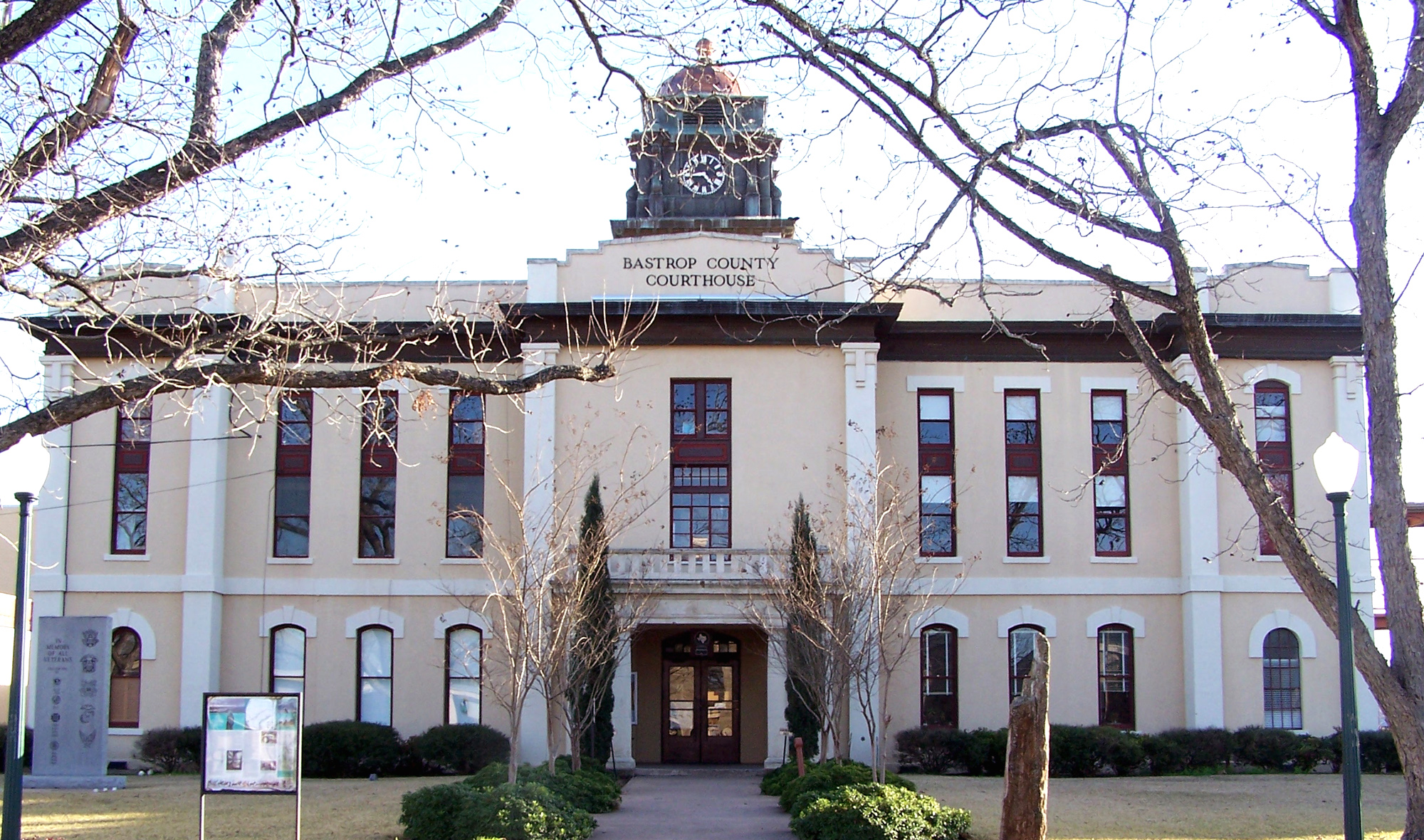
Verwaltung US-Bundesstaat: Texas Verwaltungssitz: Bastrop Adresse des
Verwaltungssitzes:Bastrop County Courthouse
P.O. Box 577
Bastrop, TX 78602Gründung: 1836 Gebildet aus: Original-County Vorwahl: 001 512 Demographie Einwohner: 57.733 (2000) Bevölkerungsdichte: 25,1 Einwohner/km² Geographie Fläche gesamt: 2.320 km² Wasserfläche: 20 km² Karte 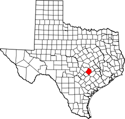
Website: www.co.bastrop.tx.us Das Bastrop County[2] ist ein County im Bundesstaat Texas der Vereinigten Staaten von Amerika. Der Verwaltungssitz (County Seat) ist Bastrop.
Inhaltsverzeichnis
Geographie
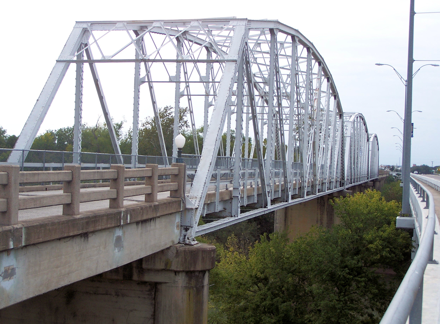
Das County liegt im mittleren Südosten von Texas und hat eine Fläche von 2.320 Quadratkilometern, wovon 20 Quadratkilometer Wasserfläche sind. Es grenzt im Uhrzeigersinn an folgende Countys: Williamson County, Lee County, Fayette County, Gonzales County, Caldwell County und Travis County. Das geographische Zentrum liegt bei 30° 04' n. B., 97° 22' w. L.
Klima
Im Bastrop County herrscht ein subtropisches Klima mit Tiefsttemperaturen von 4 °C im Januar und 36 °C im Juli. Pro Jahr gibt es durchschnittlich 270 Sonnentage.
Geschichte
Bastrop County wurde 1836 als Original-County gebildet. Benannt wurde das County und auch die Stadt nach Felipe Enrique Neri, Baron de Bastrop, einem frühen deutschen Siedler. 1850 betrug die Einwohnerzahl 2.180 Personen inklusive 919 Sklaven. Bis 1860 verdreifachte sich die Zahl der Einwohner.
Demografische Daten
Historische Einwohnerzahlen Census Einwohner ± in % 1850 3099 — 1860 7006 100 % 1870 12.290 80 % 1880 17.215 40 % 1890 20.736 20 % 1900 26.845 30 % 1910 25.344 -6 % 1920 26.649 5 % 1930 23.888 -10 % 1940 21.610 -10 % 1950 19.622 -9 % 1960 16.925 -10 % 1970 17.297 2 % 1980 24.726 40 % 1990 38.263 50 % 2000 57.733 50 % Vor 1900[3] 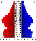 Alterspyramide für das Bastrop County
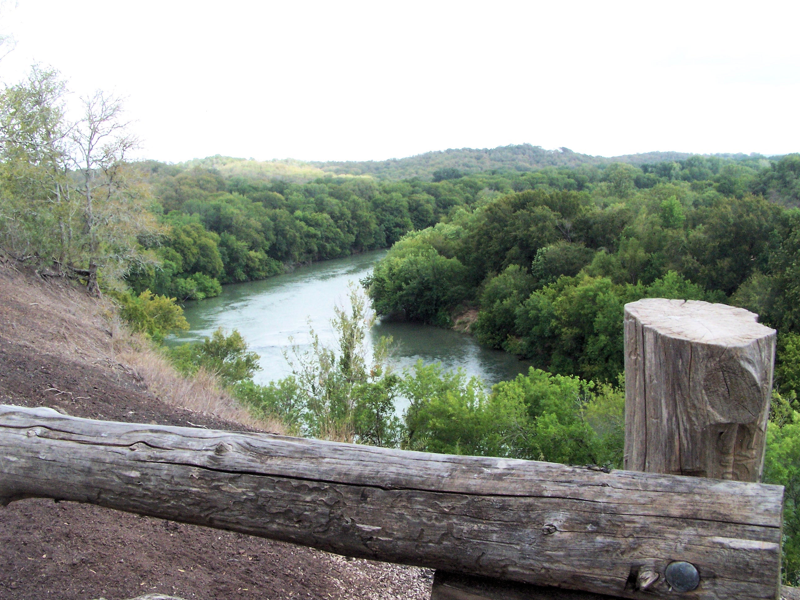
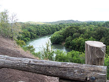 Der Colorado River im McKinney Roughs Nature Park
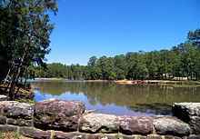 See im Bastrop State Park
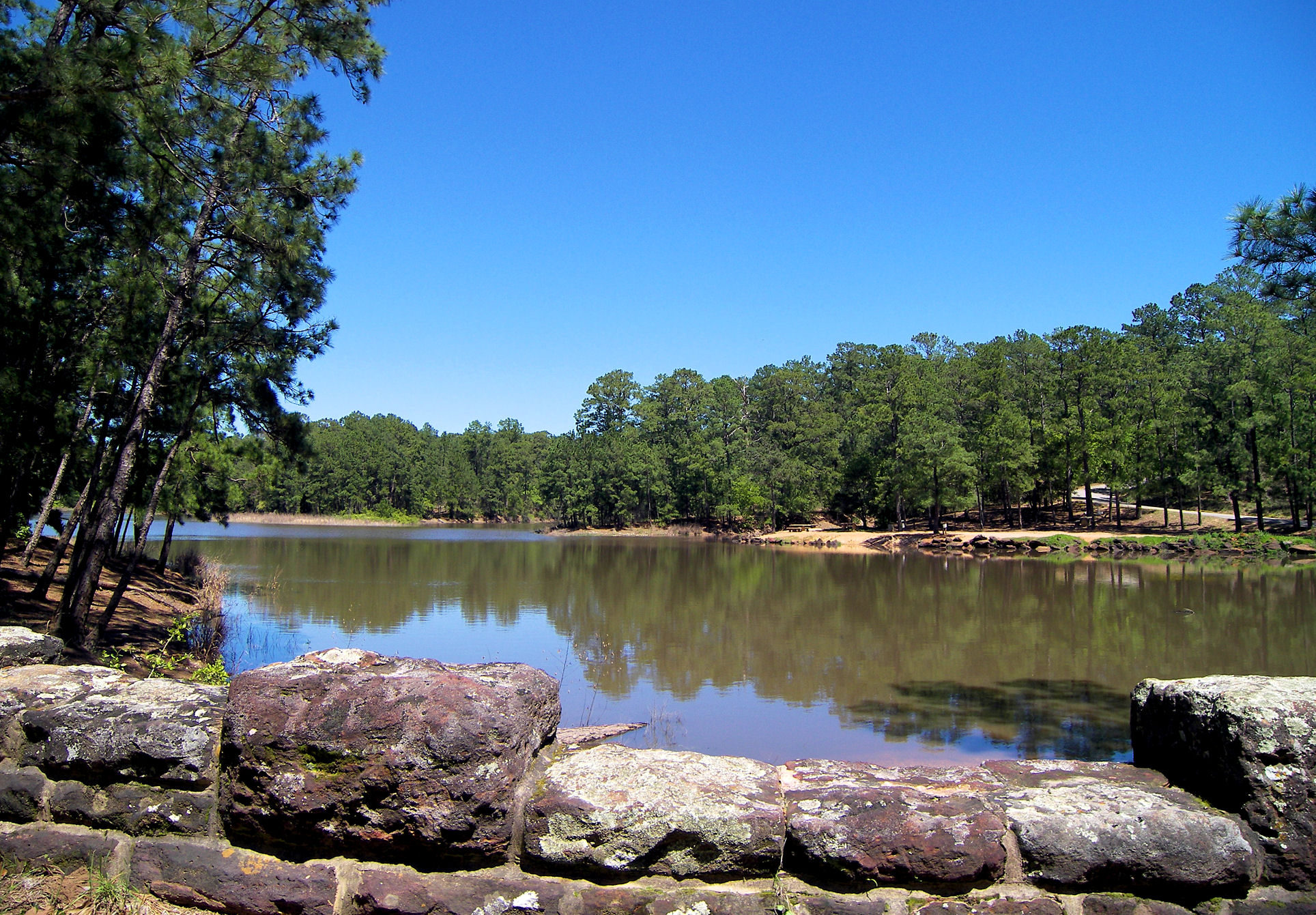
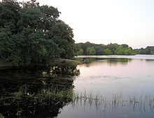 See im Buescher State Park
Nach der Volkszählung im Jahr 2000 lebten im Bastrop County 57.733 Menschen in 20.097 Haushalten und 14.771 Familien. Die Bevölkerungsdichte betrug 25 Einwohner pro Quadratkilometer. Ethnisch betrachtet setzte sich die Bevölkerung zusammen aus 80,24 Prozent Weißen, 8,79 Prozent Afroamerikanern, 0,70 Prozent amerikanischen Ureinwohnern, 0,46 Prozent Asiaten, 0,06 Prozent Bewohnern aus dem pazifischen Inselraum und 7,60 Prozent aus anderen ethnischen Gruppen; 2,15 Prozent stammten von zwei oder mehr Ethnien ab. 23,98 Prozent der Einwohner waren spanischer oder lateinamerikanischer Abstammung.
Von den 20.097 Haushalten hatten 35,9 Prozent Kinder oder Jugendliche, die mit ihnen zusammen lebten. 58,5 Prozent waren verheiratete, zusammenlebende Paare 10,5 Prozent waren allein erziehende Mütter und 26,5 Prozent waren keine Familien. 21,5 Prozent waren Singlehaushalte und in 7,5 Prozent lebten Menschen im Alter von 65 Jahren oder darüber. Die durchschnittliche Haushaltsgröße betrug 2,77 und die durchschnittliche Familiengröße betrug 3,23 Personen.
28,0 Prozent der Bevölkerung war unter 18 Jahre alt, 7,6 Prozent zwischen 18 und 24, 31,3 Prozent zwischen 25 und 44, 22,9 Prozent zwischen 45 und 64 und 10,3 Prozent waren 65 Jahre alt oder älter. Das Durchschnittsalter betrug 35 Jahre. Auf 100 weibliche Personen kamen 105,5 männliche Personen und auf 100 Frauen im Alter von 18 Jahren oder darüber kamen 104,8 Männer.
Das jährliche Durchschnittseinkommen eines Haushalts betrug 43.578 USD, das Durchschnittseinkommen einer Familie betrug 49.456 USD. Männer hatten ein Durchschnittseinkommen von 32.843 USD, Frauen 25.536 USD. Das Prokopfeinkommen betrug 18.146 USD. 8,4 Prozent der Familien und 11,6 Prozent der Einwohner lebten unterhalb der Armutsgrenze. [7]
Städte und Gemeinden
- Bastrop
- Beaukiss
- Calvin
- Cedar Creek
- Clearview
- Delhi
- Elgin
- Hill
- Hills
- Jeddo
- Kirtley
- Littig
- Lund
- Manheim
- Mc Dade
- Paige
- Red Rock
- Rosanky
- Smithville
- String Prairie
- Structure
- Type
- Upton
Siehe auch
Einzelnachweise
- ↑ Auszug aus dem National Register of Historic Places. Abgerufen am 13. März 2011
- ↑ Bastrop County im Geographic Names Information System des United States Geological Survey. Abgerufen am 22. Februar 2011
- ↑ U.S. Census Bureau - Census of Population and Housing. Abgerufen am 15. März 2011
- ↑ Auszug aus Census.gov. Abgerufen am 21. Februar 2011
- ↑ Auszug aus factfinder.census.gov Abgerufen am 26. Februar 2011
- ↑ Auszug aus dem National Register of Historic Places. Abgerufen am 13. März 2011
- ↑ Bastrop County, Texas, Datenblatt mit den Ergebnissen der Volkszählung im Jahre 2000 bei factfinder.census.gov.
Weblinks
 Commons: Bastrop County, Texas – Sammlung von Bildern, Videos und Audiodateien
Liste der Countys in Texas
Anderson | Andrews | Angelina | Aransas | Archer | Armstrong | Atascosa | Austin | Bailey | Bandera | Bastrop | Baylor | Bee | Bell | Bexar | Blanco | Borden | Bosque | Bowie | Brazoria | Brazos | Brewster | Briscoe | Brooks | Brown | Burleson | Burnet | Caldwell | Calhoun | Callahan | Cameron | Camp | Carson | Cass | Castro | Chambers | Cherokee | Childress | Clay | Cochran | Coke | Coleman | Collin | Collingsworth | Colorado | Comal | Comanche | Concho | Cooke | Coryell | Cottle | Crane | Crockett | Crosby | Culberson | Dallam | Dallas | Dawson | Deaf Smith | Delta | Denton | DeWitt | Dickens | Dimmit | Donley | Duval | Eastland | Ector | Edwards | El Paso | Ellis | Erath | Falls | Fannin | Fayette | Fisher | Floyd | Foard | Fort Bend | Franklin | Freestone | Frio | Gaines | Galveston | Garza | Gillespie | Glasscock | Goliad | Gonzales | Gray | Grayson | Gregg | Grimes | Guadalupe | Hale | Hall | Hamilton | Hansford | Hardeman | Hardin | Harris | Harrison | Hartley | Haskell | Hays | Hemphill | Henderson | Hidalgo | Hill | Hockley | Hood | Hopkins | Houston | Howard | Hudspeth | Hunt | Hutchinson | Irion | Jack | Jackson | Jasper | Jeff Davis | Jefferson | Jim Hogg | Jim Wells | Johnson | Jones | Karnes | Kaufman | Kendall | Kenedy | Kent | Kerr | Kimble | King | Kinney | Kleberg | Knox | La Salle | Lamar | Lamb | Lampasas | Lavaca | Lee | Leon | Liberty | Limestone | Lipscomb | Live Oak | Llano | Loving | Lubbock | Lynn | Madison | Marion | Martin | Mason | Matagorda | Maverick | McCulloch | McLennan | McMullen | Medina | Menard | Midland | Milam | Mills | Mitchell | Montague | Montgomery | Moore | Morris | Motley | Nacogdoches | Navarro | Newton | Nolan | Nueces | Ochiltree | Oldham | Orange | Palo Pinto | Panola | Parker | Parmer | Pecos | Polk | Potter | Presidio | Rains | Randall | Reagan | Real | Red River | Reeves | Refugio | Roberts | Robertson | Rockwall | Runnels | Rusk | Sabine | San Augustine | San Jacinto | San Patricio | San Saba | Schleicher | Scurry | Shackelford | Shelby | Sherman | Smith | Somervell | Starr | Stephens | Sterling | Stonewall | Sutton | Swisher | Tarrant | Taylor | Terrell | Terry | Throckmorton | Titus | Tom Green | Travis | Trinity | Tyler | Upshur | Upton | Uvalde | Val Verde | Van Zandt | Victoria | Walker | Waller | Ward | Washington | Webb | Wharton | Wheeler | Wichita | Wilbarger | Willacy | Williamson | Wilson | Winkler | Wise | Wood | Yoakum | Young | Zapata | Zavala
Wikimedia Foundation.
Schlagen Sie auch in anderen Wörterbüchern nach:
Bastrop County — Admin ASC 2 Code Orig. name Bastrop County Country and Admin Code US.TX.021 US … World countries Adminstrative division ASC I-II
Bastrop County, Texas — The Bastrop County Courthouse in Bastrop is designed in classical revival style. Built in 1883, the Courthouse and Jail Complex were listed in the National Register of Historic Places on November 20, 1975 … Wikipedia
National Register of Historic Places listings in Bastrop County, Texas — List of Registered Historic Places in Bastrop County, Texas Map of all coordinates from Google Map of all coordinates from Bing … Wikipedia
Liste der Einträge im National Register of Historic Places im Bastrop County — Die Liste der Registered Historic Places im Bastrop County führt alle Bauwerke und historischen Stätten im texanischen Bastrop County auf, die in das National Register of Historic Places aufgenommen wurden. Aktuelle Einträge Lfd. Nr. Name im NRHP … Deutsch Wikipedia
List of Registered Historic Places in Bastrop County, Texas — List of Registered Historic Places in Bastrop County, TexasThis is intended to be a complete list of properties and districts listed on the National Register of Historic Places in Bastrop County, Texas. The locations of National Register… … Wikipedia
Bastrop, Texas — City Main Street of Bastrop, Texas, featuring the small shops and old fashioned architecture typical of rural towns … Wikipedia
Bastrop (Texas) — Bastrop Historische Gebäude entlang der Main Street Lage von Bastrop in Texas … Deutsch Wikipedia
Bastrop Independent School District — is a public school district based in Bastrop, Texas (USA).In addition to Bastrop, the district also serves the communities of Camp Swift, Circle D KC Estates, and Wyldwood as well as the Bastrop County portion of Mustang Ridge.choolsHigh Schools… … Wikipedia
Bastrop — may mean:* Bastrop, Louisiana * Bastrop County, Texas ** Bastrop, Texas … Wikipedia
Bastrop State Park — Infobox protected area | name = Bastrop State Park iucn category = caption = locator x = 189 locator y = 137 location = Bastrop County, Texas nearest city = Bastrop lat degrees = 30 lat minutes = 6 lat seconds = 31 lat direction = N long degrees … Wikipedia
Bastrop County


18+
© Academic, 2000-2026
- Kontaktieren Sie uns: Unterstützung, Werbung
Wörterbücher Export, schritte mit PHP, Joomla, Drupal, WordPress, MODx.