- Travis County
-
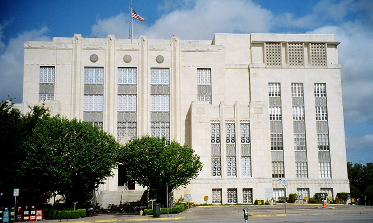
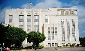 Travis County Courthouse
Verwaltung US-Bundesstaat: Texas Verwaltungssitz: Austin Adresse des
Verwaltungssitzes:Travis County Courthouse
P.O. Box 1748
1000 Guadalupe Street
Austin, TX 78767Gründung: 1840 Gebildet aus: Bastrop County Vorwahl: 001 512 Demographie Einwohner: 812.280 (2000) Bevölkerungsdichte: 317 Einwohner/km² Geographie Fläche gesamt: 2.647 km² Wasserfläche: 85 km² Karte 
Website: www.co.travis.tx.us Das Travis County ist ein County im US-Bundesstaat Texas der Vereinigten Staaten von Amerika. Der Verwaltungssitz (County Seat) ist Austin, was zeitgleich die Hauptstadt von Texas ist.
Inhaltsverzeichnis
Geographie
Das County liegt etwa 150 km südöstlich des geographischen Zentrums von Texas und hat eine Fläche von 2647 Quadratkilometern, wovon 85 Quadratkilometer Wasserfläche sind. Es grenzt im Uhrzeigersinn an folgende Countys: Williamson County, Bastrop County, Caldwell County, Hays County, Blanco County und Burnet County.
Geschichte
Travis County wurde 1840 aus Teilen des Bastrop County gebildet. Benannt wurde es nach William Barret Travis, einem Kommandeur und Verteidiger von Alamo.
Demografische Daten
Historische Einwohnerzahlen Census Einwohner ± in % 1850 3138 — 1860 8080 200 % 1870 13.153 60 % 1880 27.028 100 % 1890 36.322 30 % 1900 47.386 30 % 1910 55.620 20 % 1920 57.616 4 % 1930 77.777 30 % 1940 111.053 40 % 1950 160.980 40 % 1960 212.136 30 % 1970 295.516 40 % 1980 419.573 40 % 1990 576.407 40 % 2000 812.280 40 % Vor 1900[1] 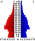 Alterspyramide für das Travis County
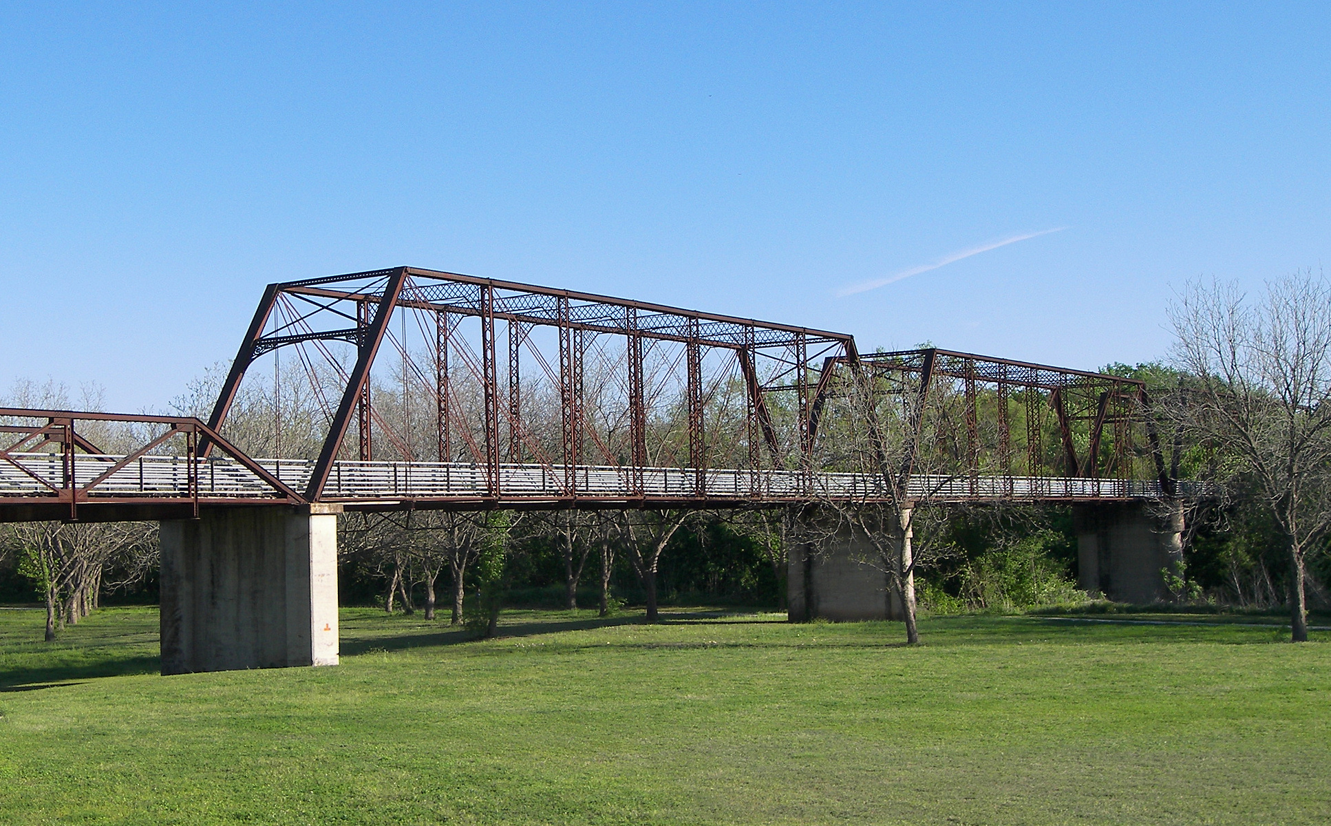
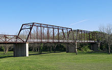 Die Moores Crossing Bridge
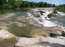 Der McKinney Falls State Park
Nach der Volkszählung im Jahr 2000 lebten im Travis County 812.280 Menschen in 320.766 Haushalten und 183.798 Familien. Die Bevölkerungsdichte betrug 317 Einwohner pro Quadratkilometer. Ethnisch betrachtet setzte sich die Bevölkerung zusammen aus 68,21 Prozent Weißen, 9,26 Prozent Afroamerikanern, 0,58 Prozent amerikanischen Ureinwohnern, 4,47 Prozent Asiaten, 0,07 Prozent Bewohnern aus dem pazifischen Inselraum und 14,56 Prozent aus anderen ethnischen Gruppen; 2,85 Prozent stammten von zwei oder mehr Ethnien ab. 28,20 Prozent der Einwohner waren spanischer oder lateinamerikanischer Abstammung.
Von den 320.766 Haushalten hatten 29,3 Prozent Kinder oder Jugendliche, die mit ihnen zusammen lebten. 42,6 Prozent waren verheiratete, zusammenlebende Paare 10,4 Prozent waren allein erziehende Mütter und 42,7 Prozent waren keine Familien. 30,1 Prozent waren Singlehaushalte und in 4,4 Prozent lebten Menschen im Alter von 65 Jahren oder darüber. Die durchschnittliche Haushaltsgröße betrug 2,47 und die durchschnittliche Familiengröße betrug 3,15 Personen.
23,8 Prozent der Bevölkerung war unter 18 Jahre alt, 14,7 Prozent zwischen 18 und 24, 36,5 Prozent zwischen 25 und 44, 18,2 Prozent zwischen 45 und 64 und 6,7 Prozent waren 65 Jahre alt oder älter. Das Durchschnittsalter betrug 30 Jahre. Auf 100 weibliche Personen kamen 104,9 männliche Personen und auf 100 Frauen im Alter von 18 Jahren oder darüber kamen 104,5 Männer.
Das jährliche Durchschnittseinkommen eines Haushalts betrug 46.761 USD, das Durchschnittseinkommen einer Familie betrug 58.555 USD. Männer hatten ein Durchschnittseinkommen von 37.242 USD, Frauen 30.452 USD. Das Prokopfeinkommen betrug 25.883 USD. 7,7 Prozent der Familien und 12,5 Prozent der Einwohner lebten unterhalb der Armutsgrenze. [4]
Städte und Gemeinden
- Austin
- Balcones
- Bee Caves
- Bluff Springs
- Briarcliff
- Camp Mabry
- Cele
- Circleville
- Colton
- Daffan
- Del Valle
- Dessau
- Elroy
- Four Points
- Garfield
- Gregg
- Hornsby Bend
- Hudson Bend
- Jonestown
- Kimbro
- Lago Vista
- Lakeway
- Leander
- Manchaca
- Manda
- Manor
- Marshall Ford
- McNeil
- Montopolis
- Moores Crossing
- New Sweden
- Oak Hill
- Pflugerville
- Pilot Knob
- Rollingwood
- San Leanna
- Spicewood
- Sprinkle
- Sunset Valley
- Tarrytown
- Travis Heights
- Webberville
- West Lake Hills
- Westlake
Siehe auch
Literatur
- The Student Geology Society (Hrsg.): Guidebook of the Geology of Travis County. University of Texas, Austin 1977 (Digitalisat)
Einzelnachweise
- ↑ U.S. Census Bureau - Census of Population and Housing. Abgerufen am 15. März 2011
- ↑ Auszug aus Census.gov. Abgerufen am 21. Februar 2011
- ↑ Auszug aus factfinder.census.gov Abgerufen am 26. Februar 2011
- ↑ Travis County, Texas, Datenblatt mit den Ergebnissen der Volkszählung im Jahre 2000 bei factfinder.census.gov.
Weblinks
 Commons: Travis County, Texas – Sammlung von Bildern, Videos und Audiodateien
- Travis County im Geographic Names Information System des United States Geological Survey
- Handbuch von Texas (engl.)

Liste der Countys in Texas
Anderson | Andrews | Angelina | Aransas | Archer | Armstrong | Atascosa | Austin | Bailey | Bandera | Bastrop | Baylor | Bee | Bell | Bexar | Blanco | Borden | Bosque | Bowie | Brazoria | Brazos | Brewster | Briscoe | Brooks | Brown | Burleson | Burnet | Caldwell | Calhoun | Callahan | Cameron | Camp | Carson | Cass | Castro | Chambers | Cherokee | Childress | Clay | Cochran | Coke | Coleman | Collin | Collingsworth | Colorado | Comal | Comanche | Concho | Cooke | Coryell | Cottle | Crane | Crockett | Crosby | Culberson | Dallam | Dallas | Dawson | Deaf Smith | Delta | Denton | DeWitt | Dickens | Dimmit | Donley | Duval | Eastland | Ector | Edwards | El Paso | Ellis | Erath | Falls | Fannin | Fayette | Fisher | Floyd | Foard | Fort Bend | Franklin | Freestone | Frio | Gaines | Galveston | Garza | Gillespie | Glasscock | Goliad | Gonzales | Gray | Grayson | Gregg | Grimes | Guadalupe | Hale | Hall | Hamilton | Hansford | Hardeman | Hardin | Harris | Harrison | Hartley | Haskell | Hays | Hemphill | Henderson | Hidalgo | Hill | Hockley | Hood | Hopkins | Houston | Howard | Hudspeth | Hunt | Hutchinson | Irion | Jack | Jackson | Jasper | Jeff Davis | Jefferson | Jim Hogg | Jim Wells | Johnson | Jones | Karnes | Kaufman | Kendall | Kenedy | Kent | Kerr | Kimble | King | Kinney | Kleberg | Knox | La Salle | Lamar | Lamb | Lampasas | Lavaca | Lee | Leon | Liberty | Limestone | Lipscomb | Live Oak | Llano | Loving | Lubbock | Lynn | Madison | Marion | Martin | Mason | Matagorda | Maverick | McCulloch | McLennan | McMullen | Medina | Menard | Midland | Milam | Mills | Mitchell | Montague | Montgomery | Moore | Morris | Motley | Nacogdoches | Navarro | Newton | Nolan | Nueces | Ochiltree | Oldham | Orange | Palo Pinto | Panola | Parker | Parmer | Pecos | Polk | Potter | Presidio | Rains | Randall | Reagan | Real | Red River | Reeves | Refugio | Roberts | Robertson | Rockwall | Runnels | Rusk | Sabine | San Augustine | San Jacinto | San Patricio | San Saba | Schleicher | Scurry | Shackelford | Shelby | Sherman | Smith | Somervell | Starr | Stephens | Sterling | Stonewall | Sutton | Swisher | Tarrant | Taylor | Terrell | Terry | Throckmorton | Titus | Tom Green | Travis | Trinity | Tyler | Upshur | Upton | Uvalde | Val Verde | Van Zandt | Victoria | Walker | Waller | Ward | Washington | Webb | Wharton | Wheeler | Wichita | Wilbarger | Willacy | Williamson | Wilson | Winkler | Wise | Wood | Yoakum | Young | Zapata | Zavala
Wikimedia Foundation.
Schlagen Sie auch in anderen Wörterbüchern nach:
Travis County — Admin ASC 2 Code Orig. name Travis County Country and Admin Code US.TX.453 US … World countries Adminstrative division ASC I-II
Travis County, Texas — Infobox U.S. County county = Travis County state = Texas map size = 225 founded = 1840 seat = Austin | area total sq mi =1022 area land sq mi =989 area water sq mi =33 area percentage = 3.21% census yr = 2007 pop = 974,365 density mi2 =985.2… … Wikipedia
National Register of Historic Places listings in Travis County, Texas — Location of Travis County in Texas This is a list of the National Register of Historic Places listings in Travis County, Texas. This is intended to be a complete list of the properties and districts on the National Register of Historic Places in… … Wikipedia
Liste der Einträge im National Register of Historic Places im Travis County — Die Liste der Registered Historic Places im Travis County führt alle Bauwerke und historischen Stätten im texanischen Travis County auf, die in das National Register of Historic Places aufgenommen wurden. Aktuelle Einträge Lfd. Nr. Name Bild… … Deutsch Wikipedia
List of highways in Travis County, Texas — The following is a list of all state highways in Travis County, Texas maintained by the Texas Department of Transportation. All state highways in Texas are paved.Interstate Highwaystate Highway Loops and SpursAdjacent counties *Caldwell County… … Wikipedia
List of Registered Historic Places in Travis County, Texas — List of Registered Historic Places in Travis County, TexasThis is intended to be a complete list of properties and districts listed on the National Register of Historic Places in Travis County, Texas. The locations of National Register properties … Wikipedia
Del Valle High School (Travis County, Texas) — Del Valle High School Whatever It Takes Location 5201 Ross Rd, Del Valle, Texas,78617 Information Type … Wikipedia
Travis Childers — U.S. Representative Travis W. Childers Member of the U.S. House of Representatives from Mississippi s 1st district In office … Wikipedia
Travis Dickerson — is an American musician and producer, best known for his work with Buckethead and Viggo Mortensen. He also runs TDRSmusic , a recording studio with its own record label that has recorded and released albums by Bill Laswell, Jethro Tull, Linda… … Wikipedia
Travis Dickerson — (* 20. Jahrhundert in Michigan) ist ein US amerikanischer Musiker und Produzent, der am besten für seine Zusammenarbeit mit Buckethead und Viggo Mortensen bekannt ist. Er betreibt unter dem Namen TDRS Music ein Tonstudio mit angegliedertem Label… … Deutsch Wikipedia
Travis County


18+
© Academic, 2000-2026
- Kontaktieren Sie uns: Unterstützung, Werbung
Wörterbücher Export, schritte mit PHP, Joomla, Drupal, WordPress, MODx.