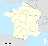
Viroflay

Viroflay
Viroflay
Wappen von Viroflay
Viroflay (Frankreich)
Viroflay
Region Île-de-France
Département Yvelines
Arrondissement Versailles
Kanton Viroflay
Koordinaten 48° 48′ N, 2° 10′ O48.82.1722222222222116Koordinaten: 48° 48′ N, 2° 10′ O
Höhe 116 m (92–176 m)
Fläche 3,49 km²
Einwohner 16.076 (1. Jan. 2008)
Bevölkerungsdichte 4.606 Einw./km²
Postleitzahl 78220
INSEE-Code
Website http://www.ville-viroflay.fr/

Viroflay ist eine französische Gemeinde mit 16.076 Einwohnern (Stand 1. Januar 2008) im Südwesten von Paris. Sie ist 14,1 km vom Pariser Stadtzentrum entfernt.

Inhaltsverzeichnis

Geographie

Die Stadt Viroflay schließt östlich an Versailles an. Sie wird von zwei Waldgebieten flankiert, im Norden von der Forêt de Fausses-Reposes, im Süden von der Forêt de Meudon. Nachbargemeinden von Viroflay sind Chaville im Osten, Vélizy-Villacoublay im Süden, Versailles im Westen und Ville-d’Avray im Norden.

Verkehr

Am Bahnhof Viroflay - Rive Gauche hält die RER C. Außerdem hat Viroflay einen weiteren Bahnhof (Viroflay – Rive Droite), der von der Nahverkehrsstrecke Transilien Paris Saint-Lazare bedient wird. Die Buslinie 171 vom Pont de Sèvres (Umstiegsmöglichkeit Métrolinie 9) nach Versailles verläuft ebenfalls durch Viroflay. Im Jahr 2009 soll in Viroflay die neue Tramlinie 6 enden. Die Stadt grenzt unmittelbar an Chaville (92370).

Städtepartnerschaften

Weblinks


Wikimedia Foundation.

Игры ⚽ Нужно решить контрольную?

Schlagen Sie auch in anderen Wörterbüchern nach:

  • Viroflay — Escudo …   Wikipedia Español

  • Viroflay — 48° 48′ 03″ N 2° 10′ 23″ E / 48.8008333333, 2.1730555556 …   Wikipédia en Français

  • Viroflay — French commune nomcommune=Viroflay 13th 17th century Saint Eustache Church in the historical centre of Viroflay map size=270px adjustable mapcaption=Location (in red) within Paris inner and outer suburbs région=Île de France city motto =… …   Wikipedia

  • Viroflay — Original name in latin Viroflay Name in other language Viroflay, Virofle, Вирофле, Вірофле State code FR Continent/City Europe/Paris longitude 48.80078 latitude 2.16181 altitude 110 Population 16137 Date 2012 01 18 …   Cities with a population over 1000 database

  • Viroflay-Vélizy-Clamart-Châtillon — Ligne 6 du tramway d Île de France Tramway T6 Réseau Tramway d Île de France Année d’ouverture prévue fin 2012 Exploitant RATP Conduite (système) Conducteur Matériel utilisé Tramway sur pneumatiques Points d’arrêt 21 …   Wikipédia en Français

  • Viroflay-Vélizy-Clamart- Châtillon — Ligne 6 du tramway d Île de France Tramway T6 Réseau Tramway d Île de France Année d’ouverture prévue fin 2012 Exploitant RATP Conduite (système) Conducteur Matériel utilisé Tramway sur pneumatiques Points d’arrêt 21 …   Wikipédia en Français

  • Gare de Viroflay-Rive-Droite —  Ne doit pas être confondu avec Gare de Viroflay Rive Gauche. Viroflay Rive Droite Le bâtiment voyageurs …   Wikipédia en Français

  • Gare De Viroflay - Rive Gauche —  Ne doit pas être confondu avec Gare de Viroflay Rive Droite. Viroflay Rive Gauche L entrée de la gare …   Wikipédia en Français

  • Gare de Viroflay - Rive Gauche —  Ne doit pas être confondu avec Gare de Viroflay Rive Droite. Viroflay Rive Gauche L entrée de la gare …   Wikipédia en Français

  • Gare de viroflay - rive gauche —  Ne doit pas être confondu avec Gare de Viroflay Rive Droite. Viroflay Rive Gauche L entrée de la gare …   Wikipédia en Français

Share the article and excerpts

Direct link
Do a right-click on the link above
and select “Copy Link”