- Belknap County (New Hampshire)
-
Verwaltung US-Bundesstaat: New Hampshire Verwaltungssitz: Laconia Adresse des
Verwaltungssitzes:Gründung: 1840 Gebildet aus: Merrimack County
Strafford CountyVorwahl: {{{VORWAHL}}} Demographie Einwohner: 56.325 (2000) Bevölkerungsdichte: 54,2 Einwohner/km² Geographie Fläche gesamt: 1.214 km² Wasserfläche: 174 km² Karte 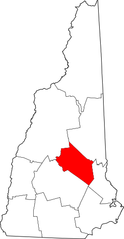
Website: www.belknapcounty.org Belknap County ist ein County im US-Bundesstaat New Hampshire. Das County hat 56.325 Einwohner. Der Sitz der Countyverwaltung (County Seat) ist in Laconia.
Inhaltsverzeichnis
Geographie
Das County hat eine Fläche von 1214 km², davon sind 1039 km² Land und 174 km² (14,35 %) sind Wasser.
Nachbar-Countys
- Carroll County, Norden
- Strafford County, Osten
- Merrimack County, Südwesten
- Grafton County, Nordwesten
Geschichte
Das County wurde 1840 gegründet aus Teilen des Merrimack Countys und des Strafford Countys. Er wurde nach Jeremy Belknap benannt, einem Historiker und Autor der Geschichte New Hampshires. 1855 wurde die Stadt Laconia gegründet.
Bevölkerungsentwicklung
1980 1990 2000 2005 42.806 49.216 56.325 61.547 Städte
Belknap County teilt sich in eine city und zehn towns, beide Begriffe werden im Deutschen mit Stadt übersetzt.
Cities
Towns
- Alton
- Barnstead
- Belmont
- Center Harbor
- Gilford
- Gilmanton
- Meredith
- New Hampton
- Sanbornton
- Tilton
- Tilton-Northfield (census-designated place gelegen in den Gemeinden Tilton und Northfield)

Belknap | Carroll | Cheshire | Coos | Grafton | Hillsborough | Merrimack | Rockingham | Strafford | Sullivan
43.519453-71.418573Koordinaten: 43° 31′ N, 71° 25′ W

Wikimedia Foundation.