- Ōsakasayama
-
Ōsakasayama-shi
大阪狭山市
Geographische Lage in Japan Region: Kinki Präfektur: Ōsaka Koordinaten: 34° 30′ N, 135° 33′ O34.503663888889135.55573888889Koordinaten: 34° 30′ 13″ N, 135° 33′ 21″ O Basisdaten Fläche: 11,86 km² Einwohner: 58.124
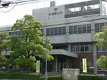
(1. Juli 2011)Bevölkerungsdichte: 4.901 Einwohner je km² Gemeindeschlüssel: 27231-1 Symbole Baum: Kirsche Blume: Azalee Rathaus Adresse: Ōsakasayama City Hall
1-2384-1, Sayama
Ōsakasayama-shi
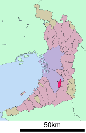
Ōsaka 589-8501Webadresse: www.city.osakasayama.osaka.jp Lage Ōsakasayamas in der Präfektur Ōsaka 
Ōsakasayama (jap. 大阪狭山市, -shi) ist eine Stadt in der Präfektur Ōsaka in Japan.
Inhaltsverzeichnis
Geographie
Ōsakasayama liegt östlich von Sakai und südöstlich von Ōsaka.
Geschichte
Ōsakasayama wurde am 1. Oktober 1987 gegründet.
Verkehr
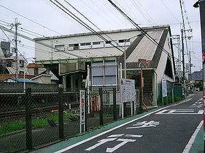
- Zug: Nankai-Koya-Linie
- Straße: Nationalstraße 310
Angrenzende Städte und Gemeinden
Weblinks
 Commons: Ōsakasayama – Sammlung von Bildern, Videos und AudiodateienGemeinden und Landkreise in der Präfektur Ōsaka
Kreisfreie Städte (shi): Daitō | Fujiidera | Habikino | Hannan | Higashiōsaka | Hirakata | Ibaraki | Ikeda | Izumi | Izumiōtsu | Izumisano | Kadoma | Kaizuka | Kashiwara | Katano | Kawachinagano | Kishiwada | Matsubara | Minō | Moriguchi | Neyagawa | Ōsaka (Verwaltungssitz) | Ōsakasayama | Sakai | Sennan | Settsu | Shijōnawate | Suita | Takaishi | Takatsuki | Tondabayashi | Toyonaka | Yao
Minamikawachi-gun: Chihaya-Akasaka | Kanan | Taishi | Mishima-gun: Shimamoto | Semboku-gun: Tadaoka | Sennan-gun: Kumatori | Misaki | Tajiri | Toyono-gun: Nose | Toyono
Wikimedia Foundation.
Schlagen Sie auch in anderen Wörterbüchern nach:
Ōsakasayama — shi (大阪狭山市) Mairie d Ōsakasayama Administration Pays Japon Région Kansai Préfecture … Wikipédia en Français
Osakasayama — 大阪狭山市 Ōsakasayama shi Geographische Lage in Japan … Deutsch Wikipedia
Ōsakasayama — This article is about a city in Japan formerly named Sayama. For the city currently known as Sayama, see Sayama, Saitama. Ōsakasayama 大阪狭山市 City … Wikipedia
Ōsakasayama, Osaka — nihongo|Ōsakasayama|大阪狭山市|Ōsakasayama shi is a city located in Osaka, Japan.As of 2003, the city has an estimated population of 57,177 and the density of 4,820.99 persons per km². The total area is 11.86 km².The city was founded on October 1,… … Wikipedia
Osakasayama-shi — Admin ASC 2 Code Orig. name Ōsakasayama shi Country and Admin Code JP.32.7391699 JP … World countries Adminstrative division ASC I-II
Osaka Prefecture — Japanese transcription(s) – Japanese 大阪府 – Rōmaji Ōsaka fu … Wikipedia
Nankai Kōya Line — Limited Express Rinkan Technical Line length 64.5 km Track gauge 1067 mm … Wikipedia
Osaka Prefectural Board of Education — is a branch of the government of Osaka Prefecture, Japan. The board supervises individual municipal school systems and directly operates public high schools in Osaka prefecture. Contents 1 Schools operated by the prefecture 1.1 High schools… … Wikipedia
Ōsakasayamashi Station — 大阪狭山市駅 Location Prefecture Osaka (See other stations in Osaka) City Ōsakasayama Neighborhood etc … Wikipedia
Hannan (Osaka) — 阪南市 Hannan shi … Deutsch Wikipedia


