- Bolsover (District)
-
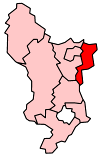
Bolsover District 
Lage in DerbyshireStatus District Region East Midlands Verw.grafschaft Derbyshire Verwaltungssitz Bolsover Fläche 160,33 km² (206.) Einwohner 74.200 (31.) ONS-Code 17UC Website www.bolsover.gov.uk Bolsover ist ein District in der Grafschaft Derbyshire in England. Verwaltungssitz ist die Stadt Bolsover; weitere bedeutende Orte sind Barlborough, Blackwell, Clowne, Glapwell, Pinxton, South Normanton und Tibshelf
Der Bezirk wurde am 1. April 1974 gebildet und entstand aus der Fusion des Urban Districts Bolsover sowie der Rural Districts Blackwell und Clowne.
Amber Valley | Bolsover | Chesterfield | Derbyshire Dales | Erewash | High Peak | North East Derbyshire | South Derbyshire
Wikimedia Foundation.