- Derbyshire
-
Derbyshire 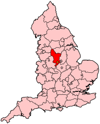
Geografie Status: Zeremonielle und Verwaltungsgrafschaft Region: East Midlands Fläche: 2.625 km² Verwaltungssitz: Matlock ISO 3166-2: GB-DBY Demografie Bevölkerung:
- Gesamt (2002 )
- Dichte:
962.502
367 / km²Distrikte 
Derbyshire [ˈdɑːbɪʃə] ist eine Grafschaft in den East Midlands von England.
Inhaltsverzeichnis
Geografie
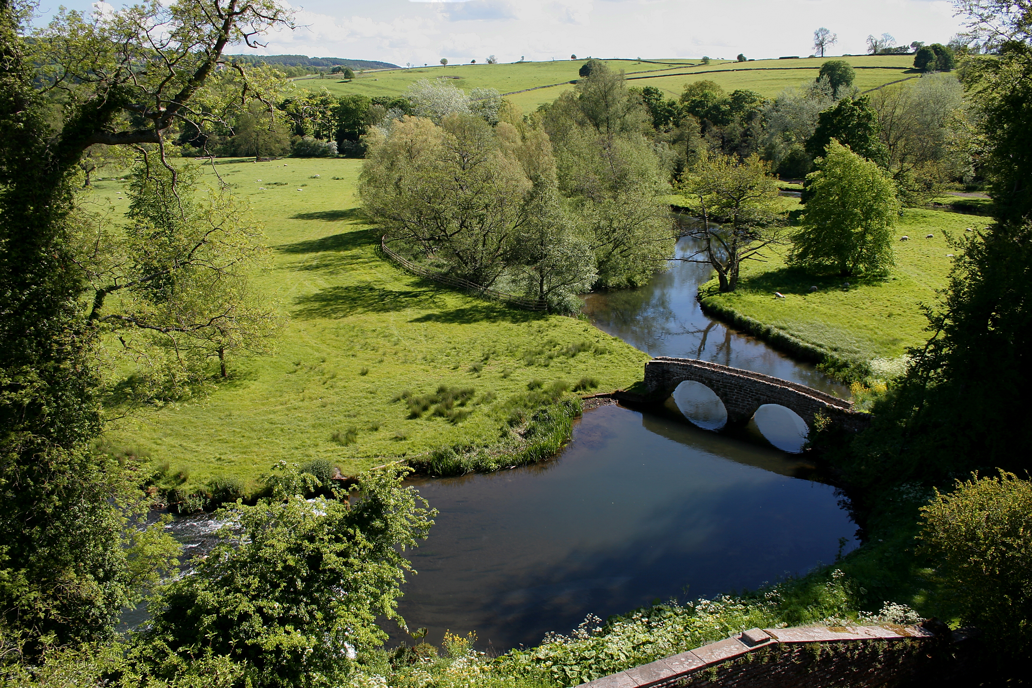
 Landschaft bei Haddon Hall in Derbyshire
Die Grafschaft liegt in einer bergigen Landschaft. Der größte Teil des Peak-District-Nationalparks liegt innerhalb Derbyshires. Der nördliche Teil der Grafschaft überlappt sich mit den Pennines, einer berühmten Hügel- und Bergkette. Die Grafschaft hat Anteil am National Forest und grenzt an die Grafschaften und Gebiete des Greater Manchester, West Yorkshire, South Yorkshire, Nottinghamshire, Leicestershire, Staffordshire und Cheshire.
Neben dem County Council in Matlock bestehen acht District Councils in den einzelnen Kreisen. Trotz der Urbanisierung in 13 Städte zwischen 10.000 und 100.000 Einwohnern sind weite Teile des Gebietes ländlich geprägt: 75% der Bevölkerung bewohnen 25% der Fläche des Landes.
Bis 1998 war die Stadt Derby Teil der Grafschaft, ist nunmehr aber autonomer Stadtkreis (Unitary Authority).
Städte und Ortschaften
- Alfreton, Alton, Ashbourne, Ashford-in-the-Water
- Bakewell, Bamford, Baslow, Beeley, Belper, Birch Vale, Bolehill, Bolsover, Borrowash, Bretby, Brimington, Burbage, Buxton
- Castleton, Chapel-en-le-Frith, Charlesworth, Chelmorton, Chesterfield, Clay Cross, Clowne, Cressbrook, Creswell, Cromford, Crowden, Curbar
- Derby, Dronfield, Duffield
- Earl Sterndale, Eckington, Edale, Edensor, Eyam
- Fernilee
- Gamesley, Glossop, Great Hucklow
- Hadfield, Hartington, Hathersage, Hayfield, Heage, Heanor, Hope
- Ilkeston
- Little Hucklow, Long Eaton
- Marston Montgomery, Marston on Dove, Matlock, Melbourne, Miller's Dale, Morley
- New Mills, Newhaven
- Over Haddon
- Peak Forest
- Repton, Riber, Ripley
- Shipley, Shirebrook, Staveley, Stoney Middleton, Stretton, Sudbury, Swadlincote
- Tansley, Taxal, Thornhill, Tibshelf, Tideswell, Tunstead Milton
- Walton, Wardlow, Whaley Bridge, Whitwell, Wirksworth
- Youlgreave
Sehenswürdigkeiten
- Alfreton Hall
- Alsop Hall
- Arbor Low Steinkreis - Teil des English Heritage
- Barlborough Hall
- Abtei Calke - Calke Abbey
- Carsington Reservoir
- Chatsworth House
- Derwent Valley Mills - ein Weltkulturerbe
- Hob Hurst's House - Teil des English Heritage
- Howden Reservoir
- Mam Tor
- National Stone Centre, in Wirksworth
- Nine Ladies Stone Circle - Teil des English Heritage
- Peveril Castle
- Riber Castle
- Crooked Spire in Chesterfield
- Höhlen von Speedwell - Speedwell Cavern
- Sutton Scarsdale Hall - Teil des English Heritage
- Wingfield Manor - Teil des English Heritage
Weblinks
 Commons: Derbyshire – Sammlung von Bildern, Videos und Audiodateien
Bedfordshire | Berkshire | Buckinghamshire | Cambridgeshire | Cheshire | Cornwall | Cumberland | Derbyshire | Devon | Dorset | Durham | Essex | Gloucestershire | Hampshire | Herefordshire | Hertfordshire | Huntingdonshire | Kent | Lancashire | Leicestershire | Lincolnshire | Middlesex | Norfolk | Northamptonshire | Northumberland | Nottinghamshire | Oxfordshire | Rutland | Shropshire | Somerset | Staffordshire | Suffolk | Surrey | Sussex | Warwickshire | Westmorland | Wiltshire | Worcestershire | Yorkshire
Wikimedia Foundation.
Schlagen Sie auch in anderen Wörterbüchern nach:
Derbyshire — es un condado situado en el centro de Inglaterra, en el Reino Unido. Aunque su ciudad más importante es Derby, ésta, al adquirir status de City , abandonó el County Council (Consejo del Condado) y dejó la capitalidad del condado en favor de… … Wikipedia Español
Derbyshire — es un condado situado en el centro de Inglaterra, en el Reino Unido. Su capital es Matlock. Ocupa un área de 2.625 Km² y su población estimada (2003) es de 976.212 habitantes. Es un condado muy montañoso por la parte norte. Por el sur está… … Enciclopedia Universal
Derbyshire — (spr. dārbĭschĭr), Grafschaft im nördlichen England, grenzt nördlich an die Grafschaft York, östlich an Nottingham und Leicester, südlich an letzteres, westlich an Stafford, Cheshire und Lancashire und umfaßt 2666 qkm (48,4 QM.) mit (1901)… … Meyers Großes Konversations-Lexikon
Derbyshire — [ dɑːbɪʃɪə], County in Mittelengland, 2 631 km2, 914 600 Einwohner, Verwaltungssitz ist Matlock; erstreckt sich vom Flachland am mittleren Trent in das Penninische Gebirge (Peak District National Park); im Osten und Süden Kohlenbergbau und… … Universal-Lexikon
Derbyshire — [dʉr′bi shir, dʉr′bishər; ] chiefly Brit [, där′bishir, där′bi shər] county in central England: 1,015 sq mi (2,629 sq km); pop. 929,000 … English World dictionary
Derbyshire — For other uses, see Derbyshire (disambiguation). Coordinates: 53°8′N 1°36′W / 53.133°N 1.6°W / 53.133; 1.6 … Wikipedia
Derbyshire — /derr bee shear , sheuhr/; Brit. /dahr bi shear , sheuhr/, n. a county in central England. 887,400; 1060 sq. mi. (2630 sq. km). Also called Derby. * * * I or Derby Administrative (pop., 2001: 734,581), geographic, and historic county, central… … Universalium
Derbyshire — 53°8′N 1°36′W / 53.133, 1.6 … Wikipédia en Français
Derbyshire — This interesting name is of Old Scandinavian origin, and has two possible meanings. Firstly, it may be an ancient regional name from the hundred of West Derby in Lancashire, which was often referred to in the Middle Ages as Derbyshire , from the… … Surnames reference
Derbyshire — Der|by|shire a ↑county in northern central England. The ↑Peak District National Park is mainly in Derbyshire, and is a popular place for tourists … Dictionary of contemporary English
- Kontaktieren Sie uns: Unterstützung, Werbung
Derbyshire

18+
© Academic, 2000-2026
Wörterbücher Export, schritte mit PHP, Joomla, Drupal, WordPress, MODx.