- Aira (Kagoshima)
-
Aira-shi
姶良市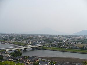
Geographische Lage in Japan 

Region: Kyūshū Präfektur: Kagoshima Koordinaten: 31° 44′ N, 130° 38′ O31.728180555556130.62738333333Koordinaten: 31° 43′ 41″ N, 130° 37′ 39″ O Basisdaten Fläche: 231,32 km² Einwohner: 75.015
(1. Juli 2011)Bevölkerungsdichte: 324 Einwohner je km² Gemeindeschlüssel: 46225-0 Rathaus Adresse: Aira City Hall
25, Miyajima
Aira-shi
Kagoshima 899-5432Webadresse: http://www.city.aira.lg.jp Lage Airas in der Präfektur Kagoshima 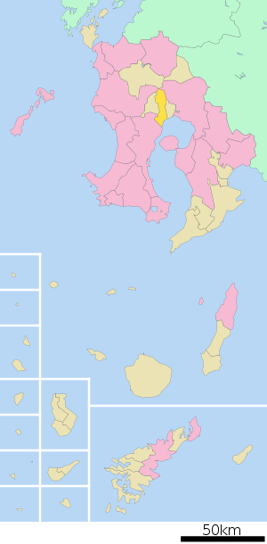
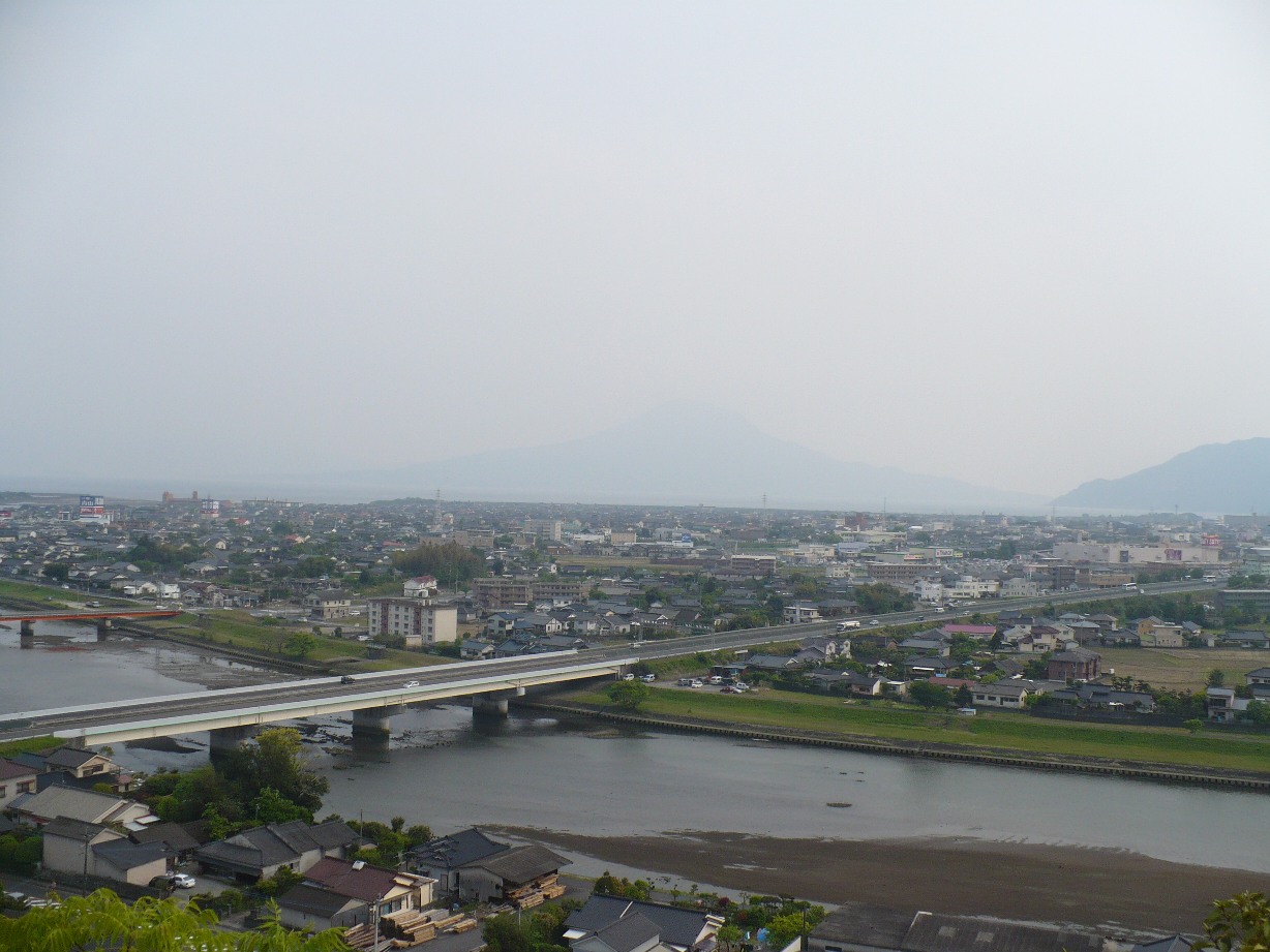
Aira (jap. 姶良市, -shi) ist eine Stadt in der Präfektur Kagoshima in Japan.
Inhaltsverzeichnis
Geographie
Aira liegt nördlich von Kagoshima und westlich von Kirishima an der Kagoshima-Bucht.
Geschichte
Die shi Aira entstand am 23. März 2010 aus dem Zusammenschluss der kreisangehörigen Städte Aira (姶良町, -chō), Kaijiki (加治木町, -chō) und Kamō (蒲生町, -chō) des Landkreises Aira.
Angrenzende Städte und Gemeinden
Weblinks

Kreisfreie Städte (shi): Aira | Akune | Amami | Hioki | Ibusuki | Ichiki-Kushikino | Isa | Izumi | Kanoya | Kagoshima (Verwaltungssitz) | Kirishima | Makurazaki | Minamikyūshū | Minamisatsuma | Nishinoomote | Satsumasendai | Shibushi | Soo | Tarumizu
Aira-gun: Yūsui | Izumi-gun: Nagashima | Kagoshima-gun: Mishima | Toshima | Kimotsuki-gun: Higashikushira | Kimotsuki | Kinkō | Minamiōsumi | Kumage-gun: Minamitane | Nakatane | Yakushima | Ōshima-gun: Amagi | China | Isen | Kikai | Setouchi | Tatsugō | Tokunoshima | Uken | Wadomari | Yamato | Yoron | Satsuma-gun: Satsuma | Soo-gun: Ōsaki


Wikimedia Foundation.