- El-Qurn
-
El-Qurn 
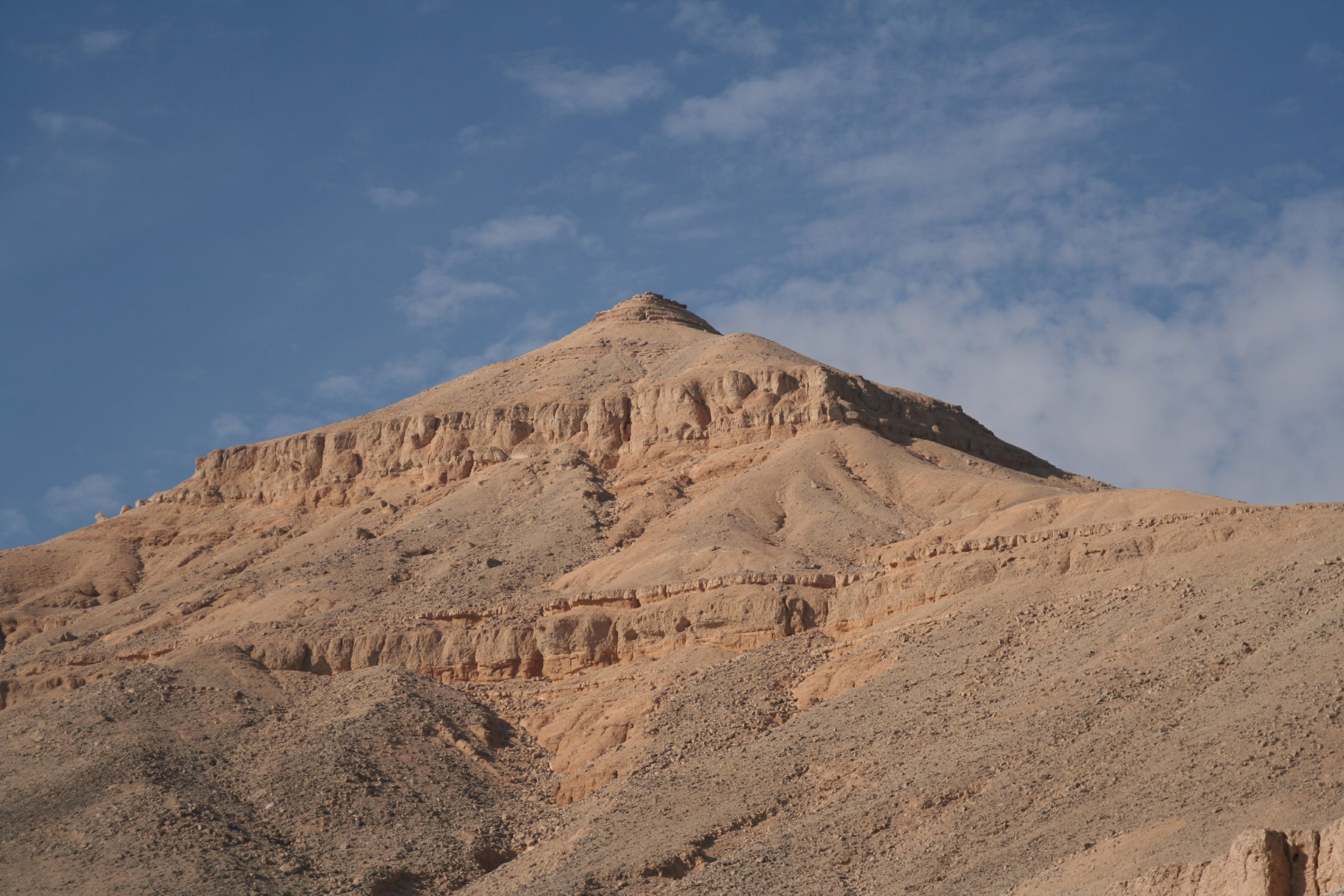
El-Qurn vom Tal der Könige aus gesehen
Höhe 420 m Lage Ägypten Gebirge Thebanische Berge Geographische Lage 25° 44′ 11″ N, 32° 35′ 46″ O25.73638888888932.596111111111420Koordinaten: 25° 44′ 11″ N, 32° 35′ 46″ O 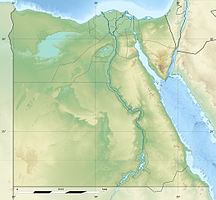

El-Qurn, Al-Qurn (englisch), el-Korn, el-Qorn (arabisch القرن, DMG al-Qurn), El-Qurn oder „das Horn“ ist der heutige Name des mit 420 Metern über Meereshöhe höchsten Punktes in den Thebanischen Bergen. Sein alter Name war Ta Dehent, oder „der Gipfel“.[1] Diese Erhebung liegt am Westufer des Nils, gegenüber von Theben, dem heutigen Luxor.
Inhaltsverzeichnis
Bedeutung
Vom Tal der Könige wirkt el-Qurn wie eine große Pyramide, weshalb einige Ägyptologen einen Zusammenhang zwischen der Form des Berges und der Wahl des Tals der Könige als Begräbnisstätte der Pharaonen des Neuen Reiches ab Thutmosis I.[2] herstellen.[3] So zum Beispiel Kent R. Weeks:[4] „Höchste Erhebung ist el-Qurn, das Horn, am Südlichen Talende (des Tals der Könige)… Dessen Pyramidenform mag die Ägypter an das Wahrzeichen des Sonnengottes Re erinnert und dazu bewogen haben, in diesem Tal den Friedhof der Herrscher anzulegen“.
Für diese Deutung sprechen insbesondere vier Indizien.[5] So insbesondere die auffällige pyramidenförmige Form des Berges, die Begräbnisstätten der Könige auf der Nordseite wie bei den Pyramiden, die wie bei den Pyramiden südlich gelegenen Begräbnisstätten der Königinnen und die Nutzung von ähnlich symbolhaften Landmarken innerhalb der gleichen (18.) Dynastie. So ließ König (Pharao) Echnaton seine neue Hauptstadt Achet-Aton mit deren Nekropole an einer Felsformation in Mittelägypten anlegen, die eine Ähnlichkeit mit dem altägyptischen Hieroglyphenzeichen für „Horizont“ (Achet[6]) aufwies und in der zu bestimmten Zeitpunkten die Sonnenscheibe als Symbol des Gottes Aton zu sehen war.[7][8]
Der Gipfel der Naturpyramide el-Qurn überragt das Tal der Könige, das 140 Meter über dem Meeresspiegel liegt, um nahezu 300 Meter. Der Bereich des Berges war mit dem Kult der Göttin Hathor und ebenfalls mit der Schlangengottheit Meretseger verbunden. Nahe beim höchsten Punkt erinnert eine plattenförmige Felsformation an den gespreizten Halsschild einer Kobra.
Gipfelwege
Der Gipfel kann zu Fuß entweder aus dem Tal der Könige oder aus der Nähe von Deir el-Medina erreicht werden. Die Ersteigung erfordert etwa ein bis anderthalb Stunden und in etwa die gleiche Zeit für den Rückweg. Die an eine Kobra erinnernde plattenförmige Felsformation liegt auf der Deir-el-Medina-Route.
Einzelnachweise
- ↑ http://www.answers.com/topic/valley-of-the-kings#cite_note-kv5histdevelopment-17 Wikipedia Valley of the Kings (History)
- ↑ http://www.nefershapiland.de/kv_20_38.htm Thutmosis I. - Königsgrab -, Nefers Hapiland, Co-Autor J. H. Pirzer
- ↑ http://www.thebanmappingproject.com/articles/article_2.3.html Historical Development of the Valley of the Kings in the New Kingdom
- ↑ Kent R. Weeks, Araldo de Luca (Hrsg.): “Im Tal der Könige. Von Grabkunst und Totenkult der ägyptischen Herrscher“ Verlagsgruppe Weltbild GmbH 2001, S. 112
- ↑ Dr. Thomas Stuhlfauth, persönliche Mitteilung, Tal der Könige (Luxor) 28. Februar 2009
- ↑ Häufig gebrauchte Hieroglyphen
- ↑ 3sat online: Hochzeit in Amarna, „Kulturzeit extra“ Nofretete und das Geheimnis von Amarna Teil 3
- ↑ Mosapedia: Achetaton
Weblinks
- Video vom Gipfel auf youtube.com
- Diashow von der Besteigung des Gipfels und umliegender Hügel auf kizoa.com
Kategorien:- Berg unter 1000 Meter
- Berg in Afrika
- Berg in Ägypten
Wikimedia Foundation.