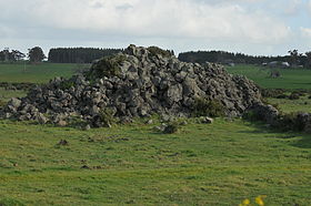
Byaduk

Byaduk
Byaduk
20090926 Volcanic Blister (Tumulus) - Byaduk - Victoria - Australia.JPG
Lavahügel bei Byaduk
Staat: Australien Australien
Bundesstaat: Flag of Victoria (Australia).svg Victoria
Gegründet: 1851
Koordinaten: 37° 44′ S, 142° 1′ O-37.733333333333142.01666666667Koordinaten: 37° 44′ S, 142° 1′ O
 
Zeitzone: AEST (UTC +10)
Postleitzahl: 3301
LGA: Shire of Southern Grampians
Byaduk (Australien)
Byaduk
Byaduk

Byaduk ist eine Stadt im Shire of Southern Grampians im Western District von Victoria, Australien. Der nächstgelegene Ort ist Hamilton.

Die europäische Besiedlung begann um 1853 durch Wenden oder Sorben, Luthersche Einwanderer aus dem Ort Neukirch in der Lausitz in Sachsen. Es war eine wendische Gemeinde, die sich auch Neukirch nannte und der erste Siedler war Johann Rentsch. Wendisch wurde dort bis zum Tode von Rentsch im Jahre 1915 gesprochen.[1]

Die Stadt wurde Byaduk genannt, ein Wort der Aborigines für Steinbeil.

Das Postoffice wurde am 1. August 1863 eröffnet.[2]

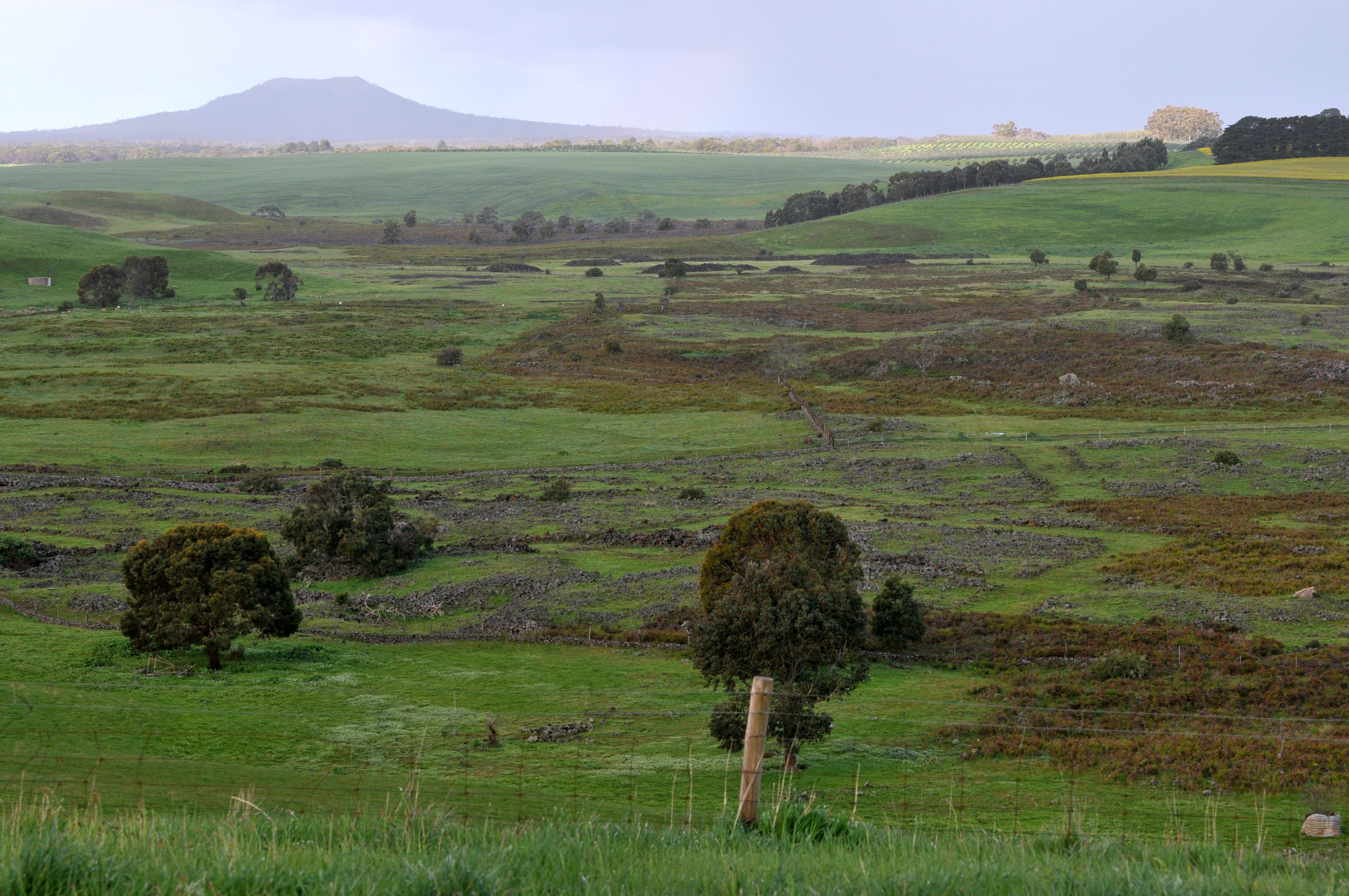
Blick aus dem Harmans Valley zum Mount Napier

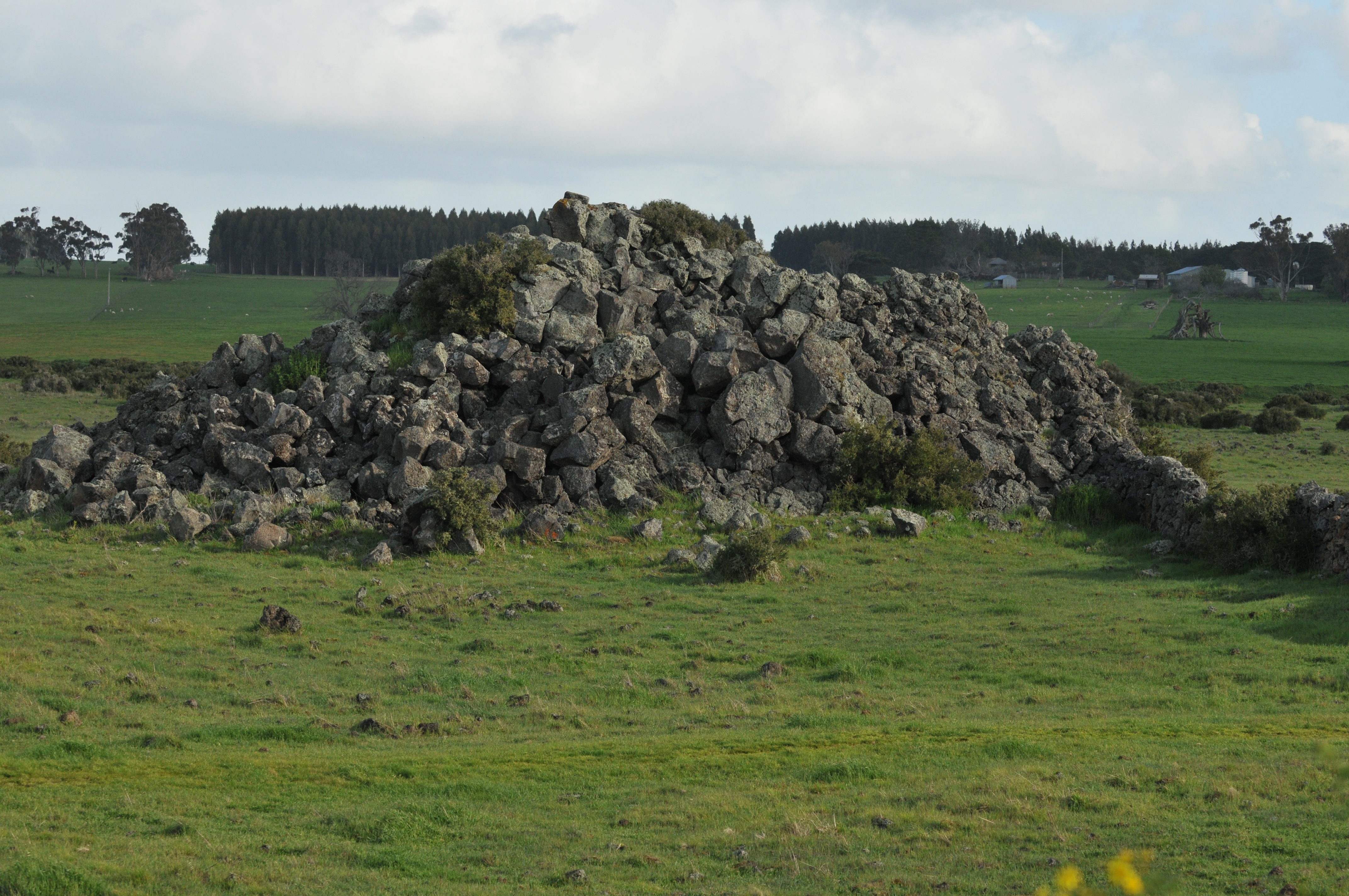
Die Byaduk-Steinbrüche, Lavaröhren und der Vulkankegel des Mount Napier liegen in der Nähe, außerdem können der extreme Lavafluss des Harmans Valley und die Lavablasen an der Old Crushers Road betrachtet werden.

Einzelnachweise

  1. web.archive.org: Early Byaduk Settlers, in englischer Sprache, abgerufen am 5. Oktober 2011
  2. premierpostal.com: Postal History, in englischer Sprache, abgerufen am 5. Oktober 2011

Wikimedia Foundation.

Игры ⚽ Нужно решить контрольную?

Schlagen Sie auch in anderen Wörterbüchern nach:

  • Byaduk, Victoria — Infobox Australian Place | type = town name = Byaduk state = vic caption = lga = Shire of Southern Grampians postcode = 3301 est = pop = elevation= maxtemp = mintemp = rainfall = stategov = Lowan fedgov = Wannon dist1 = 308 dir1 = W location1=… …   Wikipedia

  • Mount Napier — Coordinates: 37°53′38″S …   Wikipedia

  • List of localities in Victoria (Australia) — Map of Local Government Areas in Victoria This is a list of locality names and populated place names in the state of Victoria, Australia, outside the Melbourne metropolitan area. It is organised by region from the south west of the state to the… …   Wikipedia

  • Mount Napier — Höhe 440 m Lage …   Deutsch Wikipedia

  • List of caves in Australia — Caves in Australiahow CavesNew South Wales*Abercrombie Caves *Ashford Caves*Bendethera Caves *Clifden Caves *Jenolan Caves *Tuglow Caves *Wellington Caves *Wombeyan Caves *Wyanbene Cave *Yarrangobilly CavesQueensland*Capricorn CavesSouth… …   Wikipedia

  • List of Country Fire Authority brigades — A CFA brigade is a Country Fire Authority in Australia1 Indicates an Urban brigade 2 Indicates a Rural Brigade 3 Indicates a Fire Brigade 4 Indicates a Forestry Industry Brigade Some brigades have duplicate listings as both Urban and Rural… …   Wikipedia

  • Neukirch/Lausitz — Wappen Deutschlandkarte …   Deutsch Wikipedia

  • Mont Napier — Pour les articles homonymes, voir Napier. Mont Napier Vue du mont Napier. Géographie Alti …   Wikipédia en Français

  • Shrine of Remembrance — Infobox Military Memorial name=Shrine of Remembrance body=Shrine of Remembrance Trustees caption=North perspective displaying the Eternal Flame commemorates=the Australian soldiers of all wars post World War I use dates= coordinates=geolinks AU… …   Wikipedia

  • Coleraine, Victoria — Coleraine Victoria View of town from Peter Francis Points Arboretum …   Wikipedia

Share the article and excerpts

Direct link
Do a right-click on the link above
and select “Copy Link”