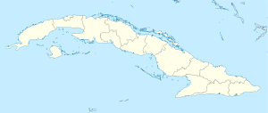
- Caimanera
-
19.99472-75.16Koordinaten: 20° 0′ N, 75° 10′ W
Caimanera Caimanera ist eine Stadt und ein Municipio im Südosten Kubas.
Basisdaten Staat Kuba Provinzen Guantánamo – im Ballungsraum 10.562 Detaildaten Fläche 361 km² Gewässer Atlantischer Ozean, Karibik Postleitzahl 97800 Vorwahl (0053)-21 Zeitzone UTC-5 Quellen: [1][2][3] Caimanera ist eine Stadt und ein Municipio im Südosten Kubas und gehört zur Provinz Guantánamo.
Geografie
Das Municipio Caimanera hat eine Gesamtfläche von 361km². Die Gemeinde wird im Süden durch die Karibik bzw. den Atlantischen Ozean begrenzt. Umgeben wird Imías von den Municipios Niceto Pérez im Westen, Guantánamo im Norden, Manuel Tames im Nordosten und San Antonio del Sur im Osten.[4]
Im Herzen des Municipios befindet sich die Bahía de Guantánamo mit dem US-amerikanischen Gefangenenlager auf dem Gelände des völkerrechtlichrechtlich umstrittenen Guantanamo Bay Militärstützpunktes. Somit unterliegt ein großer Teil des Gemeindegebiets der Kontrolle der USA.[5]
Verkehr
Das Municipio Caimanera ist im Osten an die gut ausgebauten Landstraße Carretera Central angeschlossen und verfügt damit über eine gute Verbindung in die Provinzhauptstadt Guantánamo und die für Individualreisende interessante Stadt Baracoa. Caimanera-Stadt ist über eine separate Straße direkt mit Guantánamo verbunden.
Einzelnachweise
- ↑ http://web.archive.org/web/20070927111826/http://www.atenas.inf.cu/todo/Estadisticas/TABLA+No_3balance.htm
- ↑ http://www.statoids.com/ycu.html
- ↑ http://www.geopostcodes.com/de/index.php?pg=browse&grp=0&niv=3&id=383&l=0&sort=1
- ↑ http://www.bedincuba.com/cuba_municipios_mapa_map_municipalily/guantanamo_municipios_municipality.jpg
- ↑ http://www.kuba-info.org/plaintext/politico/fidel-an-mexiko/index.html
Baracoa | Caimanera | El Salvador | Guantánamo | Imías | Maisí | Manuel Tames | Niceto Pérez | San Antonio del Sur | Yateras
Wikimedia Foundation.

