- Cayos Arcas
-
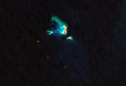
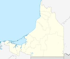
Cayos Arcas Landsat-7-Bild der Cayos Arcas Gewässer Golf von Mexiko Geographische Lage 20° 12′ N, 91° 58′ W20.2042125-91.963977777778Koordinaten: 20° 12′ N, 91° 58′ W Anzahl der Inseln 3 Hauptinsel Cayo del Centro Gesamtfläche 22,8 ha Einwohner (unbewohnt) Die Cayos Arcas sind drei zu Mexiko gehörende kleine sandige Cays im Golf von Mexiko 130 Kilometer vor der Küste westlich Campeche und 300 Kilometer südwestlich des Atolls Arrecife Alacranes, am äußeren westlichen Rand der Campeche Bank. Ihre Fläche beträgt insgesamt 22,8 Hektar. Sie gehören zur Gemeinde Champotón im Bundesstaat Campeche.
Die Cayos Arcas liegen auf einer drei bis vier Quadratkilometer großen Plattform seichten Wassers. Die Inseln auf dem Riff schließen eine kleine Lagune ein. In der Umgebung fällt der Meeresgrund auf eine Tiefe von 40 Metern ab.[1]
Die Hauptinsel ist Cayo del Centro mit einer Größe von 13,7 ha, die spärlich mit Gras bewachsen ist. Büsche und ein paar kleine Gruppen von Palmen sind ebenfalls vorhanden. Ein Paar Leuchtfeuer steht auf dem Cay. Cayo del Este ist 5,2 ha groß und 3 m hoch; es liegt auf einem Riff 0,5 km südöstlich von Cayo del Centro. Cayo del Oeste misst 3,9 ha und ist 2 m hoch, es liegt auf einem kleinen Riff etwa 1,3 km westlich der Südspitze von Cayo del Centro.[2][3]
Die Inselkette ist unbewohnt und hat keine Infrastruktur außer den Leuchtfeuern auf Cayo del Centro. Die Vegetation auf den Inseln besteht aus spärlichen Gräsern und Sträuchern. Die Inseln dienen zur Navigationshilfe. Cayos Arcas Terminal, eine umfangreiche Kette von Öl-Stationen auf dem Arcas-Riff, befindet sich südlich der Inseln. Sie gehören derzeit zu den größten Ölproduzenten im Golf.
Die Arcas-Kette war oft Ziel militärischer Operationen im Golf während des 19. Jahrhunderts. Ein Marine-Flottille der Republik Texas besetzte die Insel kurze Zeit während der Yucatán-Rebellion. Während des Amerikanischen Bürgerkriegs benutzte das berühmte Konföderierten-Segelschiff CSS Alabama die versteckte Inselkette als Rückzugspunkt, um auf die Durchführung der nächsten Operationen im Golf zu warten.
Weblinks
Einzelnachweise
- ↑ Terence M. Farrell, Christopher F. D'Elia, Lawrence Lubbers III und Lawrence Pastor Jr.: Hermatypic Coral Diversity and Reef Zonation at Cayos Arcas, Campeche, Gulf of Mexico, Atoll Research Bulletin No. 270, September 1983
- ↑ http://msi.nga.mil/MSISiteContent/StaticFiles/NAV_PUBS/SD/Pub148/Pub148bk.pdf
- ↑ http://mapserver.inegi.gob.mx/geografia/espanol/datosgeogra/extterri/frontera.cfm?c=154
Kategorien:- Unbewohnte Inselgruppe
- Inselgruppe (Mexiko)
- Inselgruppe (Golf von Mexiko)
- Inselgruppe (Nordamerika)
Wikimedia Foundation.


