Dornie

Dornie
Dornie
Koordinaten 57° 17′ N, 5° 31′ W57.277777777778-5.5141666666667Koordinaten: 57° 17′ N, 5° 31′ W
Dornie (Schottland)
Dornie
Dornie
Verwaltung
Post town DORNIE
Postleitzahlen­abschnitt IV40
Vorwahl 01599
Landesteil Scotland
Unitary authority Highland
Britisches Parlament Ross, Skye and Lochaber
Schottisches Parlament Skye, Lochaber and Badenoch
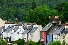
Dornie
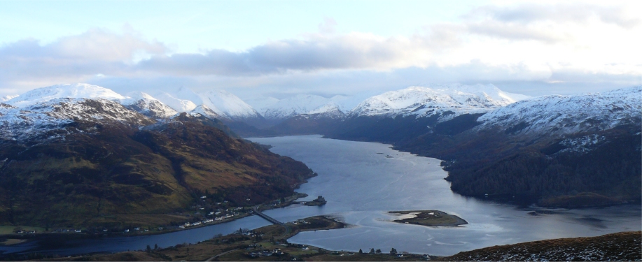
Panorama vom Loch Duich mit Dornie im Vordergrund

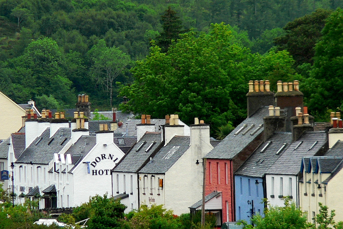
Dornie (schottisch-gälisch An Dòrnaidh) ist ein kleines Dorf im Kintail-Gebiet in den Northwest Highlands der ehemaligen Grafschaft Ross-Shire in Schottland mit ungefähr 360 Einwohnern (Volkszählung 2006). In der Vergangenheit lebten die Bewohner überwiegend vom Fischfang.

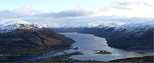
Geographisch liegt der Ort in der Nähe des Zusammenflusses von Loch Duich, Loch Alsh und Loch Long. Das bekannte Eilean Donan Castle befindet sich auf einer vorgelagerten Insel in Sichtweise des Ortes. Das Dorf selbst verläuft überwiegend entlang der Gewässer und besteht aus einer Vielzahl von Dorfhäusern, einem kleinen Geschäft und einem Hotel.

Die Hauptstraße A87 zur Hebrideninsel Skye führt unmittelbar an Dornie vorbei. Vor dem Brückenbau führte die Straße durch das Zentrum des Dorfes und der Verkehr wurde mit einem Fährbetrieb über den Loch Long bewältigt.

Unter Dudelsackpfeifern ist die Melodie des Dornie Ferry ein sehr bekannter Strathspey.

Weblinks


Wikimedia Foundation.

Игры ⚽ Нужно решить контрольную?

Schlagen Sie auch in anderen Wörterbüchern nach:

  • Dornie — Coordinates: 57°16′35″N 5°30′56″W / 57.27633°N 5.51565°W / 57.27633; 5.51565 …   Wikipedia

  • Dornie — 57° 16′ 42″ N 5° 30′ 52″ W / 57.27835, 5.514472 …   Wikipédia en Français

  • Dornie and Bundaloch —    DORNIE and BUNDALOCH, a village, in the parish of Kintail, county of Ross and Cromarty, 7 miles (N. N. W.) from Sheilhouse; containing 510 inhabitants. This is a fishing village on the banks of a branch of Loch Duich, from which the sea is… …   A Topographical dictionary of Scotland

  • Kintail —    KINTAIL, a parish, in the county of Ross and Cromarty, 10 miles (E. S. E.) from Lochalsh; containing, with the village of Dornie and Bundalloch, 1168 inhabitants. This parish derives its name from a Gaelic term, signifying the head of two seas …   A Topographical dictionary of Scotland

  • Eilean Donan Castle — p3 Eilean Donan Castle Eilean Donan Castle im Loch Duich …   Deutsch Wikipedia

  • Eilean Donan — Pour les articles homonymes, voir Eilean et Donan. Eilean Donan …   Wikipédia en Français

  • Scottish Highlands — The Scottish Highlands (Scottish Gaelic: A Ghàidhealtachd , Scots: Hielans ) include the rugged and mountainous regions of Scotland north and west of the Highland Boundary Fault, although the exact boundaries are not clearly defined, particularly …   Wikipedia

  • Highland (council area) — infobox Scotland council area Council= The Highland Council Sgire Comhairle na Gàidhealtachd SizeRank= 1st Size= 30,659 km² Water= ? AdminHQ= Inverness ISO= GB HLD ONS= 00QT PopulationRank= 7th PopulationDate= 2004 Population= 211,340… …   Wikipedia

  • North Glengarry, Ontario — North Glengarry   Township   Maxville …   Wikipedia

  • A87 road — UK road routebox road= A87 length mi= length km= direction= East to west start= Invergarry (gbmappingsmall|NH307011) destinations= end= Uig (gbmappingsmall|NG385635) construction date= completion date= junctions= ukroadsmall|82… …   Wikipedia

Share the article and excerpts

Direct link
Do a right-click on the link above
and select “Copy Link”