- Drymalia
-
Gemeinde Drymalia (1998–2010)
Δήμος Δρυμαλίας (Δρυμαλία)

Basisdaten Staat: Griechenland Verwaltungsregion: Südliche Ägäis Präfektur: Kykladen Geographische Koordinaten: 37° 4′ N, 25° 29′ O37.06421944444425.484741666667Koordinaten: 37° 4′ N, 25° 29′ O Höhe ü. d. M.: 0–1.001 m
Ägäis–Zas[1]Fläche: 302,828 km²[2] Einwohner: 6.099 (2001[3]) Bevölkerungsdichte: Gemeindelogo: 
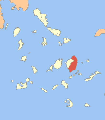
Sitz: Chalki LAU-1-Code-Nr.: 820500 Gemeindegliederung: 11 Gemeindebezirke Website: www.drymalianaxos.gr/ Lage in der ehem. Präfektur Kykladen 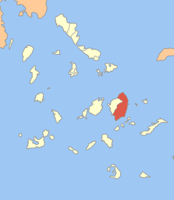
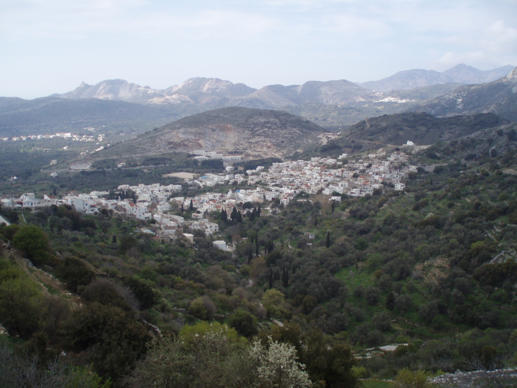
 Filoti, der größte Ort Drymalias
Drymalia (griechisch Δρυμαλία (f. sg) war bis 2010 eine Gemeinde auf der griechischen Insel Naxos innerhalb der Präfektur der Kykladen (Νομός Κυκλάδων). Verwaltungssitz war der 408 Einwohner zählende Ort Chalki. Mit der Verwaltungsreform 2010 wurde Drymalia mit fünf weiteren Gemeinden zur Gemeinde Naxos und Kleine Kykladen zusammengeschlossen, in der es seither einen Gemeindebezirk bildet.
Inhaltsverzeichnis
Lage
Der Gemeindebezirk Drymalia nimmt im Norden, Osten und Süden etwa 70% der Inselfläche der Insel Naxos ein. Die restliche Fläche entfällt auf die ehemalige Gemeinde der Stadt Naxos im Westen der Insel.
Gliederung
Die Verwaltungsreform von 1997 nach dem Programm Ioannis Kapodistrias führte auf Naxos am 31. Dezember 1998 zur Bildung der beiden Gemeinden Naxos und Drymalia. Auf die Gemeinde Drymalia im Osten der Insel entfielen mit 302,828 km² knapp mehr als 70% der Gesamtfläche.
Der Bezirk Drymalia ist in 11 Ortschaften untergliedert, die den ehemaligen Gemeindebezirken entsprechen.
Ortschaft Fläche (km²) Einwohner Siedlungen (Einwohner) Chalki 9,623 635 Chalki (Χαλκεί (n. sg.)), 408
Zoodochos Pigi (Ζωοδόχος Πηγή (f. sg)), 222
Rachi (Ράχη (f. sg)), 5Aperathos 67,956 1.078 Aperathos (Απέραθος (m. sg.)), 828
Azalas (Αζάλας (m. sg.)), 28
Kanaki (Κανάκι (n. sg.)), 23
Klido (Κλειδώ (f. sg)), 54
Lygaridia (Λυγαρίδια (n. pl.)), 49
Moutsouna (Μουτσούνα (f. sg)), 82
Panermos (Πάνερμος (m. sg.)), 14Damarionas 32,274 557 Damarionas (Δαμαριώνας (m. sg.)), 341
Agiassos (Αγιασσός (f. sg)), 136
Vouvouria (Βουρβουριά (f. sg)), 19
Damalas (Δαμαλάς (m. sg.)), 41
Pyrgaki (Πυργάκι (n. sg.)), 20Danakos 9,848 162 Danakos (Δανακός (n. sg.)), 162 Keramoti 5,575 76 Keramoti (Κεραμωτή (f. sg)), 76 Koronida 42,310 572 Koromis (Κορωνίς (f. sg)), 310
Agia (Αγιά (f. sg)), 24
Apollonas (Απόλλωνας (m. sg.)), 104
Kambos (Κάμπος (m. sg.)), 50
Myrsis (Μυρίσης (m. sg.)), 15
Taxiarchis (Ταξιάρχης (m. sg.)), 25
Faraklo (Φαρακλό (n. sg.)), 16
Chilia Brysi (Χίλια Βρύση (f. sg)), 28Koronos 21,720 744 Koronos (Κόρωνος (f. sg)), 584
Argokiliotissa (Αργοκοιλιώτισσα (f. sg)), 22
Atsipati (Ατσιπάπη (f. sg)), 25
Lionas (Λιώνας (m. sg.)), 113Mesi 6,900 116 Mesi (Μέση (f. sg)), 116 Moni 6,475 230 Moni (Μονή (n. sg.)), 230
Sifones (Σίφωνες (f. pl.)), unbewohntSkando 7,574 126 Skando (Σκαδό (n. sg.)), 126 Filoti 92,573 1.803 Filoti (Φιλότι (n. sg.)), 1.702
Kalandos (Καλαντός (m. sg.)), 101Weblinks
- ΔΑΦΝΗ - Δίκτυο Αειφόρων Νήσων του Αιγαίου, Νάξος, griechisch (.pdf 3,3 MB)
Einzelnachweise
Kategorien:- Ort in der Region Südliche Ägäis
- Naxos
- Gemeinde in Griechenland (Kapodistrias-Programm)

Wikimedia Foundation.