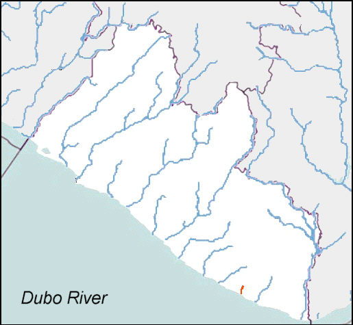
- Dubo River
-
Dubo River
D'bor River, Dubor, Dru River
Daten Lage Liberia, Westafrika Flusssystem Dubo River Quelle Quellgebiet im Tiehnpo Range
5° 5′ 53″ N, 8° 5′ 21″ W5.0980555555556-8.089166666666795Quellhöhe ca. 95 m Mündung Golf von Guinea, Atlantischer Ozean 4.7244444444444-8.50972222222220Koordinaten: 4° 43′ 28″ N, 8° 30′ 35″ W
4° 43′ 28″ N, 8° 30′ 35″ W4.7244444444444-8.50972222222220Mündungshöhe 0 m Höhenunterschied ca. 95 m Länge 100 km Rechte Nebenflüsse Bafe Creek Linke Nebenflüsse Wu River, Dubalo Creek Schiffbar nicht schiffbar Der Dubo River, auch bekannt als D'bor River, Dubor, Dru River, ist ein Fluss in der Republik Liberia in Westafrika.
Der Dubo River hat eine Länge von etwa 100 km, er entspringt im Bergland Tiehnpo Range im südwestlichsten Teil des River Gee County und durchfließt in zahllosen Windungen den Grand Kru-County. Der Fluss mündet etwa 10 Kilometer nordwestlich der Küstenstadt Sasstown in den Atlantik.
Die Landschaft des Dubo River wird vom Tropischen Regenwald geprägt und ist nur dünn besiedelt. Das Gebiet gehörte zu den Regionen Liberias, die am längsten von der indigenen Bevölkerung gegen die Bestrebungen der Amerikoliberianischen Zuwanderer behauptet wurde. Noch in den 1920er Jahren war die Region Schauplatz erbitterter Kämpfe. Die auch innerhalb der indigenen Bevölkerungsgruppen ausgetragenen Konflikte um die Vorherrschaft beim lukrativen Küstenhandel wurden als Kru Wars (deutsch: Kru-Kriege) bekannt. Erst Anfang der 1930er Jahre wurden die letzten Aufstände mit großer Brutalität seitens der Regierungstruppen niedergeschlagen.[1]
Im Ergebnis einer Lagerstättenerkundung konnten am Oberlauf des Dubo River Goldvorkommen nachgewiesen werden. Die Region war immer dünn besiedelt, ein Straßennetz ist praktisch nicht vorhanden.[2]
Weblinks
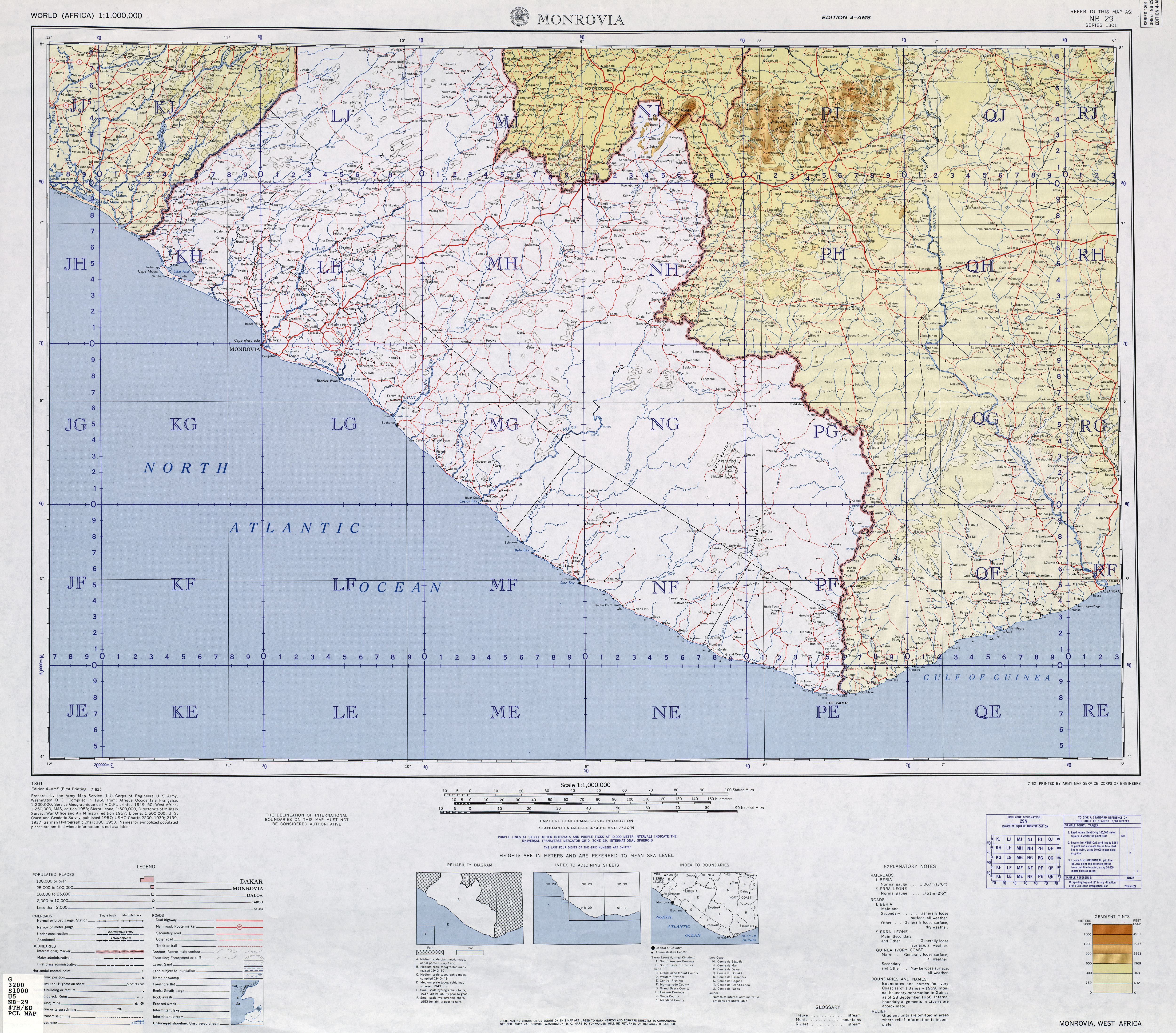
- TK250 NB29-4 (MONROVIA), US Army Map Service (Hrsg.), Washington 1960
Literatur
- J.W. Lugenbeel: The republic of Liberia: its geography, climate, soil and productions, witha a history of its early settlements. G.S. Stockwell, New York 1868, S. 299. (Digitalisat bei Google-Books)
Einzelnachweise
- ↑ TRC Final Report: Volume II. TRC, 2009, S. 384, abgerufen am 31. Januar 2011 (PDF-Datei, 3.1 MB).
- ↑ Grand Kru County Development Agenda. Gouvernement of Liberia, 2008, S. 76, abgerufen am 31. Januar 2011 (englisch).
Kategorien:- Fluss in Afrika
- Fluss in Liberia
Wikimedia Foundation.