- Dziemiany
-
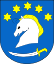
Dziemiany 
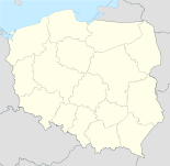
Basisdaten Staat: Polen Woiwodschaft: Pommern Landkreis: Kościerzyna Geographische Lage: 54° 0′ N, 17° 46′ O54.00638888888917.768333333333Koordinaten: 54° 0′ 23″ N, 17° 46′ 6″ O Einwohner: -
(31. Dez. 2010)[1]Postleitzahl: 83-425 Telefonvorwahl: (+48) 58 Kfz-Kennzeichen: GKS Gemeinde Gemeindeart: Landgemeinde Gemeindegliederung: 8 Schulzenämter Fläche: 125 km² Einwohner: 4214
(31. Dez. 2010) [2]Bevölkerungsdichte: 34 Einw./km² Gemeindenummer (GUS): 2206022 Verwaltung (Stand: 2010) Gemeindevorsteher: Leszek Pobłocki Adresse: ul. 8-go Marca 3
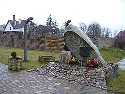
83-425 DziemianyWebpräsenz: dziemiany.pl Dziemiany (deutsch Dzimianen) ist ein Dorf und Sitz der gleichnamigen Landgemeinde in Polen. Es liegt im Powiat Kościerski der Wojewodschaft Pommern. Hier im Jahre 1944 war SS-Truppenübungsplatz "Westpreußen".
Gemeinde
Zur Landgemeinde Dziemiany gehören 8 Ortsteile (deutsche Namen bis 1945)[3] mit einem Schulzenamt:
- Dziemiany (Dzimianen)
- Jastrzębie Dziemiańskie
- Kalisz (Kalisch)
- Piechowice (Piechowitz)
- Płęsy (Plense)
- Raduń (Raduhn)
- Schodno
- Trzebuń (Trzebuhn, 1942–1945 Tremborn)
Weitere Ortschaften der Gemeinde sind:
- Belfort
- Białe Błoto
- Borsztal
- Czarne
- Dunajki
- Dąbrówka (Dombrowo)
- Dębina
- Dywan
- Głuchy Bór
- Kalwaria
- Kloc
- Lampkowo
- Leżuchowo
- Milkowo
- Mutkowo
- Nowe Słone (Neu Slonnen)
- Pełki
- Przerębska Huta
- Rozwalewo
- Rów
- Słupinko
- Stare Słone (Alt Slonnen)
- Szablewo
- Tklania
- Tomaszewo
- Turzonka
- Wilczewo
- Zajączkowo
- Zarośle
- Zatrzebionka
- Zimny Dwór
- Żabowo
Weblinks
- Website der Gemeinde (polnisch)
Fußnoten
- ↑ Population. Size and Structure by Territorial Division. As of December 31, 2010. Główny Urząd Statystyczny (GUS), abgerufen am 6. August 2011.
- ↑ Population. Size and Structure by Territorial Division. As of December 31, 2010. Główny Urząd Statystyczny (GUS), abgerufen am 6. August 2011.
- ↑ Das Genealogische Orts-Verzeichnis
Städte: Kościerzyna (Berent)
Landgemeinden: Dziemiany (Dzimianen) | Karsin (Karschin) | Kościerzyna – Gmina (Berent – Land) | Liniewo (Lienfelde) | Lipusz (Lippusch) | Nowa Karczma (Neukrug) | Stara Kiszewa (Alt Kischau)
Wikimedia Foundation.


