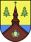
- Karsin
-
Karsin 
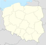
Basisdaten Staat: Polen Woiwodschaft: Pommern Landkreis: Kościerzyna Geographische Lage: 53° 54′ N, 17° 56′ O53.90517.928333333333Koordinaten: 53° 54′ 18″ N, 17° 55′ 42″ O Einwohner: -
(31. Dez. 2010)[1]Postleitzahl: 83-440 Telefonvorwahl: (+48) 58 Kfz-Kennzeichen: GKS Gemeinde Gemeindeart: Landgemeinde Gemeindegliederung: 11 Schulzenämter Fläche: 169,2 km² Einwohner: 6027
(31. Dez. 2010) [2]Bevölkerungsdichte: 36 Einw./km² Gemeindenummer (GUS): 2206032 Verwaltung (Stand: 2010) Gemeindevorsteher: Roman Brunke Adresse: ul. Długa 222
83-440 KarsinWebpräsenz: www.karsin.pl Karsin (deutsch: Karschin) ist ein Dorf und Sitz der gleichnamigen Landgemeinde in Polen. Es liegt im Powiat Kościerski der Wojewodschaft Pommern.
Gemeinde
Zur Landgemeinde Karsin gehören 11 Ortsteile (deutsche Namen bis 1945)[3] mit einem Schulzenamt:
- Bąk (Bak)
- Borsk (Borsk)
- Cisewie (Eibenfelde)
- Dąbrowa (Dombrowo)
- Górki
- Karsin (Karschin, 1939–1945: Karßin)
- Osowo (Ossowo)
- Przytarnia (Wildau)
- Wdzydze Tucholskie (Weitsee)
- Wiele
- Zamość
Weitere Ortschaften der Gemeinde sind:
- Abisynia
- Białe Błoto
- Dębowiec
- Jasnochówka
- Joniny Małe
- Joniny Wielkie
- Kliczkowy
- Knieja
- Lipa
- Malary
- Miedzno
- Mniszek (Mischke, 1939–1945: Mieschke)
- Piątkowo
- Podrąbiona
- Popia Góra (Popiagora)
- Przydół
- Robaczkowo
- Rogalewo
- Zabrody
- Żebrowo
Weblinks
- Website der Gemeinde (polnisch)
Fußnoten
- ↑ Population. Size and Structure by Territorial Division. As of December 31, 2010. Główny Urząd Statystyczny (GUS), abgerufen am 6. August 2011.
- ↑ Population. Size and Structure by Territorial Division. As of December 31, 2010. Główny Urząd Statystyczny (GUS), abgerufen am 6. August 2011.
- ↑ Das Genealogische Orts-Verzeichnis
Städte: Kościerzyna (Berent)
Landgemeinden: Dziemiany (Dzimianen) | Karsin (Karschin) | Kościerzyna – Gmina (Berent – Land) | Liniewo (Lienfelde) | Lipusz (Lippusch) | Nowa Karczma (Neukrug) | Stara Kiszewa (Alt Kischau)
Wikimedia Foundation.


