Folsom (New Mexico)

Folsom (New Mexico)
Folsom
Union County New Mexico Incorporated and Unincorporated areas Folsom Highlighted.svg
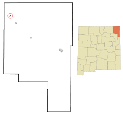
Lage von Folsom im Union County in New Mexiko
Basisdaten
Staat: Vereinigte Staaten
Bundesstaat: New Mexico
County:

Union County

Koordinaten: 36° 51′ N, 103° 55′ W36.848055555556-103.918055555561948Koordinaten: 36° 51′ N, 103° 55′ W
Zeitzone: Mountain Standard Time (UTC−7)
Einwohner: 75 (Stand: 2000)
Bevölkerungsdichte: 53,6 Einwohner je km²
Fläche: 1,4 km² (ca. 1 mi²)
davon 1,4 km² (ca. 1 mi²) Land
Höhe: 1948 m
Postleitzahl: 88419
Vorwahl: +1 575
FIPS: 35-26780
GNIS-ID: 0902249
Eine Speerspitze der Folsom-Kultur, charakteristisch ist der lange Schaft

Folsom ist ein Dorf im Union County im US-Bundesstaat New Mexiko. Im Jahr 2000 hatte das Dorf 75 Einwohner. Das Dorf umfasst eine Fläche von 1.4km2 und liegt auf 1948 müM.

Das kleine Dorf erlangte internationale Bekanntheit für die Archäologie Nordamerikas durch eine in der Nähe befindliche Ausgrabungsstätte. Hier wurden 1927 erstmals Beweise für die gleichzeitige Existenz prähistorischer Bisons und Menschen gefunden. Die hier gefundenen charakteristischen Speerspitzen nennt man deshalb Folsom Points und das Volk, das hier lebte, die Folsom-Menschen. Das von Jesse Figgins ausgegrabene Beweisstück, eine Speerspitze, die noch zwischen den Rippen einer vor etwa 10.000 Jahren ausgestorbenen Bisonart steckt, kann heute im Denver Museum of Nature and Science bestaunt werden. Die Ausgrabungsstätte, die sich etwas westlich vom Dorf, bereits im Colfax County befindet, ist heute ein National Historic Landmark.

Weblinks


Wikimedia Foundation.

Игры ⚽ Нужно решить контрольную?

Schlagen Sie auch in anderen Wörterbüchern nach:

  • Folsom, New Mexico — Infobox Settlement official name = Folsom, New Mexico settlement type = Village nickname = motto = imagesize = image caption = image imagesize = image caption = image mapsize = 250px map caption = Location of Folsom, New Mexico mapsize1 = map… …   Wikipedia

  • New Mexico locations by per capita income — New Mexico has the fifth lowest per capita income in the United States of America, at $17,261 (2000). Its personal per capita income is $25,541 (2003). Contents 1 New Mexico counties ranked by per capita income 2 New Mexico places ranked by Per… …   Wikipedia

  • New Mexico State Road 456 — State Road 456 Route information Maintained by NMDOT Length: 58.784 mi …   Wikipedia

  • New Mexico — Nouveau Mexique New Mexico State of New Mexico [ anglais ] Estado de Nuevo México [ espagnol ] État du Nouveau Mexique …   Wikipédia en Français

  • Clayton, New Mexico —   Town   Main Street in Clayton …   Wikipedia

  • Liste der State-, U.S.- und Interstate-Highways in New Mexico — Dies ist eine Aufstellung von State Routes, U.S. Highways und Interstates im US Bundesstaat New Mexico, nach Nummern. Inhaltsverzeichnis 1 State Routes 2 United States Highways 2.1 Gegenwärtige Strecken …   Deutsch Wikipedia

  • National Register of Historic Places listings in New Mexico — Map of all coordinates from Google Map of all coordinates from Bing Export all coordinates as …   Wikipedia

  • National Register of Historic Places listings in Colfax County, New Mexico — Location of Colfax County in New Mexico This is a list of the National Register of Historic Places listings in Colfax County, New Mexico. This is intended to be a complete list of the properties and districts on the National Register of Historic… …   Wikipedia

  • Folsom point — Folsom points are a distinct form of chipped stone projectile points associated with the Folsom Tradition of North America.The style of toolmaking was named for Folsom, New Mexico where the first sample was found within the bone structure of a… …   Wikipedia

  • Union County (New Mexico) — Union County Courthouse, gelistet im NRHP mit der Nr. 87000891[1] Verwaltung …   Deutsch Wikipedia

Share the article and excerpts

Direct link
Do a right-click on the link above
and select “Copy Link”