General Bathymetric Chart of the Oceans
- General Bathymetric Chart of the Oceans
-
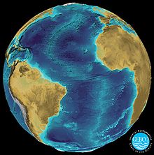
GEBCO (General Bathymetric Chart of the Oceans) ist ein öffentlich verfügbarer bathymetrischer Datensatz. Er erfasst weltweit die Wassertiefen der Meere.
Organisation
Die GEBCO ist eine internationale Organisation mit dem Ziel, eine Meereskarte mit Wassertiefen und geografischen Namen zu erstellen. Beteiligt sind die meisten Länder der Welt, vertreten durch führende Ozeanografen. Die Organisation steht unter Federführung der Intergovernmental Oceanographic Commission (IOC) der UNESCO und der International Hydrographic Organization (IHO).
Datensatz
Der Datensatz basiert auf zusammengetragenen Daten aus Schiffs-Echoloten. Somit ist er sehr genau für häufig befahrene Seewege. Die Topografie wurde anhand von Satellitenmessungen ergänzt. Bis zu einer Auflösung von 1 Bogenminute ist er frei, feinere Auflösungen sind eingeschränkt verfügbar.
Der Datensatz liegt als digitales Grid vor und ist somit direkt bearbeitbar mit Generic Mapping Tools.
Kooperation mit OpenSeaMap

Darstellung bei OpenSeaMap

Tiefenlinien bei Gibraltar
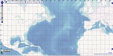
In einer Kooperation zwischen GEBCO und OpenSeaMap wird der GEBCO_08 Datensatz dargestellt: Wassertiefen zwischen 100 und 10'000 Meter durch eine 23-stufige Blauskala dargestellt, mit Schattierung der Abhänge. In hohen Zoomstufen werden zusätzlich Höhenlinien gezeigt.
Weblinks
Wikimedia Foundation.
Schlagen Sie auch in anderen Wörterbüchern nach:
General Bathymetric Chart of the Oceans — La General Bathymetric Chart of the Oceans, ou GEBCO est une représentation bathymétrique des océans consultable et utilisable par le grand public. Elle est l œuvre conjointe de la Commission océanographique intergouvernementale et de l… … Wikipédia en Français
Bathymetric chart — A bathymetric chart is the submerged equivalent of an above water topographic map. Bathymetric charts are designed to present accurate, measurable description and visual presentation of the submerged terrain. In an ideal case, the joining of a… … Wikipedia
GEBCO — The General Bathymetric Chart of the Oceans (GEBCO) is a publicly available bathymetry of the world s oceans. The project was conceived with the aim of preparing a global series of charts showing the general shape of the seafloor. Over the years… … Wikipedia
Composite Gazetteer of Antarctica — The Composite Gazetteer of Antarctica (CGA) of the Scientific Committee on Antarctic Research (SCAR) is the authoritative international gazetteer containing all the Antarctic toponyms published in national gazetteers, plus basic information about … Wikipedia
GEBCO — General Bathymetric Chart of the Oceans (Academic & Science » Ocean Science) … Abbreviations dictionary
GEBCO — General Bathymetric Chart of the Oceans ( > IEEE Standard Dictionary ) … Acronyms
GEBCO — General Bathymetric Chart of the Oceans ( > IEEE Standard Dictionary ) … Acronyms von A bis Z
map — mappable, adj. mapper, n. /map/, n., v., mapped, mapping. n. 1. a representation, usually on a flat surface, as of the features of an area of the earth or a portion of the heavens, showing them in their respective forms, sizes, and relationships… … Universalium
Map — /map/, n. Walter, c1140 1209?, Welsh ecclesiastic, poet, and satirist. Also, Mapes /mayps, may peez/. * * * I Graphic representation, drawn to scale and usually on a flat surface, of features usually geographic, geologic, or geopolitical of an… … Universalium
MAP — See modified American plan. * * * I Graphic representation, drawn to scale and usually on a flat surface, of features usually geographic, geologic, or geopolitical of an area of the Earth or of any celestial body. Globes are maps represented on… … Universalium


