- Guadalupe River (San Antonio Bay)
-
Guadalupe River 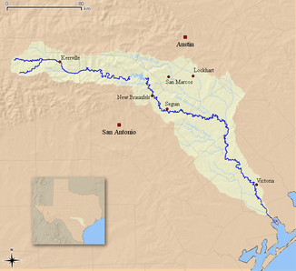
Einzugsgebiet und Verlauf des Guadalupe River
Daten Gewässerkennzahl US: 1377682 Lage Texas (USA) Flusssystem Guadalupe River Abfluss über Guadalupe River → Golf von Mexiko Quelle im Kerr County
30° 4′ 17″ N, 99° 19′ 52″ W30.0713195-99.3311569676Quellhöhe 676 m Mündung San Antonio Bay, einer Nebenbucht des Golf von Mexiko 28.4347245-96.80442892Koordinaten: 28° 26′ 5″ N, 96° 48′ 16″ W
28° 26′ 5″ N, 96° 48′ 16″ W28.4347245-96.80442892Mündungshöhe 2 m Höhenunterschied 674 m Länge 370 km Einzugsgebiet 3.256 km² Abflussmenge MQ: 34 m³/s Rechte Nebenflüsse San Antonio River Linke Nebenflüsse San Marcos River Mittelstädte New Braunfels, Victoria 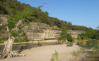
Felswand im Guadalupe River State Park
Der Guadalupe River ist ein 370 km langer Fluss im US-Bundesstaat Texas. Er fließt vom Kerr County zur San Antonio Bay und in den Golf von Mexiko. Der Fluss wird zum Rafting und Kanufahren genutzt. Größere Städte am Flusslauf sind New Braunfels, Kerrville, Seguin, Gonzales, Cuero und Victoria.
Der Guadalupe River wird von mehreren Dämmen aufgestaut. Der bekannteste davon ist der Canyon Dam, welcher den Fluss nordwestlich von New Braunfels zum Canyon Lake aufstaut.
Inhaltsverzeichnis
Flusslauf
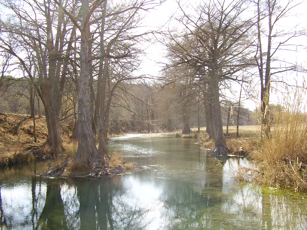
Der Oberlauf des Guadalupe River, im Texas Hill Country, ist ein kleines schnellfließendes Gewässer mit Kalksteinufern, der von Pecannussbäumen und Echten Sumpfzypressen gesäumt wird. Der eigentliche Fluss entsteht durch den Zusammenfluss der beiden Hauptquellarme, dem North Fork und dem South Fork Guadalupe River.
Der obere Flussabschnitt ist in den Frühjahr- und Sommermonaten beliebt zum Tubing. Dabei lassen sich die Leute mit aufgeblasenen Gummischläuchen (tubes) den Fluss hinunter treiben.
Östlich von Boerne, an der Grenze zwischen Kendall County und Comal County, durchfließt der Fluss den Guadalupe River State Park, einen der beliebtesten Tubing-Strecken am gesamten Flusslauf.
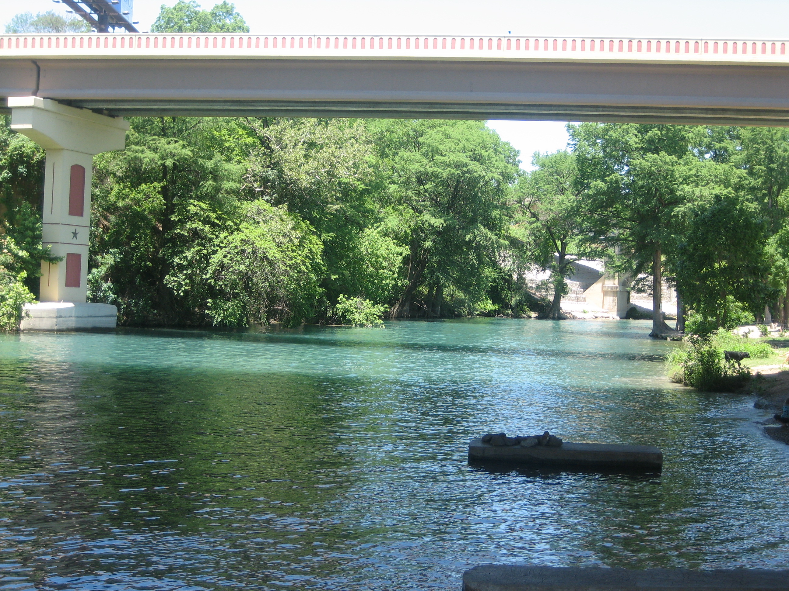
Der untere Flusslauf beginnt am Ausfluss aus dem Canyon Lake nahe New Braunfels. Dieser Abschnitt zwischen Canyon Dam und New Braunfels wird am stärksten von Erholungssuchenden genutzt. Es sind Wildwasser-Aktivitäten für Rafting, Kanu, Kajak und Tubing möglich.
Die Abflussmengen des Flusses variieren stark. Sie hängen von den Jahreszeiten sowie von Niederschlagsereignissen in der Umgebung ab.
Der Comal River mündet in New Braunfels in den Guadalupe River. Etwa 3 km westlich von Gonzales trifft der San Marcos River auf den Guadalupe River.
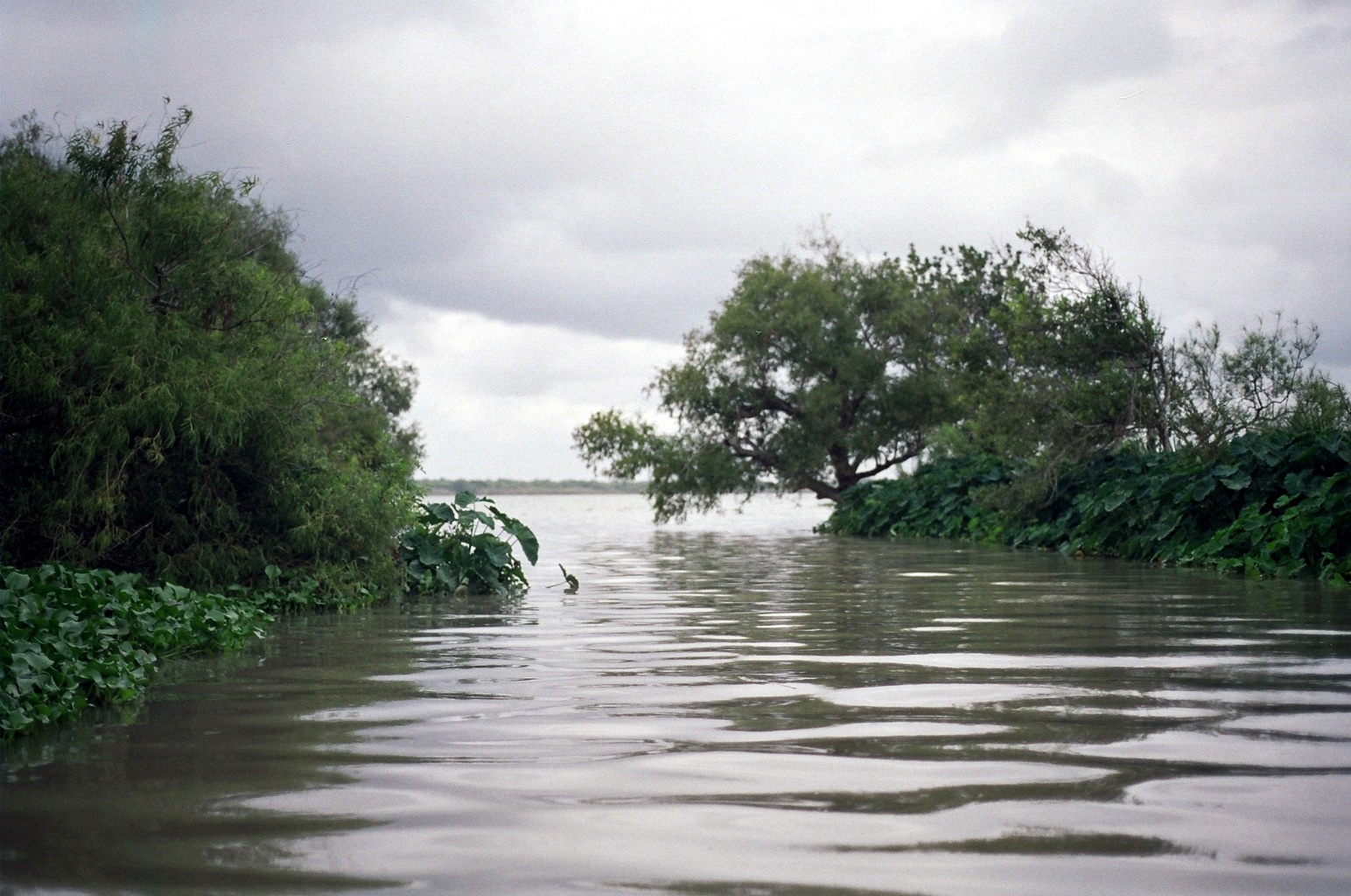
Der San Antonio River erreicht den Guadalupe River etwas nördlich von Tivoli. Bevor der Guadalupe River in das Ästuar der San Antonio Bay mündet, bildet er ein Flussdelta und teilt sich in zwei Arme auf, dem North und dem South Guadalupe River. Beide Arme fließen in die Guadalupe Bay und San Antonio Bay.
-
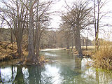
Guadalupe River nahe Hunt im Texas Hill Country
-

Guadalupe River unter der Interstate 35 in New Braunfels
-
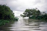
Mündung des South Guadalupe River bei Guadalupe Bay
Sehenswertes
 Commons: Guadalupe River – Sammlung von Bildern, Videos und Audiodateien
- Riverside Nature Center in Kerrville - Guadalupe River Home Page
siehe auch
- Guadalupe-Blanco River Authority
Web links
Kategorien:- Fluss in Texas
- Fluss in Nordamerika
-


Wikimedia Foundation.