- Kosi (Division)
-
Kosi Division
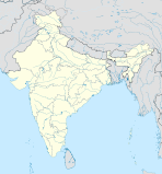
कोसी प्रमंडलBundesstaat: Bihar Koordinaten 25° 53′ N, 86° 36′ O25.8886.6Koordinaten: 25° 53′ N, 86° 36′ O Verwaltungssitz: Saharsa Fläche: 5.893 km² Einwohner: 4.402.078 Bevölkerungsdichte: 747 Einwohner/km² Distrikte: 3 Kosi ist eine Division im indischen Bundesstaat Bihar. Sie hat ihren Verwaltungssitz in Saharsa.
Geschichte
Das Distrikt Supaul wurde am 14. März 1991 aus Teilen des Distrikts Saharsa gebildet.
Distrikte
Die Division besteht aus drei Distrikten:
Distrikt Hauptstadt Fläche in km² Einwohner (Stand: 2001) Bev.-Dichte in E/km² Madhepura Madhepura 1.787 1.524.596 853 Saharsa Saharsa 1.696 1.132.413 668 Supaul Supaul 2.410 1.745.069 724 Schlagen Sie auch in anderen Wörterbüchern nach:
Kosi division — division is an administrative geographical unit of Bihar state of India. Saharsa is the administrative headquarters of the division. Currently (2005), the division consists of Saharsa district, Madhepura district, and Supaul district.ee… … Wikipedia
Kosi — may refer to: NOTOC Places* Koshi River, river in Nepal and Bihar, India * Dudh Kosi, river in Nepal, tributary of the Kosi River * Sun Kosi, river in Nepal, tributary of the Kosi River * Bhote Kosi, river in Nepal, tributary of the Sun Kosi… … Wikipedia
Kosi — bezeichnet: eine Verwaltungszone im Osten Nepals, siehe Kosi (Zone) eine Division in Indien, siehe Kosi (Division) ein Fluss in Nepal und Indien, siehe Koshi (Fluss) eine Seenlandschaft in KwaZulu Natal, Südafrika, siehe Kosi Bucht Dies … Deutsch Wikipedia
Darbhanga division — is an administrative geographical unit of Bihar state of India, and Darbhanga town is the administrative headquarters of the division. As of 2005[update], the division consists of Darbhanga District, Begusarai District, Madhubani District,and… … Wikipedia
Dudh Kosi — Origin East of Gokyo Lakes 27°52′26″N 86°35′28″E / … Wikipedia
Munger division — is an administrative geographical unit of Bihar state of India. Munger is the administrative headquarters of the division. Currently (2005), the division consists of Munger District, Begusarai District Jamui District, Khagaria District,… … Wikipedia
Saran division — is an administrative geographical unit of Bihar state of India. Chapra is the administrative headquarters of the division. Currently (2005), the division consists of Saran District, also called Chapra District, Siwan District, Gopalganj District … Wikipedia
Magadh division — is an administrative geographical unit of Bihar state of India. Gaya is the administrative headquarters of the division. Currently (2005), the division consists Gaya district, Nawada district, Aurangabad district, Jehanabad district, and Arwal… … Wikipedia
Saran (Division) — Vorlage:Infobox Division in Indien/Wartung/FlächeVorlage:Infobox Division in Indien/Wartung/Einwohner Saran Division सारन प्रमंडल … Deutsch Wikipedia
Darbhanga (Division) — Darbhanga Division दरभंगा प्रमंडल … Deutsch Wikipedia

