- Tirhut
-
Tirhut Division
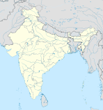
तिरहुत प्रमंडलBundesstaat: Bihar Koordinaten 26° 4′ N, 85° 27′ O26.0785.45Koordinaten: 26° 4′ N, 85° 27′ O Verwaltungssitz: Muzaffarpur Fläche: 17.143 km² Einwohner: 15.969.116 Bevölkerungsdichte: 932 Einwohner/km² Distrikte: 6 Tirhut ist eine Division im indischen Bundesstaat Bihar. Sie hat ihren Verwaltungssitz in Muzaffarpur.
Geschichte
Das Distrikt Vaishali wurde am 12. Oktober 1972 aus Teilen des Distrikts Muzzafarpur gebildet.
Distrikte
Die Division besteht aus sechs Distrikten:
Distrikt (weiterer Name) Hauptstadt Fläche in km² Einwohner (Stand: 2001) Bev.-Dichte in E/km² East Champaran (Motihari) Motihari 3.969 3.933.636 991 Muzaffarpur Muzaffarpur 3.173 3.743.836 1.180 Sheohar Sheohar 443 515.961 [1] 1.165 Sitamarhi Sitamarhi 2.294 [2] 2.013.796 878 Vaishali Hajipur 2.036 2.718.421 1.335 West Champaran (Bettiah) Bettiah 5.228 3.043.466 [3] 582 Einzelnachweis
- ↑ Offizielle Webseite des Distrikts Sheohar Abgerufen am 9. März 2010
- ↑ Offizielle Webseite des Distrikts Sitamarhi Abgerufen am 9. März 2010
- ↑ Offizielle Webseite des Distrikts West Champaran Abgerufen am 9. März 2010
Schlagen Sie auch in anderen Wörterbüchern nach:
Tirhut — désigne une partie de la plaine indo gangétique du nord du Gange dans l État indien du Bihar. Historiquement, cela correspond à la région de Mithila. Portail de l’Inde Catégorie : Géogra … Wikipédia en Français
Tirhut — Historically Tirhut refers to the Indo Gangetic plains lying north of the Ganga River, in the Indian state of Bihar. The geographical area known as Tirhut corresponds to the ancient region of Mithila. Tirhut, a densely populated area of India,… … Wikipedia
Tirhut division — is an administrative geographical unit of Bihar state of India. Muzaffarpur is the administrative headquarters of the division. Currently (2005), the division consists of West Champaran, also called Bettiah district; East Champaran, also called… … Wikipedia
Oudh and Tirhut Railway — The Oudh and Tirhut Railway was a Railway company operated in India. On January 1, 1943, the Bengal and North Western Railway and the Rohilkund and Kumaon Railway were acquired by the Government of India and they were amalgamated with the Tirhut… … Wikipedia
Muzaffarpur district — This article is about the district. For its eponymous headquarters, see Muzaffarpur. Muzaffarpur district मुज़फ़्फ़रपुर ज़िला … Wikipedia
Muzaffarpur — This article is about the municipality in India. For its namesake district, see Muzaffarpur district. Muzaffarpur town … Wikipedia
Muzzafarpur — History = Muzaffarpur district, ‘The Land Of Leechi’ was created in 1875 for the sake of administrative convenience by splitting up the earlier district of Tirhut. Overview The present district of Muzaffarpur came to its existence in the 18th… … Wikipedia
Raj Darbhanga — Darbhanga Raj, also known as Raj Darbhanga and the Royal Family of Darbhanga, were a family of Zamindars and rulers of territories that are now part of Mithila and Darbhanga district, Bihar, India. Their seat was at the city of Darbhanga. The… … Wikipedia
Champaran — village Coordinates Country India State Bihar … Wikipedia
Goud Saraswat Brahmin — ethnic group group = Goud Saraswat गौड़ सारस्वत ಗೌಡ ಸಾರಸ್ವತ್ ഗൌഡ് സാരസ്വത് poptime = 300,000 (approx) popplace = Primary populations in: *Goa *Maharashtra *Karnataka *KeralaPopulations in: *United Kingdom *United States *Arab States langs =… … Wikipedia

