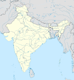
- Purnia (Division)
-
Purnia Division
पूर्णिया प्रमंडलBundesstaat: Bihar Koordinaten 25° 47′ N, 87° 28′ O25.7887.47Koordinaten: 25° 47′ N, 87° 28′ O Verwaltungssitz: Purnia Fläche: 11.054 km² Einwohner: 7.721.089 Bevölkerungsdichte: 698 Einwohner/km² Distrikte: 4 Purnia ist eine Division im indischen Bundesstaat Bihar. Sie hat ihren Verwaltungssitz in Purnia.
Geschichte
Der Distrikt Katihar wurde am 2. Oktober 1972 aus dem Distrikt Purnia gebildet.
Distrikte
Die Division Purnia besteht aus vier Distrikten:
Distrikt Hauptstadt Fläche in km² Einwohner (Stand: 2001) Bev.-Dichte in E/km² Araria Araria 2.830 2.158.608 763 Katihar Katihar 3.056 2.389.533 782 Kishanganj Kishanganj 1.939 [1] 1.294.063 [1] 667 Purnia Purnia 3.229 1.878.885 582 Einzelnachweise
- ↑ a b Offizielle Webseite des Distrikts Kishanganj Abgerufen am 8. März 2010
Schlagen Sie auch in anderen Wörterbüchern nach:
Purnia division — is an administrative geographical unit of Bihar state of India. Purnia is the administrative headquarters of the division. Currently (2005), the division consists of Purnia district, Katihar district, Araria district, and Kishanganj district.ee… … Wikipedia
Purnia district — is one of the thirty eight districts of Bihar state, India. The town of Purnia is the administrative headquarters of this district.Purnia district is a part of Purnia Division. The district extends from the Ganges river northwards to the frontier … Wikipedia
Purnia — Infobox Indian Jurisdiction native name = Purnia | type = city | latd = 25.78 | longd = 87.47 locator position = right | state name = Bihar district = Purnia leader title = leader name = altitude = 36 population as of = 2001 population total =… … Wikipedia
Darbhanga division — is an administrative geographical unit of Bihar state of India, and Darbhanga town is the administrative headquarters of the division. As of 2005[update], the division consists of Darbhanga District, Begusarai District, Madhubani District,and… … Wikipedia
Munger division — is an administrative geographical unit of Bihar state of India. Munger is the administrative headquarters of the division. Currently (2005), the division consists of Munger District, Begusarai District Jamui District, Khagaria District,… … Wikipedia
Saran division — is an administrative geographical unit of Bihar state of India. Chapra is the administrative headquarters of the division. Currently (2005), the division consists of Saran District, also called Chapra District, Siwan District, Gopalganj District … Wikipedia
Magadh division — is an administrative geographical unit of Bihar state of India. Gaya is the administrative headquarters of the division. Currently (2005), the division consists Gaya district, Nawada district, Aurangabad district, Jehanabad district, and Arwal… … Wikipedia
Saran (Division) — Vorlage:Infobox Division in Indien/Wartung/FlächeVorlage:Infobox Division in Indien/Wartung/Einwohner Saran Division सारन प्रमंडल … Deutsch Wikipedia
Darbhanga (Division) — Darbhanga Division दरभंगा प्रमंडल … Deutsch Wikipedia
Kosi (Division) — Kosi Division कोसी प्रमंडल … Deutsch Wikipedia

