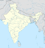
Bhagalpur division — is an administrative geographical unit of Bihar state of India, with Bhagalpur as the administrative headquarters of the division. As of 2005, the division consists of Bhagalpur District, and Banka District.ee Also … Wikipedia
Bhagalpur — steht für: Bhagalpur (Division), eine Division im indischen Bundesstaat Bihar Bhagalpur (Distrikt), ein Distrikt der Division Bhagalpur Bhagalpur (Bihar), der Verwaltungssitz der gleichnamigen Division Bistum Bhagalpur, eine römisch katholische… … Deutsch Wikipedia
Bhagalpur district — is one of the thirty seven districts of Bihar state, India, and Bhagalpur town is the administrative headquarters of this district. Bhagalpur district is a part of Bhagalpur Division. The river Ganga flows through the district.DemographyThe… … Wikipedia
Munger division — is an administrative geographical unit of Bihar state of India. Munger is the administrative headquarters of the division. Currently (2005), the division consists of Munger District, Begusarai District Jamui District, Khagaria District,… … Wikipedia
Darbhanga division — is an administrative geographical unit of Bihar state of India, and Darbhanga town is the administrative headquarters of the division. As of 2005[update], the division consists of Darbhanga District, Begusarai District, Madhubani District,and… … Wikipedia
Saran division — is an administrative geographical unit of Bihar state of India. Chapra is the administrative headquarters of the division. Currently (2005), the division consists of Saran District, also called Chapra District, Siwan District, Gopalganj District … Wikipedia
Magadh division — is an administrative geographical unit of Bihar state of India. Gaya is the administrative headquarters of the division. Currently (2005), the division consists Gaya district, Nawada district, Aurangabad district, Jehanabad district, and Arwal… … Wikipedia
Saran (Division) — Vorlage:Infobox Division in Indien/Wartung/FlächeVorlage:Infobox Division in Indien/Wartung/Einwohner Saran Division सारन प्रमंडल … Deutsch Wikipedia
Darbhanga (Division) — Darbhanga Division दरभंगा प्रमंडल … Deutsch Wikipedia
Kosi (Division) — Kosi Division कोसी प्रमंडल … Deutsch Wikipedia

