- Kınalıada
-
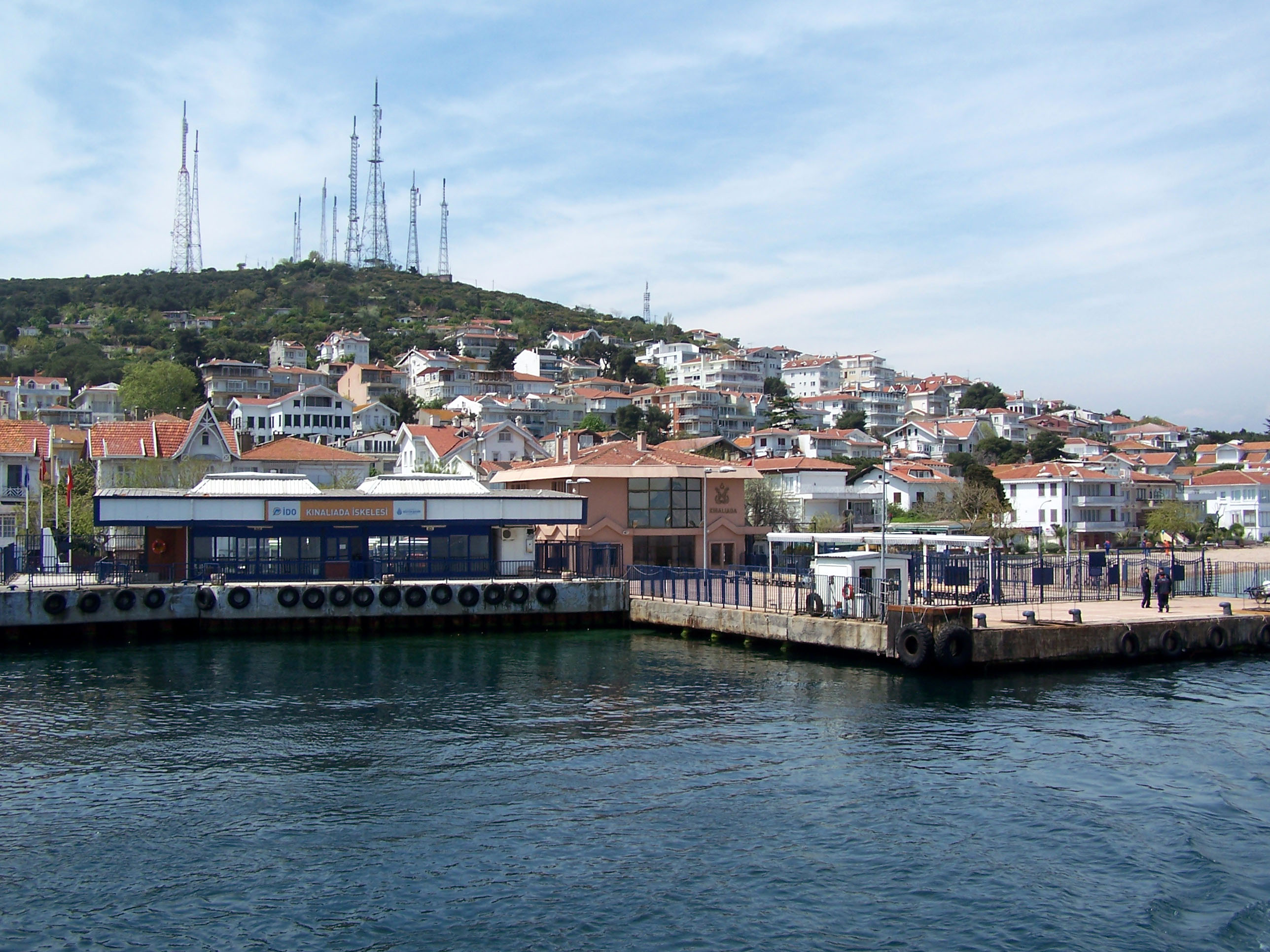
Kınalıada Fähre im Hafen von Kınalıada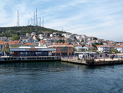
Gewässer Marmarameer Inselgruppe Prinzeninseln Geographische Lage 40° 54′ 47″ N, 29° 3′ 0″ O40.91305555555629.05115Koordinaten: 40° 54′ 47″ N, 29° 3′ 0″ O 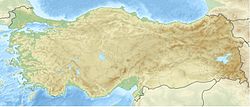

Länge 1,6 km Breite 1,5 km Fläche 1,3 km² Höchste Erhebung Çınartepe
115 mEinwohner 3.318
2.552 Einw./km²Hauptort Kınalı Kınalıada (griechisch:Πρώτη / Proti) ist eine Insel der Prinzeninseln bei Istanbul und gehört zum Bezirk Adalar. Die 1,3 km² große, waldarme Insel liegt 5,7 km vom asiatischen Festland entfernt
Kınalıada bedeutet so viel wie Hennainsel. Die Bezeichnung stammt von der roten Erde, die für das Eiland typisch ist. In der Vergangenheit wurden auf Kınalıada Kupfer und Eisen gewonnen, wodurch sich das Erdreich rot färbte, und ist damit die am wenigsten bewaldete Insel.
Die Insel war Rückzugsort und Exil byzantinischer Herrscher, bekanntester von Ihnen ist Romanos IV..
Die nur 12 km südöstlich vom europäischen Festland entfernte Ausflugsinsel kann man in 25 - 40 Minuten mit einer Fähre erreichen.
Weblinks
Inseln der Prinzeninseln (Istanbul)Burgazada | Büyükada | Heybeliada | Kaşıkadası | Kınalıada | Sedef Adası | Sivriada | Tavşanadası | Yassıada
Wikimedia Foundation.
Schlagen Sie auch in anderen Wörterbüchern nach:
Kınalıada — (Greek: Πρώτη (Proti)) is one of the Princes Islands in the Sea of Marmara, near Istanbul. It is officially a neighbourhood in the Adalar district of Istanbul, Turkey. Kınalıada (meaning Henna Island , after the colour of its earth) is the… … Wikipedia
Kınalıada — 40°54′30″N 29°2′52″E / 40.90833, 29.04778 … Wikipédia en Français
Kınalıada — Vista de Kınalıada. Imagen de satélite de las Islas Príncipe. Kınal … Wikipedia Español
Кыналыада — тур. Kinaliada (греч. Proti и Akoni) Координаты: Координаты … Википедия
Princes' Islands — The Princes Islands (Turkish: Prens Adaları [Prince Islands] or more commonly Kizil Adalar [Red Islands] as they are officially named; classical Greek: Prinkēpōn nēsoi , polytonic|Πριγκήπων νήσοι , modern Greek: Prinkiponisia ,… … Wikipedia
Prinzeninseln (Istanbul) — Vorlage:Infobox Ort in der Türkei/Wartung/LandkreisVorlage:Infobox Ort in der Türkei/Wartung/LandkreisOhneEinwohnerOderFläche Prinzeninseln Hilfe zu Wappen … Deutsch Wikipedia
Car-free zone — Car free zones (also known as auto free zones and pedestrian zones) are areas of a city or town in which automobile traffic is prohibited. They are instituted by communities who feel that it is desirable to have areas not dominated by the… … Wikipedia
Dardanelles Operation — For the World War I operations in the Dardanelles, see Dardanelles Campaign. Dardanelles Operation Part of the Anglo Turkish War … Wikipedia
Armenian Patriarch of Constantinople — The Armenian Patriarch of Istanbul is today head of one of the smallest Patriarchates of the Oriental Orthodox Church but has exerted a very significant political role and today still exercises a spiritual authority, which earns him considerable… … Wikipedia
Marmara Island — Aerial view of the island Marmara is a Turkish island in the Sea of Marmara. It is the largest island in the Sea of Marmara that is the center of Marmara district in Balıkesir Province. Transportation is possible from Istanbul by ship and ferry,… … Wikipedia
Kınalıada
18+
© Academic, 2000-2026
- Kontaktieren Sie uns: Unterstützung, Werbung
Wörterbücher Export, schritte mit PHP, Joomla, Drupal, WordPress, MODx.